This item has been sold, but you can get on the Waitlist to be notified if another example becomes available, or purchase a digital scan.
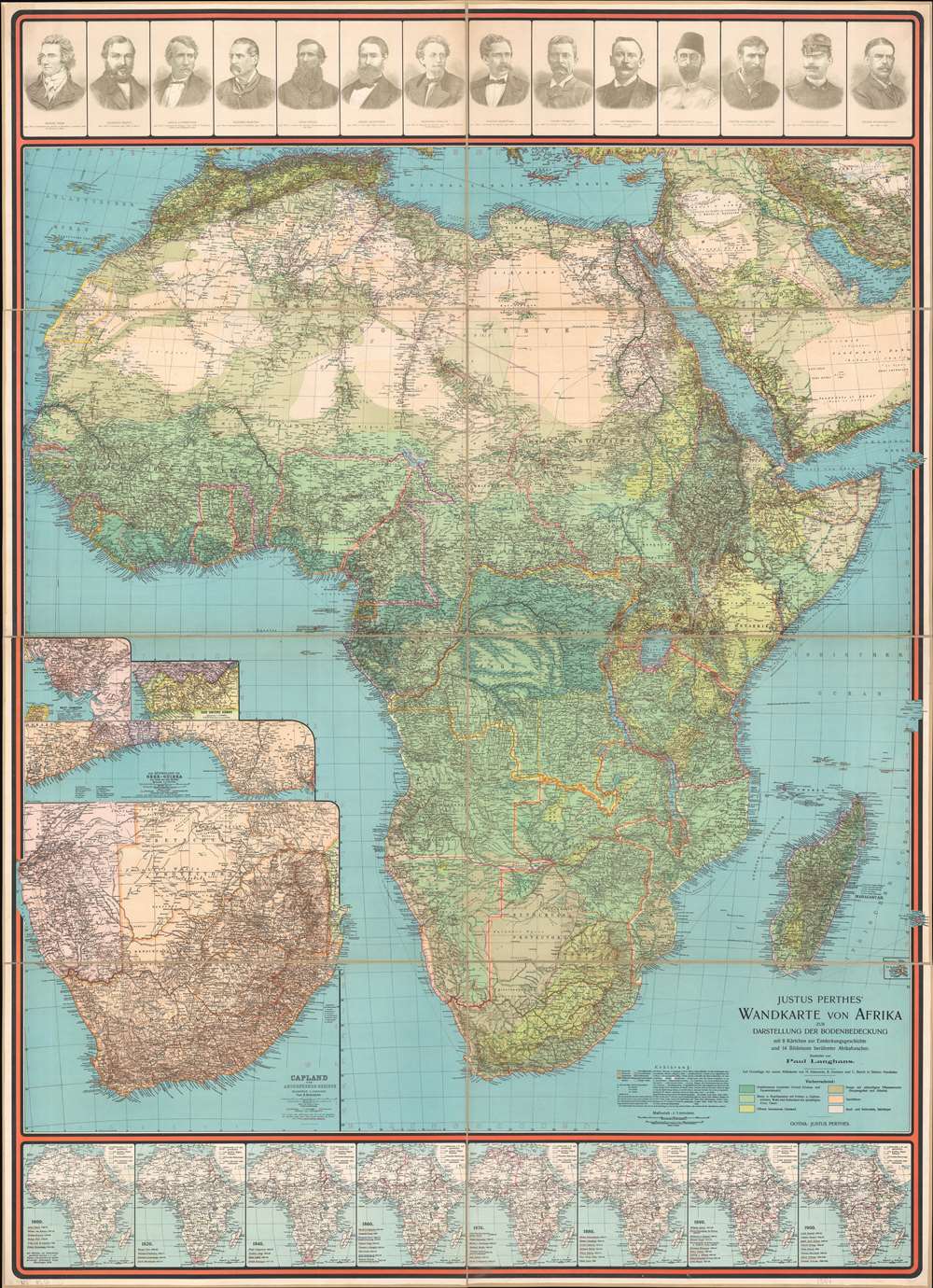
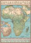
1906 Langhans 'Scramble for Africa' Wall Map of Africa
WandkarteAfrika-langhans-1906$1,750.00


Title
Justus Perthes' Wandkarte von Afrika zur Darstellung der Bodenbedeckung mit 8 Kärten zur Entdeckungsgeschichte und 14 Bildnissen berühmter Afrikaforscher.
1906 (undated) 57.5 x 41.75 in (146.05 x 106.045 cm) 1 : 7500000
1906 (undated) 57.5 x 41.75 in (146.05 x 106.045 cm) 1 : 7500000
Description
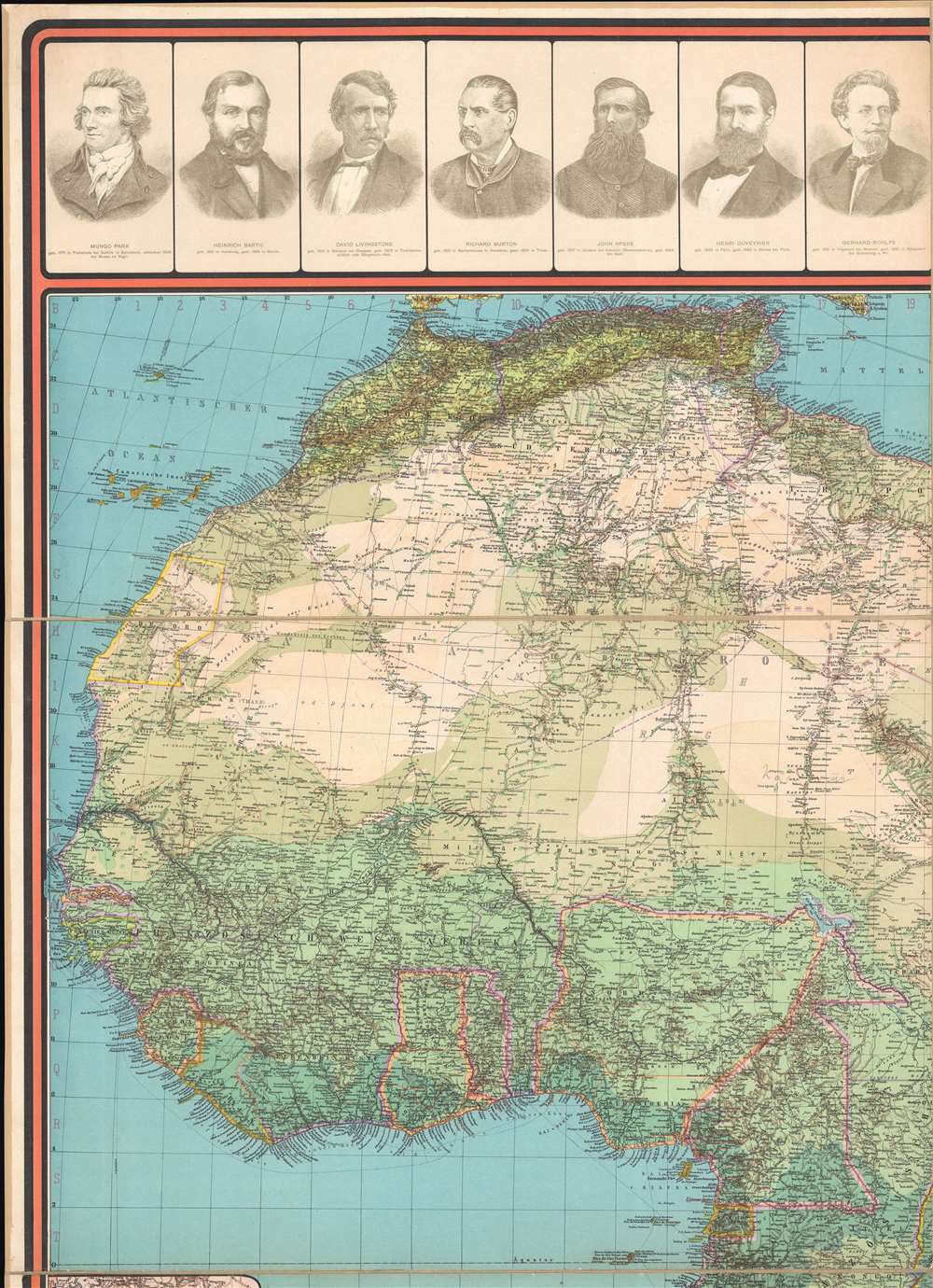
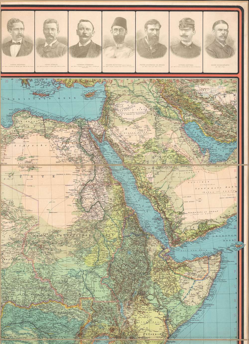
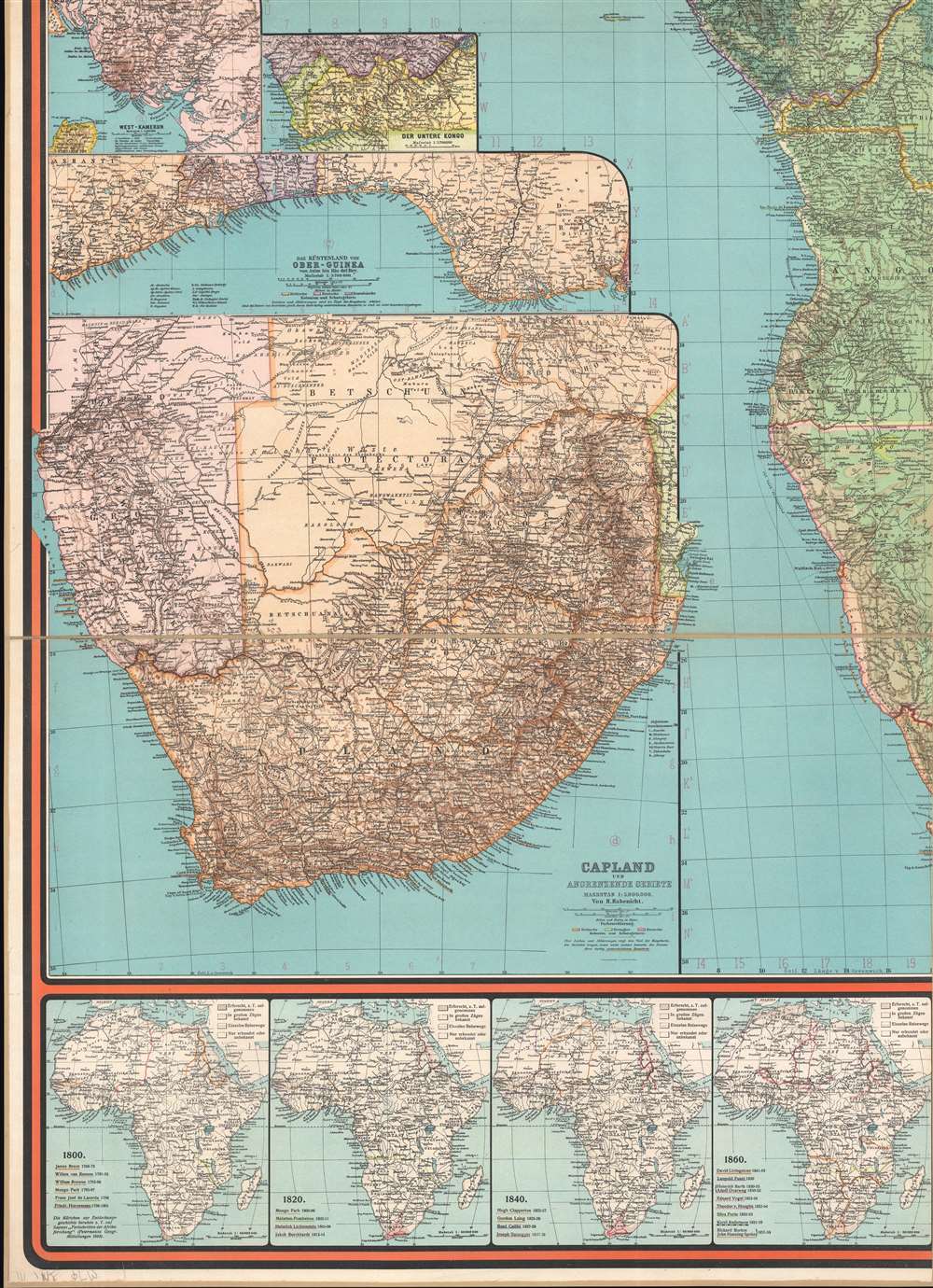
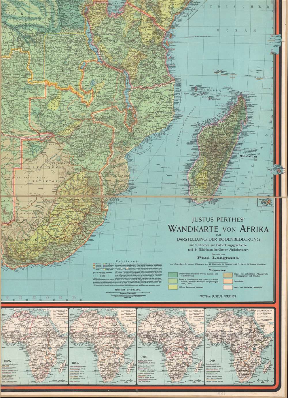
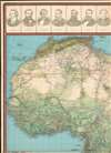
This is a 1906 Paul Langhans wall map of Africa made at the height of the Scramble for Africa, when European nations vied for influence and colonies across the vast resource-rich continent. The map highlights European exploration in Africa's in the 19th century. Portraits of fourteen European explorers of Africa, including Henry Stanley, David Livingstone, and Mungo Park, occupy the top portion of the map. Eight smaller maps along the bottom border trace their routes across the continent. Like much of Langhans' work, this map is educational, but the content can also be understood in the light of his ardently held belief that Europeans, and in particular Germans, held an inherent right to hegemony over non-European peoples.
The Large Wall Map
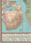
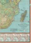
The large central map uses color to differentiate terrain. The Nile, Niger, and Congo Rivers are emphasized. Colonial territories are demarcated with French, British, Germans, Spanish, and Portuguese colonies illustrated. Inset maps in the lower left focus on southern Africa, the Bight of Benin, the mouth of the Congo, and West Cameroon (German colony).Scramble for Africa
The map is an artifact of the 'Scramble for Africa,' the series of late 19th and early 20th century occupations, usurpations, annexations, divisions, and land seizures by European powers in Africa, here specifically England, Germany, Portugal, and France. The Scramble for Africa was mainly characterized by heightened occupation and direct ownership of colonial lands. Rivalries and treaties led to several new African states, many of which remain, but few of which paid heed to traditional boundaries or cultural distinctions. The Scramble began at the Berlin Conference of 1884, wherein European colonization of Africa was regulated as official policy and the doctrine of Effective Occupation introduced. What followed is, as described, an all-out land-scramble. The 10% of Africa that was under formal European control in 1870 increased to almost 90 percent by 1914, with only Ethiopia (Abyssinia) and Liberia remaining independent.Effective Occupation
The 1884 - 1885 Berlin Conference adopted the Doctrine of Effective Occupation as a baseline for establishing and maintaining colonial claims. According to this doctrine, colonial powers needed to prove 'effective occupation.' This means they needed to establish the existence of treaties with local powers, show that their flags were being flown, build railroads and other infrastructure, or have active forts in the region. The doctrine led to increased European military and economic activity in Africa as colonizers sought to bolster their 'effective occupation' claims. While this, in part, led to the advancement of infrastructure in Africa, including the construction of modern facilities such as hospitals and railroads, it also led to more intensive direct ownership of colonial lands by Europeans and the exploitation of indigenous peoples.Publication History and Census
This map was created by Paul Langhans and published by Justus Perthes in Gotha, 1906. We note five separate entries in OCLC that catalog seven examples: Columbia University, Harvard University, the Staatsbibliothek zu Berlin, the Universitätsbibliothek Erfurt, the Biblioteca Nacional de España, the Universitätsbibliothek Marburg, and the Bibliothèque Nationale de France.CartographerS
Paul Max Harry Langhans (April 1, 1867 - January 17, 1952) was a German cartographer and geographer. Langhans was born in Hamburg, the son of an innkeeper. He attended secondary school from 1878 to 1886 in Hamburg. Then, in Kiel and Leipzig from 1886 to 1889, studied natural sciences, economics, and geography. He started working for Justus Perthes's Geographisch-kartographischen Anstalt in 1889 and created maps and atlases for the company during the following decades. Langhans worked as the editor of Petermanns Geographische Mitteilungen from 1909 until 1937 and was the editor-in-chief of Gothaischer Hofkalender beginning in 1923. Considered to be one of the most important German representatives of ethnocentric geopolitics, Langhans, founded the magazine Deutsche Erde in 1902, which supported folk and cultural soil research and was close to the Pan-German Association. He was a member of the German Social Reform party, an anti-Semitic political party, and worked as editor of the Antisemitic Monthly Gazette from 1896 to 1907. IN 1931, Langhans joined the National Socialist German Workers' Party (NAZI). He worked as a training speaker in Schönau vor dem Walde at the NSDAP district school. He was married to Rosa Langhans (born Rasch, 1870 - 1960) with whom he had a daughter. More by this mapmaker...
Johan Georg Justus Perthes (September 11, 1749 - May 2, 1816) was one of the most important German cartographic engravers of the 19th century. He was born in the Thuringian town of Rudolstadt, the son of a court physician. In 1778, he began working as a bookseller in Gotha. Perthes began his publishing empire shortly thereafter with the 1784 issue of the famed survey of European nobility known as the Almanac de Gotha. In the next year, 1785, he founded the cartographic firm of Justus Perthes Geographische Anstalt Gotha. His son Wilhelm Perthes (1793 - 1853) joined the firm in 1814. Wilhelm had prior publishing experience at the firm of Justus Perthes' nephew, Friedrich Christoph Perthes, who ran a publishing house in Hamburg. After Justus Perthes died in 1816, Wilhelm took charge and laid the groundwork for the firm to become a cartographic publishing titan. From 1817 to 1890. the Perthes firm issued thousands of maps and more than 20 different atlases. Along with the visionary editors Hermann Berghaus (1797 - 1884), Adolph Stieler (1775 - 1836), and Karl Spruner (1803 - 1892), the Perthes firm pioneered the Hand Atlas. When Wilhelm retired, management of the firm passed to his son, Bernhardt Wilhelm Perthes (1821 – 1857). Bernhardt brought on the cartographic geniuses August Heinrich Peterman (1822 - 1878) and Bruno Hassenstein (1839 - 1902). The firm was subsequently passed to a fourth generation in the form of Berhanrd Perthes (1858 – 1919), Bernhard Wilhelm's son. The firm continued in the family until 1953 when, being in East Germany, it was nationalized and run as a state-owned enterprise as VEB Hermann Haack Geographisch-Kartographische Anstalt Gotha. The Justus family, led by Joachim Justus Perthes and his son Wolf-Jürgen Perthes, relocated to Darmstadt where they founded the Justus Perthes Geographische Verlagsanstalt Darmstadt. Learn More...
Condition
Very good. Dissected and mounted on linen in eight (8) panels.
References
OCLC 54432140, 254312613, 1103677067, 179864799, 1111616024.