
1838 Blachford Blueback Nautical Map Chart: West Indies, Florida, Caribbean, and Gulf of MEXICO

This item has been sold.
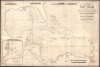
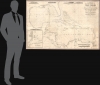
Blachfords, New General Chart of the West Indies, Including the Caribee and Virgin Islands, Porto Rico, St. Domingo, Jamaica and Cuba. The Windward Passages gulfs of Florida and Mexico, Bay of Honduras, And Coast of Colombia Compiled from the best Authorities, Including the surveys of Mr. A. de Mayne R.N., Mr. Lockwood etc.
Manuscript Whaler's Annotations in Gulf of Mexico.
- Digital Map Information
- Suitable for large format printing
- File Size: 113.86 MB
- File Type: ZIP / TIFF
- ICC color profile embedded
- Delivered instantly via download link
Manuscript Whaler's Annotations in Gulf of Mexico.
A spectacular 1838 / 1843 Blachford blueback nautical map of the West Indies, including Florida, the Gulf of Mexico, the Caribbean, and Central America. This beautiful map features pencil manuscript annotations in the Gulf of Mexico that strongly suggest whaling.A Closer Look
Coverage embraces from Mexico to Barbados and from Florida to Panama and the Orinoco Delta, thus including Florida, Cuba, the Bahamas, the Greater and Lesser Antilles, the Yucatan, the Gulf of Mexico littoral (Louisiana, Mississippi, Texas, Florida), and most of Central America. An inset in the lower left details the Bay of Honduras and the colony of British Honduras (modern-day Belize).Blachford credits the 1825-27 surveys in the Straits of Florida, Cuba, and the Bahamas by Royal Navy hydrographers Anthony de Mayne ( - 1832) Anthony Lockwood (1775 - 1855). De Mayne is also likely responsible for the hydrography of Nassau, Jamaica, and the inset map of Belize.
Manuscript Whaling Annotations in the Gulf of Mexico
The map exhibits a dizzying array of faded manuscript notes in the Gulf of Mexico west of Tampa. Most indicated specific sites with dates. The markings, dates, and their seemingly haphazard disbursement over a small area are sure signs that these represent the activities of a whaling ship, the markings being whales sighted or taken. Whaling was one of the major economic drivers in the Gulf of Mexico at this time, with historians counting some 204 whalers active in the Gulf from 1788 to 1878.Blueback Charts
Blueback nautical charts began appearing in London in the late 18th century. Bluebacks, as they came to be called, were privately published large-format nautical charts known for their distinctive blue paper backing. The backing, a commonly available blue manila paper traditionally used by publishers to wrap unbound pamphlets, was adopted as a practical way to reinforce the low-quality paper used by private chart publishers to cut costs. That being said, not all blueback charts are literally backed with blue paper; some are unbacked or backed with linen. Moreover, as blueback charts, which were typically composed of multiple sheets, they were designed in a modular fashion so that multiple charts could be joined to create truly massive custom maps suited for specific voyages. The earliest known blueback charts include a 1760 chart issued by Mount and Page and a 1787 chart issued by Robert Sayer. The tradition took off in the early 19th century, when British publishers like John Hamilton Moore, Robert Blachford, James Imray, William Heather, John William Norie, Charles Wilson, David Steel, R. H. Laurie, and John Hobbs, among others, rose to dominate the chart trade. Bluebacks became so popular that the convention was embraced by chartmakers outside of England, including Americans Edmund March Blunt and George Eldridge, as well as Scandinavian, French, German, Russian, and Spanish chartmakers. Blueback charts remained popular until the late 19th century, when government-subsidized organizations like the British Admiralty Hydrographic Office and the United States Coast Survey, began issuing their own superior charts on high-quality paper that did not require reinforcement.Publication History and Census
This map was compiled by Robert and William Blachford and first published in 1827. The present example is the 1838 edition, with corrections to 1843 by William Blachford. The map was sold at the Navigation Warehouse of Blachford and Imray. We see only one other example of this map, located at the National Maritime Museum, Greenwich, London.Cartographers
Robert Blachford (1775 - c. 1852) was an Irish maker of blueback nautical charts active in the middle part of the 19th century. Compared with many major nautical chart publishers in London, little is known of Blachford. Around 1802, he married Elizabeth Moore, the daughter of John Hamilton Moore (1738 - 1807), a prolific producer of navigational textbooks and nautical charts. Blachford must have been introduced to nautical chart-making by Moore, but his partnership with the latter was short-lived and dissolved two years later in 1804. By 1805, Blachford had established his own firm located at 137 Minories, London. Initially, Blachford's business seems to have been poor, and he produced charts only sporadically until about 1808, when he opened a new shop at 114 Minories. From this location, he published about 20 - 30 known charts, primarily focusing on the North Sea and the Baltic. Most of these were based on Moore's earlier work but fully re-engraved by Samuel Stockley (who also, incidentally, engraved for William Heather). With such a meager publication history, it is unsurprising that Blachford declared bankruptcy in May of 1819. Shortly thereafter, Blachford was back in business and partnered with William Lane. This partnership was also short-lived, issuing about 15 charts before being dissolved in 1821. Around 1827, Blachford again reappeared, this time at his old stomping ground, the Minories (116), an office he would maintain for the next 25 years. Robert, this time, partnered with William Blachford, presumably a relative, though the relationship is unclear. The firm issued numerous charts focused on the British coastal trade. The rough, damp conditions synonymous with this trade are the reason that few Blachford charts from this period survive. Around 1835, Robert and William Blachford retired, passing the business on to Michael Blachford (1807 - 1889), who partnered with the stationer and draftsman James Imray (1803 - 1870). Today, Imray continues to publish maritime charts as "Imray, Laurie, Norie and Wilson". Further Details...
Anthony De Mayne (c. 1790 - 1828) was a Royal Navy officer and hydrographer active in the early 19th century. De Mayne achieved the rank of Master on July 31, 1806. His earliest known surveys date to 1811, when he was assigned to the west coast of Africa on the Amelia and produced surveys of the coast from the River Gambia to Cape Lopez. Then, he was sent to North America, where he completed influential surveys of the American coast from the Chesapeake Bay to St. Augustine. Around this time he also caught the attention of Thomas Hurd, head Hydrographer of the British Admiralty from 1808 - 1823, who admired his hydrographic skills and who was eager to support his rise in rank. Subsequently, on the Royal Navy schooner Kangaroo, he conducted surveys in the West Indies, including in and around Cuba, the Bahamas, Florida, Jamaica, and Belize. When the Kangaroo was recalled to England in 1827, De Mayne was left behind in the Bahamas, possibly due to illness. He died there a year later. Further Details...
Anthony Lockwood (1775 - April 2, 1855) was a Royal Navy officer and hydrographer active in the West Indies and Canada in the early 19th century. He joined the Royal Navy in 1791 and became a master of the Royal Navy on May 27, 1795. From 1799 - 1801, he was assigned as master of the Crescent, producing surveys of Curaçao and the Spanish Main. During this work, he fell ill, possibly malaria, and returned to England in 1804. Recovering somewhat, he surveyed Cape Ferrat, France, La Coruña, Spain, and Falmouth Harbour, England, as well as making an incomplete survey of the Channel Islands. In 1807 he was assigned to Barbados as 'acting master attendant'. By 1811 he was back in the West Indies, where he produced a survey of the Virgin Islands. He retired from the navy with a considerable pension in 1818. Returning to England, he privately published A Brief Description of Nova Scotia, with plates of the Principal Harbors. In 1819, he petitioned for the position of Surveyor General of New Brunswick, which he was awarded. He was initially very active in this position, producing several acclaimed new surveys. Nonetheless, he began to suffer from an unknown mental illness. By 1822, Lockwood's mental state had deteriorated considerably and contemporaries described him as 'erratic' and 'pugnacious'. Other reports suggest he was simply 'very ardent' in the pursuit of social justice. Unable to continue in his office, he was replaced by George Shore, who found the offices and paperwork in a sorry state of disarray. Even more alarming was an accounting discrepancy of some £2,000, which briefly landed Lockwood in jail. After selling off his estate to pay the missing funds, he returned to England for mental health treatment. There he remained, passing in and out of 'insanity' until his 1855 death. A fascinating new book, Master and Madman, by Peter Thomas and Nicholas Tracy, details Lockwood's fascinating life. Further Details...
James Imray (May 16, 1803 - November 15, 1870) was a Scottish hydrographer and stationer active in London during the middle to latter part of the 19th century. Imray is best known as the largest and most prominent producer of blue-back charts, a type of nautical chart popular from about 1750 to 1920 and named for its distinctive blue paper backing (although not all charts called "blue-backs" actually have a blue backing). Unlike government charts issued by the British Admiralty, the U.S. Coast Survey, and other similar organizations, Imray's charts were a private, profit-based venture. They were not generally the result of unique survey work. Rather, Imray's charts were judicious and beautiful composites based on pre-existing charts (some dating to the 17th century) and new information gleaned from governmental and commercial pilots and navigators. Imray was born in Spitalfields, England, the eldest son of a Jacobite dyer also named James. Imray did not follow his father's profession; instead, he apprenticed to William Lukyn, a stationer. He established himself as a bookseller and bookbinder at 116 Minories Street, where he shared offices with the nautical chart publisher Robert Blanchford (1775 - c. 1852). In 1836, Imray signed on as a full partner in Blanchford's enterprise, christening themselves Blanchford & Imray. At the time, the Blanchford firm lagged far behind competing chart publishers Norie and Laurie; nevertheless, with the injection of Imray's marketing savvy, the firm began a long rise. James Imray bought out Blanchford's share in 1846, becoming the sole proprietor of the chart house, publishing under the imprint of James Imray. Relocating in 1850 to larger offices at 102 Minories, Imray was well on track to become the most prominent chart publisher in London. In 1854, when Imray's 25-year-old son, James Frederick Imray, joined as a full partner, the firm again changed its imprint, this time to James Imray and Son. The elder Imray was a master of marketing and quick to respond to shifts in trade and historical events. Many of his most successful charts were targeted at specific trade routes; for example, he issued charts titled "Cotton Ports of Georgia" and "Rice Ports of India". Other charts emerged quickly following such events as the 1849 California Gold Rush. Imray's rise also coincided with the development of governmental mapping organizations such as the Admiralty and the U.S. Coast Survey, whose work he appropriated and rebranded in practical format familiar to navigators. Imray's death in 1870 marked a major transition in the firm's output and the beginning of its decline. Though Imray's son, James Frederick, excelled at authoring pilot books, he had little experience with charts and issued few new publications. Most James Frederick Imray publications issued from 1870 to 1899 were either revisions of earlier maps prepared by his father or copies of British Admiralty charts. Charts from this period are recognizable as less decorative than the elder Imray's charts, which follow the stylistic conventions established by the Admiralty. The Admiralty itself at the same time began to rise in prominence, issuing its own official charts that were both cheaper and more up to date than those offered by private enterprises. By the end of the century, the firm was in decline, and in 1899, "James Imray and Son" amalgamated with the similarly suffering "Norie and Wilson", which was itself acquired by Laurie in 1904. Today, it continues to publish maritime charts as "Imray, Laurie, Norie and Wilson". Further Details...
Condition
Good. Professional restoration repairing numerous cracks and tears. Some infill. Pencil marks relating to maritime use, particularly in the Gulf of Mexico west of Tampa, and near the Bahamas. Laid down on blue linen with brown edging.
References
National Maritime Museum, Greenwich, G245:1/15.