This item has been sold, but you can get on the Waitlist to be notified if another example becomes available.
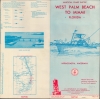
1967 U.S.C.G.S. Nautical Map from West Palm Beach to Miami (Intracoastal Waterway)
WestPalmBeachMiami-uscgs-1967$75.00


Title
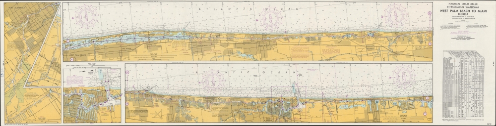
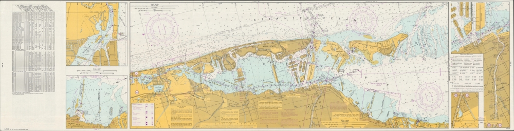
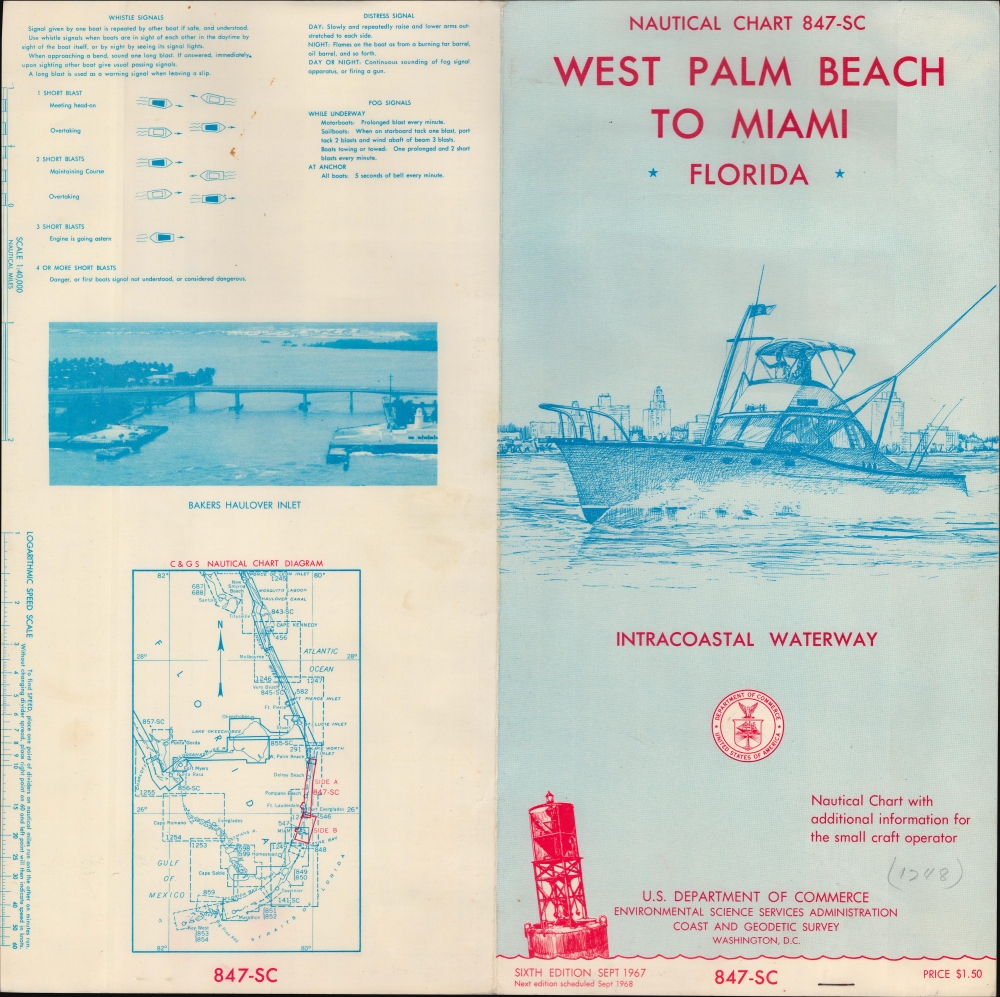
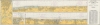
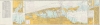
Nautical Chart 847-SC. Intracoastal Waterway. West Palm Beach to Miami Florida.
1967 (dated) 15 x 59 in (38.1 x 149.86 cm) 1 : 40000
1967 (dated) 15 x 59 in (38.1 x 149.86 cm) 1 : 40000
Description
This is a 1967 U.S. Coast and Geodetic Survey nautical chart of the Florida coast from West Palm Beach to Miami focusing on the Intracoastal Waterway.
A Closer Look
Printed on both recto and verso, this map extends 59 inches and depicts from West Palm Beach to Golden Beach on the recto (in two sections) and from there south to Matheson Hammock Beach on the verso. The Intracoastal Waterway is detailed throughout, and inlets, lakes, pipelines, cables, rivers, and numerous other features are labeled. Boynton Beach, Delray Beach, Fort Lauderdale, Miami, Miami Beach, and Key Biscayne are all identified. Innumerable depth soundings fill the Atlantic. On the recto, two insets focus on Fort Lauderdale and the surrounding area and on the verso two insets illustrate Biscayne Bay and a third illustrated the Miami River and the Miami Canal.Publication History and Census
This map was created and published by the U.S. Coast and Geodetic Survey in September 1967. The present edition is the sixth edition. This chart is not cataloged in OCLC.Cartographer
The Office of the Coast Survey (1807 - present) founded in 1807 by President Thomas Jefferson and Secretary of Commerce Albert Gallatin, is the oldest scientific organization in the U.S. Federal Government. Jefferson created the "Survey of the Coast," as it was then called, in response to a need for accurate navigational charts of the new nation's coasts and harbors. The spirit of the Coast Survey was defined by its first two superintendents. The first superintendent of the Coast Survey was Swiss immigrant and West Point mathematics professor Ferdinand Hassler. Under the direction of Hassler, from 1816 to 1843, the ideological and scientific foundations for the Coast Survey were established. These included using the most advanced techniques and most sophisticated equipment as well as an unstinting attention to detail. Hassler devised a labor intensive triangulation system whereby the entire coast was divided into a series of enormous triangles. These were in turn subdivided into smaller triangulation units that were then individually surveyed. Employing this exacting technique on such a massive scale had never before been attempted. Consequently, Hassler and the Coast Survey under him developed a reputation for uncompromising dedication to the principles of accuracy and excellence. Unfortunately, despite being a masterful surveyor, Hassler was abrasive and politically unpopular, twice losing congressional funding for the Coast Survey. Nonetheless, Hassler led the Coast Survey until his death in 1843, at which time Alexander Dallas Bache, a great-grandson of Benjamin Franklin, took the helm. Bache was fully dedicated to the principles established by Hassler, but proved more politically astute and successfully lobbied Congress to liberally fund the endeavor. Under the leadership of A. D. Bache, the Coast Survey completed its most important work. Moreover, during his long tenure with the Coast Survey, from 1843 to 1865, Bache was a steadfast advocate of American science and navigation and in fact founded the American Academy of Sciences. Bache was succeeded by Benjamin Pierce who ran the Survey from 1867 to 1874. Pierce was in turn succeeded by Carlile Pollock Patterson who was Superintendent from 1874 to 1881. In 1878, under Patterson's superintendence, the U.S. Coast Survey was reorganized as the U.S. Coast and Geodetic Survey (C & GS) to accommodate topographic as well as nautical surveys. Today the Coast Survey is part of the National Oceanic and Atmospheric Administration or NOAA as the National Geodetic Survey. More by this mapmaker...
Condition
Very good. Light wear along original fold lines. Map on both recto and verso.