This item has been sold, but you can get on the Waitlist to be notified if another example becomes available, or purchase a digital scan.
1885 Eastman Pocket Map of the White Mountains, New Hampshire
WhiteMountains-eastman-1885$250.00

Title
Eastman's New Map of the White Mountains.
1885 (undated) 18.25 x 17.25 in (46.355 x 43.815 cm) 1 : 260000
1885 (undated) 18.25 x 17.25 in (46.355 x 43.815 cm) 1 : 260000
Description
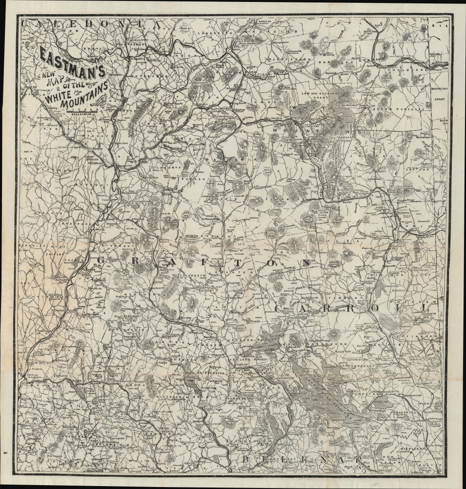
A fascinating c. 1885 Edison Eastman pocket map of the White Mountains, New Hampshire. Among other features, it represents the spread of passenger railroads throughout the region, leading to posh hotels designed above all as rural getaways for well-heeled New Yorkers and Bostonians.
Mt. Washington, tallest peak in the northeastern U.S., appears towards top-right. Although not labelled, the railroad departing from near Fabyan House is the famous cog railway, in operation since 1868, the first mountain-climbing cog railway in the world. The path leading up the mountain's east side, starting near the Glen House, is a carriage road that eventually became the Mount Washington Auto Road (the first ascent by an automobile was completed in 1899). The Crawford (Bridle) Path from Crawford Notch to the summit of Mount Washington is the oldest continuously maintained footpath in the United States; the (Old) Davis Path is similarly well-trodden.
Aside from passenger railroads, logging railroads also began to crisscross the region in the decades after the U.S. Civil War, allowing for a rapid expansion of the logging industry. Forests were clearcut throughout this region around the turn of the 20th century, but almost as quickly began to regrow; the establishment of the White Mountain National Forest in 1918, along with a decline of logging in northern New England, laid the groundwork for the magnificent forests seen today.
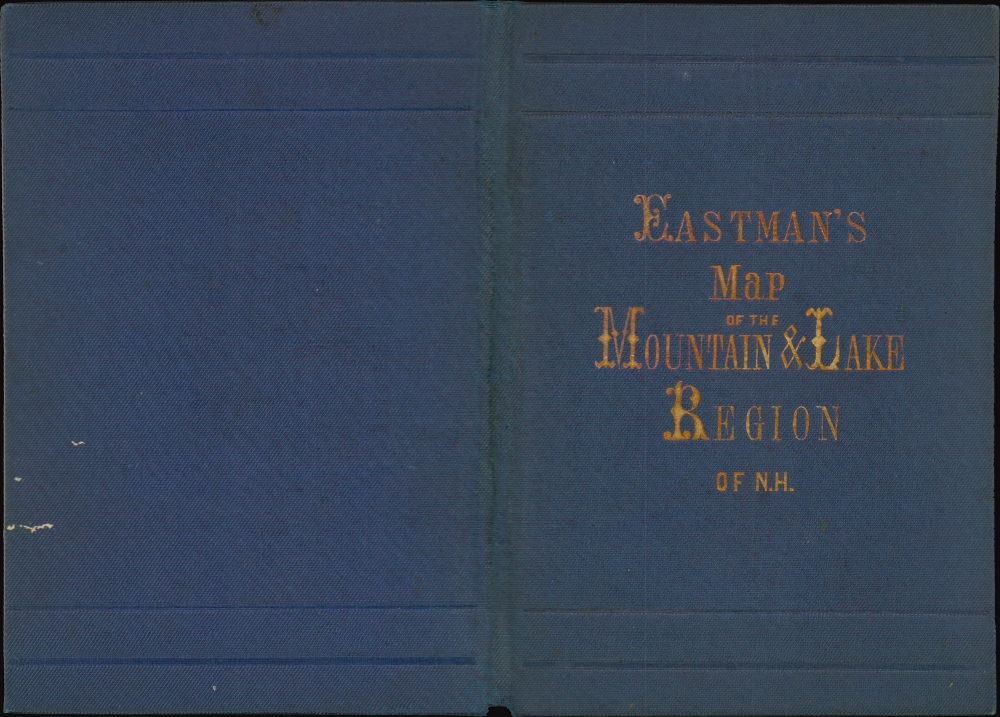
Though separately issued, this map was meant to accompany Eastman's White Mountain Guide Book. As Eastman's pocket map and guide book were issued multiple times but never dated, multiple catalog listings appear in the OCLC. That being said, the inclusion of 'new' in the title and being printed by the Photo-Electrotype Co. distinguish this edition, which is only known to be held by the Beinecke Library at Yale University.
A Closer Look
Covering the entire White Mountains region from Lancaster and St. Johnsbury, Vermont in the north to Lebanon and Lake Winnipesaukee in the south, this highly detailed map notes town boundaries, waterways, mountains and hills, roads, railroads, hotels, hiking trails, and more. Designed for tourists, it is especially comprehensive on railroads and accommodations for visitors, which proliferated in the late 19th century.Mt. Washington, tallest peak in the northeastern U.S., appears towards top-right. Although not labelled, the railroad departing from near Fabyan House is the famous cog railway, in operation since 1868, the first mountain-climbing cog railway in the world. The path leading up the mountain's east side, starting near the Glen House, is a carriage road that eventually became the Mount Washington Auto Road (the first ascent by an automobile was completed in 1899). The Crawford (Bridle) Path from Crawford Notch to the summit of Mount Washington is the oldest continuously maintained footpath in the United States; the (Old) Davis Path is similarly well-trodden.
The 'Whites' By Rail
Many of the rail lines seen here were soon afterwards acquired by the Boston and Maine Railroad and, with the rise of automobiles, their rights-of-way were used for roads or, in some cases, have been converted into hiking paths. But portions of the former passenger network can still be ridden today on the Conway Scenic Rail, operating out of the station in North Conway built in 1874 by the Portsmouth, Great Falls and Conway Railroad, and the Hobo and Winnipesaukee Scenic Railroad, which operates several short routes out of Lincoln and around Lake Winnipesaukee.America's Favorite Mountain Retreat
At the time of this map's publication, the White Mountains were the preferred rustic retreat of urbanites from Boston and New York City, both in the summer, when the heat and smells of the city became oppressive, and in the winter, as the mountains offered skiing and scenery that could not be had in an urban environment. With railways providing ready access, and entire economy grew to cater to this clientele, including luxury hotels (in later decades, especially as automobiles became more widespread and affordable, tourists from a wider socioeconomic stratum began visiting the area in large numbers).Aside from passenger railroads, logging railroads also began to crisscross the region in the decades after the U.S. Civil War, allowing for a rapid expansion of the logging industry. Forests were clearcut throughout this region around the turn of the 20th century, but almost as quickly began to regrow; the establishment of the White Mountain National Forest in 1918, along with a decline of logging in northern New England, laid the groundwork for the magnificent forests seen today.
Publication History and Census
This map was published by Edison (or Edson) Eastman and was printed by the Photo-Electrotype Co. in Boston. It is undated, but from context can be dated to c. 1885. Many of the railroad lines present (such as the Profile and Franconia Notch, the Montpellier and Wells River, and the Sawyer River) began operations in the late 1870s. On the other hand, the extension of single-gauge line to the Waumbek House in Jefferson in 1892 is not represented here, while several lines that were absorbed by the Boston and Maine Railroad in the 1890s still are labelled independently. Likewise, the famous Mount Washington Hotel at Bretton Woods (near the Fabyan House), built between 1900 and 1902, does not appear.Though separately issued, this map was meant to accompany Eastman's White Mountain Guide Book. As Eastman's pocket map and guide book were issued multiple times but never dated, multiple catalog listings appear in the OCLC. That being said, the inclusion of 'new' in the title and being printed by the Photo-Electrotype Co. distinguish this edition, which is only known to be held by the Beinecke Library at Yale University.
CartographerS
Edison C. Eastman (c. 1832 - 1911), also as Edson, was a publisher of guidebooks and maps of the White Mountains region of New Hampshire in the late 19th and early 20th centuries. Government records indicate that he spent most of his life in Concord, New Hampshire, with his occupation listed variously as publisher, bookseller, or bookkeeper. He also served in the Union Army during the U.S. Civil War. More by this mapmaker...
James Henry Stark (July 6, 1846 - August 30, 1919) was an American publisher active in the late 19th and early 20th centuries. Stark was born in Mutcham, Surrey, England. As a young man in England he was raised by Thomas Cook, the famous English travel agent. He moved to the United States in 1856, when he was 9 or 10. In the United States, he studied at Hawes Grammar School in South Boston, and later attended the Lincoln School and the Boston Latin School. He began studying printing, particularly stereotyping and electrotyping, in 1864. In 1870 he established himself as a printer at the corner of Water and Congress Streets. He prospered until the Great Boston Fire of 1872, when his establishment burnt to the ground. After the fire, he turned his attention to yachting, suggesting access to considerable wealth, and sailed from Boston to the Caribbean and to South America, where he prospected for and discovered gold in Dutch Giana. He eventually returned to Boston, where he once again went into the printing business, establishing a stereotype and electrotype foundry at 1717 Devonshire Street. Stark partnered with William H. Mumler (1832 - 1884) in 1877 to found the Photo-Electrotype Company, one of the earliest American photolithography companies. Stark sold his shares of the company in 1900 and turned to Real Estate. Through his interest in Yachting and Caribbean travel, and possibly influenced by his connected to Thomas Cook, Start also had a successful business composing and writing guidebooks for various West India Islands. He also issued the Stranger's Guide to Boston. Learn More...
Condition
Very good. Light wear along original fold lines. Verso repairs and reinforcements at fold intersections. Accompanied by original binder.
References
Beinecke Library Call No. 762 W588 1870.