
1936 Geological Map of Part of the Gold Mining District, Wiluna, Western Australia

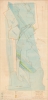

Geological Map of the Southern Portion of the Wiluna District. Wiluna, Western Australia.
Gold mining in Western Australia.
$600.00
Choose a Collection:
- Digital Map Information
- Suitable for large format printing
- Full resolution TIFF file
- ICC color profile embedded
- Delivered instantly via download link
This Item
Enquire
Gold mining in Western Australia.
A rare find, this is a c. 1936 geological map of gold mining near Wiluna, Western Australia. The map delineates specific mines and company claims, with manuscript highlighting of geological formations. A ferro-gallic print, this piece was likely created in the field in fewer than 10 examples.A Closer Look
Most of the depicted region is part of the claims of either Wiluna Gold Mines Limited or Gold Fields Australian Development Co. Ltd. The Wiluna Gold claim is outlined by a blue line, while the claim of Gold Fields is bordered in orange. Mines and ore fields are identified by name, including Moonlight, Golden Age, Bulletin, Happy Jack, Essex, West Lode, No. 2 West Lode, East Lode, and Squib. Color highlights different rock formations, with abbreviations used to specifically identify each one.Wiluna Gold Mines Limited and Gold Fields Australian Development Co. Ltd.
Gold mining in Western Australia began in 1895, with gold production reaching its peak in 1903. However, World War I (1914 - 1918) caused an extreme loss of manpower and machinery for the mining industry. This loss, combined with an exhaustion of the alluvial fields, meant output in 1926 was less than a quarter of what it had been in 1903. Then, in the late 1920s, Gold Fields of South Africa invested in gold mining activities in the two largest goldfields in Western Australia: Wiluna and 'Lake View and Star'. The Wiluna Gold Corporation (WGC) was founded in 1927 and Consolidated Gold Fields of South Africa quickly became the majority shareholder. WGC created a subsidiary company, Wiluna Gold Mines Limited (WGM) to operate the mines near Wiluna, construct a treatment plant, and undertake other necessary tasks. WGC also became a minor shareholder in Gold Fields Australian Development Company (GFA), which operated the Moonlight Mine. Operations at Moonlight ended in 1945 and at Happy Jack in 1947. In the 1930s, Wiluna had a population of over 9,000, but by 1949, the town was largely abandoned.Gold Fields of South Africa
Gold Fields of South Africa (the major investor behind operations in Wiluna) was founded in 1887 by Cecil John Rhodes and Charles Dunell Rudd. Its initial interests were in gold mining at Witwatersrand and diamond mining the Kimberley. Eventually, Gold Fields operated mines in Western Australia and New Guinea, a lead and zinc mine in New South Wales, light and power companies, and alluvial mines in the United States.Ferro-Gallic Print
Ferro-Gallic printing, also called 'Iron Gall' is a photo-reproductive process developed in 1859 by Alphonse Louis Poitevin. The process became popular in the late 1880s when it was introduced commercially, particularly as it could be used to make fast copies of tracings and allowed for corrections to be made during the printing process. Moreover, copies could be made directly from originals without an intermediary negative process. Due to the chemicals used in this process, the background is never white; instead, it takes on a pale brown to lavender tint. Like most photo-reproductive processes of the period, ferro-gallic printing was used only for short-run printing, usually of less than 5 copies, and was impractical for mass production. Moreover, due to the print's photoreactive nature and the generally low-quality field papers used, ferro-gallic prints rarely survive more than 30 years, making the early examples extremely scarce. The ferro-gallic process is similar to the Diazo Print or Whiteprint process, which replaced it in popularity in the early 20th century.Publication History and Census
This map was created and published by an unknown entity c. 1936. This is the only known surviving example of what must have been a very small print run.Condition
Very good. Ferrogallic print on surveyor's paper. All color (including black) manuscript.
References
Porter, R. Consolidated Gold Fields in Australia: The Rise and Decline of a British Mining House, 1926 - 1998. (Acton: Australian National University Press) 2020.