This item has been sold, but you can get on the Waitlist to be notified if another example becomes available.
1956 General Drafting Pictorial Map of World and How we Make Cars
WorldAutomobile-generaldrafting-1956$175.00

Title
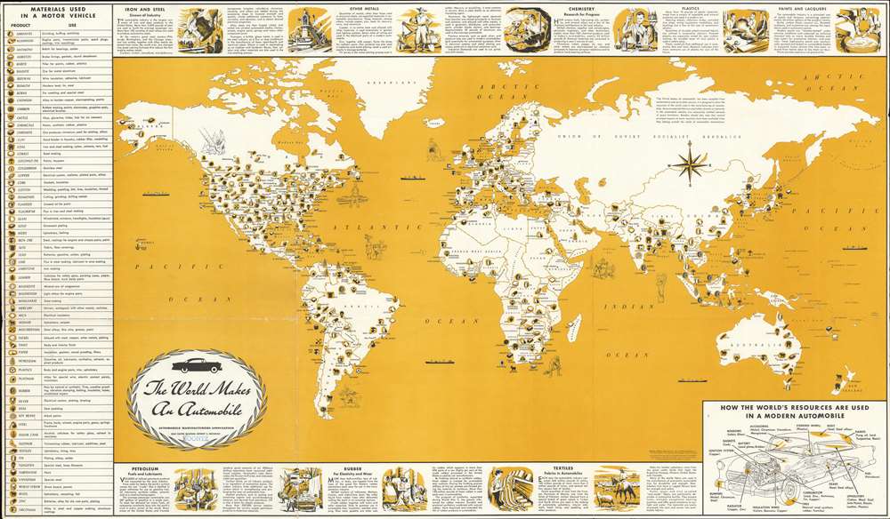
The World Makes an Automobile.
1956 (dated) 21.625 x 37.125 in (54.9275 x 94.2975 cm) 1 : 31900000
1956 (dated) 21.625 x 37.125 in (54.9275 x 94.2975 cm) 1 : 31900000
Description
This is a 1956 General Drafting map of the world highlighting the worldwide effort necessary to build an automobile. Symbols spread throughout the world note where metals (iron, copper, antimony, manganese, nickel, platinum…), petroleum, rubber, and materials for textiles (wool, cotton, jute, and nylon) are mined, drilled, tapped, or harvested for use by the automobile industry. Meant for use in schools, short texts and two-tone vignettes along the top and bottom borders provide explanations about the use of these materials, including the smelting steel from iron and other metals, the use of other metals in cars, and how oil and rubber are gathered and used by the auto industry. A table along the left lists over sixty materials used in automobile manufacturing and acts as a map key. A diagram of a car in the lower right highlights some common car parts and names materials used in its manufacture.
Publication History and Census
This map was created by the General Drafting Company and published by the Automobile Manufacturers Association in 1956. The OCLC catalogs fourteen examples as being part of institutional collections including at the New York Public Library, the Library of Congress, the University of Illinois at Urbana Champaign, and Stanford University. However, this map is scarce on the private market. At least two editions of this map were published. The present example represents the first edition published in 1956. The second edition, which was colored light blue instead of yellow, was published in the early 1960s.Cartographer
General Drafting Corporation (1909 - 1992) was one of the 'Big Three' publishers of road maps between 1930 and 1970, along with H. M. Gousha and Rand McNally. Founded in 1909, Otto G. Lindberg, an immigrant from Finland and the company's founder, began his business with a borrowed drafting board and a $500 loan from his father. At the time only twenty-three years old, Lindberg advertised his business as 'any and all general drafting' and was based out of 170 Broadway in New York City. Only two years later, in 1911, the firm secured its first contract from the American Automobile Association to make 'road maps'. Lindberg incorporated his business in 1914 and became its first Chairman of the Board, a position he held until his death in 1968. Lindberg persuaded Standard Oil of New Jersey to let him draw the 'best' road map of the state that they had ever seen, and Standard Oil would distribute it for free. Sufficiently impressed with the finished product, Standard contracted General Drafting to make all their road maps - a relationship that lasted another six decades. This relationship allowed General Drafting to work exclusively for Standard Oil, but when oil companies stopped providing free maps, General Drafting was in a bind. The company tried to expand into the retail map market, and it of course continued creating maps for Exxon (the new name for Standard Oil) to sell, but its returns continued to decline. The firm was purchased in 1992 by Langenscheidt and subsequently absorbed into the American Map Company. General Drafting's state maps became this company's 'Travelvision' lineup. More by this mapmaker...
Condition
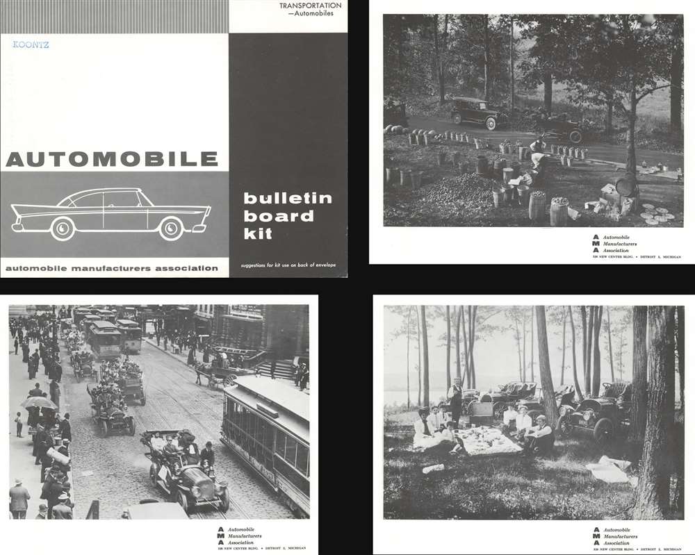
Very good. Exhibits light wear along original fold lines and at fold intersections. Verso repairs to fold separations. Closed margin tears professionally repaired on verso. Blank on verso. Accompanied by Bulletin Board Kit.
References
OCLC 12443795.