
Chevenard, L.
American colonies at the outset of the Revolutionary War.
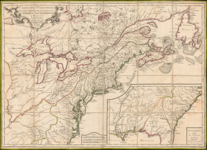
Carte des Possessions des Colonies Anglaises dans le Continent de L'Amérique Septentrionale et Partie de la Louisiane.
$2,400.00
Acquire
- Digital Map Information
- Suitable for large format printing
- Full resolution TIFF file
- ICC color profile embedded
- Delivered instantly via download link
This is the 1776 edition of Sebastian G. Longchamps's map of eastern North America, published at the outset of the American Revolutionary War (1775 - 1783) to capitalize on popular French interest in the conflict. The map was first issued in 1756, during the French and Indian War (1754 - 1763), but has here been revived with significant new engraving, additional relevant details, and a new title to illustrate the opening theaters of the American Revolution. Key revisions give greater prominence to the individual New England colonies and expand the coastal nomenclature of northern Newfoundland, where France retained valuable fishing privileges despite losing Canada. (more details)