
City Maps - Plans - Views (sold)
Capturing a glimpse of Cartier's meeting with the St. Lawrence Iroquois.
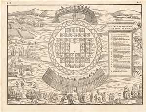
La Terra de Hochelaga Nella Nova Francia
sold
- Digital Map Information
- Suitable for large format printing
- DPI: 600
- File Size: 11.86 MB
- File Type: ZIP / TIFF
- ICC color profile embedded
- Delivered instantly via download link
This is an attractive example of the scarce first map of 'Montreal.' Printed in 1565, it is what Schwartz calls 'The very first plan of a village in the United States or Canada,' and it is the earliest printed map to use the place name 'Monte Real,' which would become Montreal. Perhaps even more significantly, this woodcut is one of the only images from the Discovery Period of an intact indigenous town, and its customs. (more details)
Published soon after the end of the Second French Intervention in Mexico in 1867.
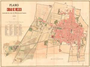
Plano de la Ciudad de Mexico.
sold
- Digital Map Information
- Suitable for large format printing
- File Size: 39.62 MB
- File Type: ZIP / TIFF
- ICC color profile embedded
- Delivered instantly via download link
Published following the 1867 Republican siege of Mexico City, this E. M. Segredo and Ministerio de Fomento (Ministry of Development) city plan or map of Mexico City depicts the recaptured capital of the restored Republic of Mexico. Some 125 parishes, churches, and other public establishments are numerically labeled throughout and correspond to an index below title. Converge extends from the Chapultepec castle in the lower left quadrant, along the Calzada Imperial (present day Paseo de Reforma), to the historic center of Mexico City. Of note is the planned expansion in the northeast, what is today Colonia Santa María la Ribera. The Chapultepec Castle and grounds, now a beautiful public park, was the shortly before this map as made, the seat of the Emperor Maximilian I, of the Second Mexican Empire. (more details)
Beautiful powder horn used during the American Revolutionary War.
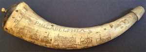
This is a beautifully carved powder horn dating to 1779. The horn is beautifully carved with the owner’s name and date of 1779 carved around the wide base of the horn. Images of a windmill, two ships, and several images of buildings are carved throughout. ... (more details)
The official map of Boston following the Annexation of Roxbury.
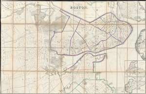
Plan of Boston.
sold
- Digital Map Information
- Suitable for large format printing
- File Size: 111.66 MB
- File Type: ZIP / TIFF
- ICC color profile embedded
- Delivered instantly via download link
The Boston City Engineer's Office produced this 1868 city plan or map of Boston. Depicting all the city of Boston, including the Roxbury, which was annexed into Boston January 5, 1868, shortly before this map went to press. Insets of South Boston and East Boston are situated on the bottom right. The color coding on the map refers to school districts with red indicating boy's schools, blue girl's schools, and green co-educational schools. As the most up to date official map of Boston, this map provided the base cartography for numerous subsequent commercial maps, including those issued by A. J. Johnson and Samuel Augustus Mitchell Jr. (more details)
'The crowning achievement of fifty years of exploration and research in the geography of Palestine' -Yehoshua Ben-Arieh
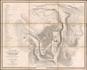
Plan of the Town and Environs of Jerusalem Constructed From the English Ordnance Survey and Measurements of Dr. T. Tobler.
sold
- Digital Map Information
- Suitable for large format printing
- File Size: 54.5 MB
- File Type: ZIP / TIFF
- ICC color profile embedded
- Delivered instantly via download link
Considered to be the most accurate map of Jerusalem published at the time, this is Charles William Meredith van de Velde's 1858 city plan or map of Jerusalem and its environs. Presenting the region in exceptional detail, the map covers from the Tombs of the Martyrs to Mount of Olives and from the Tomb of Simon the Just to the Hill of Evil Counsel. Important sites are labeled throughout, with the Dome of the Rock, the Al-Aqsa Mosque, the Church of the Holy Sepulcher, and the Church of the Tomb of the Virgin among them, and a further fifty-one sites are numerically identified and correspond with an index situated along the left border. Relief is indicated by hachure. (more details)
Overlooks Paris from the east and illustrates the Louvre, Notre Dame, and the Arc de Triomphe.
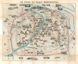
Le Guide de Paris Monumental.
sold
- Digital Map Information
- Suitable for large format printing
- File Size: 42.69 MB
- File Type: ZIP / TIFF
- ICC color profile embedded
- Delivered instantly via download link
Overlooking Paris from the east, this 1878 Jacques-Alphonse Testard pictorial map of Paris presents the 'City of Light' from a unique perspective. Drawn 'from' the donjon at the Château de Vincennes, Pere Lachaise cemetery and the Gare de Lyon are prominant in the foreground. Paris's other monuments line both banks of the Seine, which bisects the map. The Pantheon, Notre Dame, the Louvre, the Arc de Triomphe, and Les Invalides are all illustrated in profile. The city's streets wind their way from one end of the city to the other, with many of Baron Haussmann's Grands Boulevards illustrated and labeled. Paris's old city walls, colored pink, encircle the city, along with several railroad lines. (more details)
A city map of Cuba created by the Instituto Cartografico Nacional from aerial photographs provided by the U.S. Air Force.
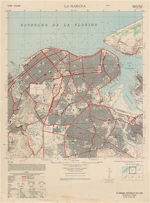
La Habana.
sold
- Digital Map Information
- Suitable for large format printing
- File Size: 29.99 MB
- File Type: ZIP / TIFF
- ICC color profile embedded
- Delivered instantly via download link
This is a 1955 Instituto Cartográfico Nacional city plan or map of Havana (La Habana), Cuba issued at the height of the Cuban Revolution (1953 - 1959). This map was compiled by the Batista regime and its U.S. allies to help strategize defense against the encroaching Revolutionaries under Fidel Castro. Streets are illustrated throughout and buildings outside the main city center are depicted ichnographically. The city's fortresses are illustrated and labeled, along with its port and railway network. Depth soundings are provided in the Strait of Florida and Havana Bay. (more details)
Beautiful city plan of Cleveland, Ohio.
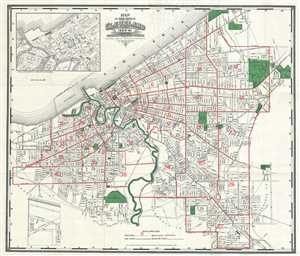
Map of the City of Cleveland for 1890-91.
sold
- Digital Map Information
- Suitable for large format printing
- File Size: 21.52 MB
- File Type: ZIP / TIFF
- ICC color profile embedded
- Delivered instantly via download link
This is a beautiful 1890 map of the city of Cleveland, Ohio issued by the Cleveland Directory Company. The map extends southward from Lake Erie and covers the entire city of Cleveland at the time, centered on the Cuyahoga River. An inset in the top left ... (more details)
The Young People's Society for the Christian Endeavor!
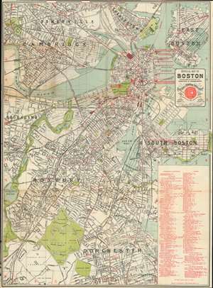
Official Map of Boston.
sold
- Digital Map Information
- Suitable for large format printing
- File Size: 39.37 MB
- File Type: ZIP / TIFF
- ICC color profile embedded
- Delivered instantly via download link
Published for the Fourteenth International Convention of the Young People's Society for the Christian Endeavor, this is an 1895 George H. Walker and Company city plan or map of Boston, Massachusetts. Red overprinting highlights over 100 different locations around the city, including hotels, churches, historic sites, and railroad stations. Seventy-nine of these are numerically labeled, while others are identified by name. Two massive tents erected on Boston Common, named Walliston and Endeavor, hosted many of the convention's events. (more details)
Locations throughout the city are identified and an arrow points the way to Chichen Itza.
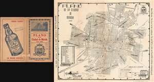
Plano de la Ciudad de Merida.
sold
- Digital Map Information
- Suitable for large format printing
- File Size: 22.66 MB
- File Type: ZIP / TIFF
- ICC color profile embedded
- Delivered instantly via download link
This is a 1953 Luis Gutierrez Gonzales city plan or map of Mérida, Yucatán, Mexico, the capital and largest city in Yucatán. In central Mérida, the streets are numbered, much like streets and avenues in major cities throughout the world. Neighborhoods are labeled and districts are numbered. Very few locations are labeled around the city, but those that are include the Cerveceria Yucateca, the Centro Social Turistico Los Tulipanes, and the cementerio general. Thirty-three locations are numerically identified, including numerous parks, the university, the archaeological museum, and the prison. Thirty of these locations are listed in a table situated along the left border, which also provides their grid location on the map, while a handful of hotels and three other locations are identified in the lower right corner. An arrow along the right border points the way to the Mayan ruins at Chichen Itza. (more details)
Brussels after the end of World War I.
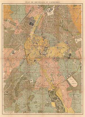
Plan de Bruxelles et Faubourgs.
sold
- Digital Map Information
- Suitable for large format printing
- File Size: 69.78 MB
- File Type: ZIP / TIFF
- ICC color profile embedded
- Delivered instantly via download link
Published soon after the end of World War I, this is a c. 1920 Albert de Boeck city plan or map of Brussels / Bruxelles, Belgium. Important municipal buildings, including the king's palace, government ministries, and the law courts, are all labeled. City parks are illustrated in detail, as is the street network. The railroad stations are labeled, along with the city's slaughterhouses, racecourses, prisons, and universities. (more details)
Depicts Wrigley Field and Soldier Field in profile.
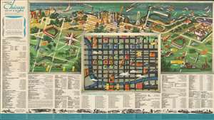
A Profile of Chicago Host City to the Nation.
sold
- Digital Map Information
- Suitable for large format printing
- File Size: 69.2 MB
- File Type: ZIP / TIFF
- ICC color profile embedded
- Delivered instantly via download link
Created in the euphoria just after World War II, this 1948 Robert McCall pictorial map of Chicago captures the era's gaiety. A promotional piece meant to draw vacationers to the city, muted colors evoke warmth and comfort. Chicago's institutions, including the University of Chicago, the Museum of Science and Technology, the Shedd Aquarium, and the Newberry Library are all prominently illustrated. Wrigley Field, Soldier Field, Comiskey Park, and Navy Pier also take pride of place. The detailed inset of the business district, The Loop, emphasizes the newfound prosperity of the post-war years and Chicago's economic importance. An additional sixty-three locations are numerically identified between the two maps and correspond with an index situated along the bottom border. An even larger index catalogs hotels, department stores, theaters, skyscrapers, and other places of interest to potential visitors. (more details)
Details the red-light district of New Orleans, popular with travelers, musicians, and many others from 1897 until 1917.
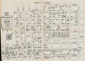
Storyville, New Orleans 1900 - 1915.
sold
- Digital Map Information
- Suitable for large format printing
- File Size: 15.35 MB
- File Type: ZIP / TIFF
- ICC color profile embedded
- Delivered instantly via download link
This is a 1944 Paul Eduard Miller and Richard M. Jones map of Storyville, New Orleans, the city's red-light district. Established in 1897 by municipal ordinance, Storyville consisted of thirty-eight blocks and was bounded by North Robertson, Iberville, Basin, and St. Louis Streets. Miller and Jones (who had lived and worked in Storyville) detail the district and identify brothels as well as grocery stores, hospitals, shops, saloons, and honky tonks. Streets are labeled, as is the railroad station across Basin Street from some of the highest-end establishments, including Mahogany Hall. (more details)