
Comissão de Cartografia das Colónias

Comissão de Cartografia das Colónias (fl. c. 1883 - 1936), in its early years as 'Comissão de Cartographia das Colónias', was an office within the Ministério da Marinha e Ultramar tasked with surveying Portugal's colonies, primarily in Africa. It was dissolved in 1936 and replaced with Junta das Missões Geográficas e de Investigações Colonia.
Forgotten Portuguese explorers of Africa's interior.
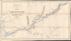
Carta do curso do rio Zaire de Stanley-Pool au Oceano.
$1,900.00
Acquire
- Digital Map Information
- Suitable for large format printing
- Full resolution TIFF file
- ICC color profile embedded
- Delivered instantly via download link
This is a remarkable 1883 map of the Congo River and adjoining regions produced by the Portuguese Comissão de Cartografia das Colónias. It highlights knowledge gained from the forgotten but important 1877 - 1879 Capelo-Ivens Expedition, a Portuguese effort to map and claim the lands along the river in the early days of the Scramble for Africa. (more details)
Portugal's dream of a transcontinental African colony.
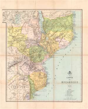
Carta de Moçambique.
$800.00
Acquire
- Digital Map Information
- Suitable for large format printing
- Full resolution TIFF file
- ICC color profile embedded
- Delivered instantly via download link
This is an 1889 map of Mozambique (Portuguese East Africa) made by the Comissão de Cartographia and printed in Paris by Georges Erhard. It was produced at the height of a Portuguese-British competition in central and eastern Africa, part of the 'Scramble for Africa' among European powers. The map reflects territorial claims extending far past areas of Portugal's actual control, a failed attempt to claim sovereign based on the doctrine of 'effective occupation' laid out at the Berlin Conference of 1884 - 1885. (more details)
British and Portuguese struggle for control of central Africa.
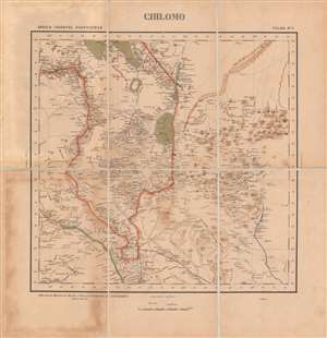
Chilomo - Africa Oriental Portugueza, Folha No. 5.
$800.00
Acquire
- Digital Map Information
- Suitable for large format printing
- File Size: 20.75 MB
- File Type: ZIP / TIFF
- ICC color profile embedded
- Delivered instantly via download link
This is a very rare c. 1896 map of the border region between the British Central Africa Protectorate and Portuguese Mozambique. This area had been hotly contested between the two colonial powers just a few years before and the border only recently settled in a contest that ensured British primacy in central Africa. (more details)
Lourenço Marques and the South African Republic's 'national railway.'
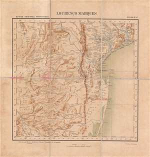
Lourenço Marques.
$800.00
Acquire
- Digital Map Information
- Suitable for large format printing
- File Size: 21.52 MB
- File Type: ZIP / TIFF
- ICC color profile embedded
- Delivered instantly via download link
This is a rare c. 1896 folding map of Lourenço Marques (now Maputo) and its surrounding region in Portuguese East Africa (Mozambique) made by the Comissão de Cartografia das Colónias. The map was produced in the wake of a Portuguese-British struggle for primacy in southeastern Africa and attempts by the South African Republic to maintain its independence by using Lourenço Marques as an outlet to the coast. (more details)