
Hanway, Jonas
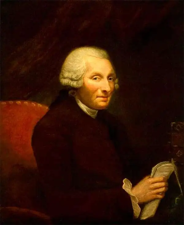
Jonas Hanway (August 12, 1712 - September 5, 1786), was an English philanthropist, traveller, and writer. He was apprenticed in 1729 to a merchant in Lisbon, but in 1743 he became partner to merchant and member of the British Russia Company Robert Dingley (1710 - 1780) who was based in St. Petersburg. This led to the travels in Russia, Central Asia, and Persia which would inform Hanway's (copious) writing on the topic of British trade in the Caspian Sea, which would earn him the attentions of scholar Charles Wilson who hailed him 'one of the most indefatigable and splendid bores of English history.' On his return to London his narrative brought him some fame and success, and thereafter he remained in the city devoted to good causes and good citizenship. He founded The Marine Society in 1756 (a charity supporting inland youths wishing to go to sea.) He was instrumental in the aid of various hospitals; arranged improvements in Londons's birth registration system; and in 1762 he was appointed a commissioner for victualling the navy. Hanway was an eccentric and a gadfly. He protested, voluminously, the English practice of tea drinking, both on the grounds of its effect on the health and on the balance of foreign trade. He was the first male Londoner to carry an umbrella. This shocking move drew the opprobrium of fellow Londoners who objected to the effeminate, French contraption, and the ire of hansom cab drivers who quite correctly identified the invention as a threat to their trade (rainstorms caused Londoners to flock to hansom cabs as a sheltered means of transport.) He died unmarried. A monument to his memory stands in Westminster Abbey, praising his works of charity. It discusses neither umbrellas nor tea.
Expanding Russian control of Siberia.
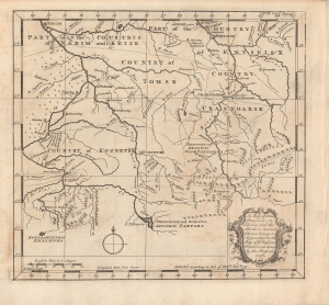
A map of some provinces in Siberia, and the borders towards China : being an appendage to the map of Russian Frontiers, as surveyed by the Russians, 1747.
$400.00
Acquire
- Digital Map Information
- Suitable for large format printing
- Full resolution TIFF file
- ICC color profile embedded
- Delivered instantly via download link
A wonderfully detailed map of a central portion of Siberia around Tomsk, engraved by John Gibson and published in 1753 in Jonas Hanway's An Historical Account of the British Trade over the Caspian Sea. With Russia's presence being established in the area in the early 17h century, the map reflects the steadily growing presence of Russian soldiers, missionaries, and settlers by the mid-18th century. (more details)
Britannia Propositions Persia With Intercourse.
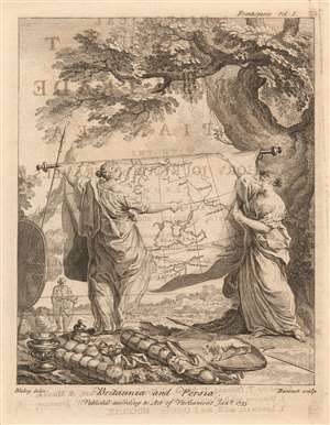
Britannia and Persia.
$150.00
Acquire
- Digital Map Information
- Suitable for large format printing
- Full resolution TIFF file
- ICC color profile embedded
- Delivered instantly via download link
This attractive, charming engraving was the frontispiece to Jonas Hanway's An Historical Account of the British Trade over the Caspian Sea an account of his journey from Russia to Persia and an exhaustive collection of the journals of other travelers to the region. The book supported British efforts to establish trade with the Persian Empire and this frontispiece visually sets the tone of the work. (more details)
Russian mapping of their southeastern frontier.
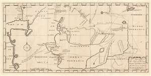
The Appendage to the Maps of the Orenburg Expedition, No. 1. and the Provinces in Siberia, No. 2. As taken by the Russians in 1747.
$650.00
Acquire
- Digital Map Information
- Suitable for large format printing
- Full resolution TIFF file
- ICC color profile embedded
- Delivered instantly via download link
This fascinating map of modern-day Turkmenistan, Uzbekistan and Tajikistan, engraved by John Gibson in 1753, was based on Russian maps Jonas Hanway included in his An Historical Account of the British Trade Over the Caspian Sea. Hanway supplemented the results of his own travels to the Caspian with a multiplicity of travelers' journals and the maps of other explorers, compiling an exhaustive collection of the most up to date geographical sources for this area, which remained one of the most obscure regions in the world. The map is centered on the Silk Route capitals of Samarkand and Bukhara, east of the Aral Sea. The cities of Tashkent and Badakshan are shown; the northeastern Caspian Sea and the lower part of the Ural River appears at the west; the eastern shore of the endoheiric Aral Sea is shown as well, but the western shore and indeed all the land between the Caspian and the Aral Sea is obscure. (The nomadic Tatars occupying that region were notoriously ill disposed towards travelers.) The map excels in detailing the regions south and east of the Aral, which include cities having 'plantations of trees' and 'mountains on which the Persians say is Gold and Silver and Lapis Lazuli.' (more details)
The most detailed chart of the Caspian Sea of the mid-18th century.
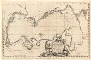
A Plain Chart of the Caspian-Sea, According to the Observations of Capt. John Elton, Author of Elton's Quadrant, and Thomas Woodroofe, Master of the British Ship Empress of Russia, Who navigated this Sea three years; Presented to Mr. Jonas Hanway of St. Petersburgh in 1745 by his most Obedient Servant Thomas Woodroofe.
$650.00
Acquire
- Digital Map Information
- Suitable for large format printing
- Full resolution TIFF file
- ICC color profile embedded
- Delivered instantly via download link
This superbly detailed chart of the Caspian Sea, engraved by John Gibson in 1753, was the first detailed charting of that sea following the work of Carl Van Verden, and arguably the better chart. It was produced for inclusion in Jonas Hanway's An Historical Account of the British Trade Over the Caspian Sea and relies on details provided Hanway by captains John Elton and Thomas Woodroofe, whose accounts have been preserved nowhere but in Hanway's work. (more details)
Russian mapping of their southeastern frontier.
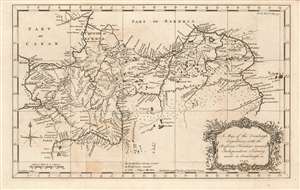
A Map of the Orenburgh Expedition, with the Russian Frontiers towards Independent Tartary, made in Orenburgh in 1747.
$550.00
Acquire
- Digital Map Information
- Suitable for large format printing
- Full resolution TIFF file
- ICC color profile embedded
- Delivered instantly via download link
This fascinating map, engraved by John Gibson in 1753, depicts modern-day southern Russia, along the empire's contentious frontier with the lands of the Kazakh and Oirat tribes. These and other tribes from what the map terms 'Independent Tartary' made regular incursions into Russian territory, and the first part of the 18th century was characterized by Russia's efforts to stem those incursions. Among these efforts was the construction of the Irtysh line, a series of fortifications clearly shown on this map spanning the Volga and the Irtysh Rivers, for much of the distance following the north bank of the Ural, or Yaik river. The map distinguishes between those fortifications already constructed, and those which were yet intended to be built. (more details)
The Volga and its tributaries in the mid-18th century.
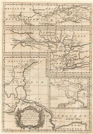
An exact map of the course of the Great River Volga, from the Survey made by Order of the Russian Court agreeable to the set of Maps publish'd in St. Petersburg in 1745.
$250.00
Acquire
- Digital Map Information
- Suitable for large format printing
- Full resolution TIFF file
- ICC color profile embedded
- Delivered instantly via download link
This is a superbly detailed chart of the Volga River, engraved by John Gibson in 1753, produced for inclusion in Jonas Hanway's An Historical Account of the British Trade Over the Caspian Sea. It relies on details provided Hanway by sources in the Russian Academy in St. Petersburg. In composing the map, Gibson has solved the problem of displaying a long, meandering river in detail by framing the map in three sections, adding a fourth general map to indicate how the detail maps connect. A General View of the Volga, positioned in the lower right quadrant of the sheet, shows the full length of the Volga from its source to the Caspian Sea with the letters 'A' and 'B' marking the points where the corresponding positions on the detail maps connect. (more details)
Trade routes between London and Persia.
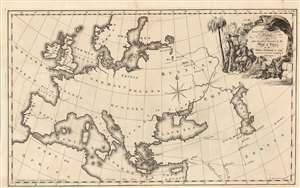
The Several Routs, to and from Persia taken from the Map, presented to the House of Lords by the Russia Company in 1740 and since Corrected according to Experience.
$450.00
Acquire
- Digital Map Information
- Suitable for large format printing
- Full resolution TIFF file
- ICC color profile embedded
- Delivered instantly via download link
This elegant 1753 Jonas Hanway map of Europe and the Near East illustrates the trade routes of British Russia Company, as proposed to the House of Lords in 1740. It was engraved in 1753 by John Gibson to accompany Jonas Hanway's account of his journey from Russia to Persia. Although not himself a company member, the merchant Hanway entered into partnership with member Robert Dingley (1710 - 1780). Thus, Hanway's routes taken in his 1743 journey hewed closely to the northern one proposed here. This route ran by sea to St. Petersburg and then by land to Tsaritsyn, Astrakhan and the Caspian Region. A southern route was also presented, from London via the Mediterranean to Syrma, and then to Persia via Asia Minor. (more details)
Trade routes between London and Russia.
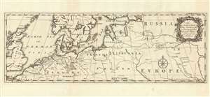
The Author's Routs from London as far as Zaritzen and back through Russia Germany and Holland.
$250.00
Acquire
- Digital Map Information
- Suitable for large format printing
- Full resolution TIFF file
- ICC color profile embedded
- Delivered instantly via download link
This is an example of John Gibson's rare map of Northern Europe, engraved in 1753 to accompany Jonas Hanway's account of his journey from Russia to Persia. It shows the track Hanway took in 1743 to northern Persia via Russia, as well as his return in 1750 via Germany and the Netherlands. Although its intent is simply to visually support Hanway's narrative, it highlights the important trade routes of Northern Europe between Britain and the East. (more details)