
Hewitt, Nathaniel Rogers

Nathaniel Rogers Hewitt (July 19, 1783 - 1841) was a British engraver active in London during the first half of the 19th century. Hewitt was born in London on the 19th of July 1785. His map engraving work appears as early as 1804, although it is most commonly associated with the 1812 - 1817 atlas maps of publisher John Thomson. Hewitt also worked with James Wyld, Samuel William Fores, and other map publishers of the period. In 1824, Hewitt announced plans to independently publish a series of Parish maps by subscription, and a beautifully engraved map of St. Giles in the Fields followed. The map series must not have been able to attract many followers, as Hewitt declared bankruptcy shortly after in 1826.
Poland on the eve of Partition.
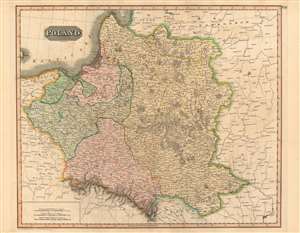
Poland.
$400.00
Acquire
- Digital Map Information
- Suitable for large format printing
- DPI: 600
- File Size: 78.93 MB
- File Type: ZIP / TIFF
- ICC color profile embedded
- Delivered instantly via download link
This is a fine example of John Thomson's 1814 map of Poland. It illustrates the lands of the former Polish-Lithuanian Commonwealth at the end of the Napoleonic Wars and on the cust of its partition betweem Russia, Prussia, and Austria. (more details)
Europe's Icy North.
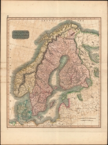
Scandinavia, or Sweden, Denmark and Norway.
$350.00
Acquire
- Digital Map Information
- Suitable for large format printing
- Full resolution TIFF file
- ICC color profile embedded
- Delivered instantly via download link
A fascinating hand colored c. 1815 map by John Thomson depicting Sweden, Denmark, and Norway. Modern day Finland, though included, was then part of the Kingdom of Sweden. (more details)
The Outer Edge of England.
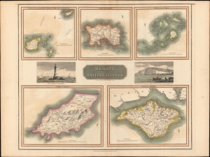
Remote British Islands.
$250.00
Acquire
- Digital Map Information
- Suitable for large format printing
- Full resolution TIFF file
- ICC color profile embedded
- Delivered instantly via download link
A lovely example of John Thomson's 1817 map of remote British islands, including the Isles of Wight, Man, and Jersey, with views of the Eddystone Lighthouse and Freshwater Bay on the Isle of Wight. (more details)
Sea at the center of the world.
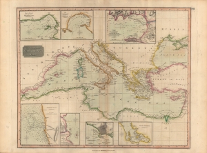
Chart of the Mediterranean Sea.
$250.00
Acquire
- Digital Map Information
- Suitable for large format printing
- Full resolution TIFF file
- ICC color profile embedded
- Delivered instantly via download link
A handsome 1817 map of the Mediterranean Sea produced for John Thomson's New General Atlas. It provides abundant information on the coasts and some of the main ports in the sea 'at the center of the world'. (more details)
1817 Thomson Map of the Southeastern United States: Georgia, Carolina, Virginia, Tennessee, Kentucky
A young nation looking west.
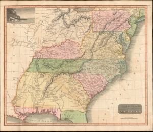
Southern Provinces of the United States.
$950.00
Acquire
- Digital Map Information
- Suitable for large format printing
- DPI: 600
- File Size: 633.59 MB
- File Type: ZIP / TIFF
- ICC color profile embedded
- Delivered instantly via download link
A scarce first edition of John Thomson's 1817 map of the southeastern part of the United States. Thomson prepared this map during a transitional period of expansion shortly following the American Revolutionary War and is among most thorough treatments of this region prior to the U.S. Government Surveys. It records early U.S. efforts to acquire and assimilate American Indian territories west of the Appalachian Mountains. (more details)
The 'District of Maine' and the Connecticut Western Reserve!
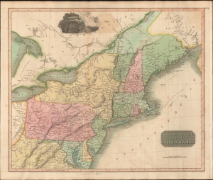
Northern Provinces of the United States.
$450.00
Acquire
- Digital Map Information
- Suitable for large format printing
- DPI: 600
- File Size: 631.07 MB
- File Type: ZIP / TIFF
- ICC color profile embedded
- Delivered instantly via download link
A scarce first edition example of John Thomson's 1817 map of the northeastern parts of the United States, including New York, Massachusetts, Connecticut, Vermont, New Hampshire, Maine, Pennsylvania, New Jersey, Maryland, Rhode Island, and parts of adjacent Virginia, Canada, and the Great Lakes. There appears a large inset of Niagara Falls along the top border. (more details)
Map of North America that predates the Louisiana Purchase.
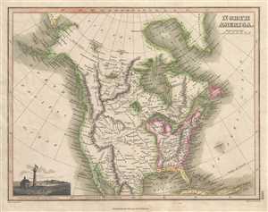
North America.
$275.00
Acquire
- Digital Map Information
- Suitable for large format printing
- DPI: 300
- File Size: 4.02 MB
- File Type: ZIP / TIFF
- ICC color profile embedded
- Delivered instantly via download link
This 1819 Thomson map of North America depicts the entire continent from north of the Arctic Circle to northern Mexico and Baja California. The United States is labeled in detail, including the Western Territory, New England, and the states of Pennsylvania, New ... (more details)