
Hewitt, Nathaniel Rogers (sold)

Nathaniel Rogers Hewitt (July 19, 1783 - 1841) was a British engraver active in London during the first half of the 19th century. Hewitt was born in London on the 19th of July 1785. His map engraving work appears as early as 1804, although it is most commonly associated with the 1812 - 1817 atlas maps of publisher John Thomson. Hewitt also worked with James Wyld, Samuel William Fores, and other map publishers of the period. In 1824, Hewitt announced plans to independently publish a series of Parish maps by subscription, and a beautifully engraved map of St. Giles in the Fields followed. The map series must not have been able to attract many followers, as Hewitt declared bankruptcy shortly after in 1826.
Large map of the Russian Empire spanning Asia and Europe.
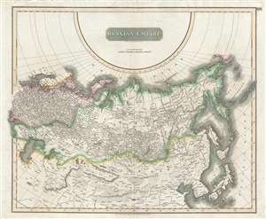
Russian Empire.
sold
- Digital Map Information
- Suitable for large format printing
- DPI: 300
- File Size: 15.94 MB
- File Type: ZIP / TIFF
- ICC color profile embedded
- Delivered instantly via download link
This large 1814 atlas map depicts the Russian Empire in its entirety, both in Europe and in Asia as well as adjacent parts of Tartary, Chinese Tartary, Japan, Korea, and the Gobi. In 1815 Tsarist Russia emerged from the Napoleonic Wars economically insolvent and ... (more details)
A map of the Russian Empire at the end of the Napoleonic Wars.
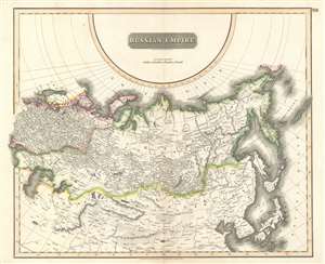
Russian Empire.
sold
- Digital Map Information
- Suitable for large format printing
- DPI: 600
- File Size: 31.41 MB
- File Type: ZIP / TIFF
- ICC color profile embedded
- Delivered instantly via download link
This is an 1814 John Thomson map of the Russian Empire. The map depicts the region from the Baltic Sea, Prussia, and Sweden to the Aleutian Islands and from the Arctic Ocean to the Yellow River. Highly detailed, myriad cities, towns, and villages are labeled throughout, including St. Petersburg, Moscow, Minsk, Kiev, and Kharkov. Rivers and mountain ranges are also identified, as are islands and numerous locations along the coastlines. It is important to note that the long-disputed sea between Korea and Japan is identified as the 'Sea of Japan. (more details)
1817 Thomson Map of the Southeastern United States: Georgia, Carolina, Virginia, Tennessee, Kentucky
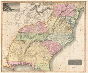
Southern Provinces of the United States.
sold
- Digital Map Information
- Suitable for large format printing
- DPI: 300
- File Size: 18.64 MB
- File Type: ZIP / TIFF
- ICC color profile embedded
- Delivered instantly via download link
A scarce first edition of John Thomson's 1817 map of the southeastern part of the United States. Thomson prepared this map during a transitional period of expansion shortly following the American Revolutionary War and is among most thorough treatments of this region prior to the U.S. Government Surveys. It records early U.S. efforts to acquire and assimilate American Indian territories west of the Appalachian Mountains. (more details)
The 'District of Maine' and the Connecticut Western Reserve!
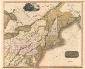
Northern Provinces of the United States.
sold
- Digital Map Information
- Suitable for large format printing
- Full resolution TIFF file
- ICC color profile embedded
- Delivered instantly via download link
A scarce first edition example of John Thomson's 1817 map of the northeastern parts of the United States, including New York, Massachusetts, Connecticut, Vermont, New Hampshire, Maine, Pennsylvania, New Jersey, Maryland, Rhode Island, and parts of adjacent Virginia, Canada, and the Great Lakes. There appears a large inset of Niagara Falls along the top border. (more details)
The pseudo-state of Franklinia!
![1819 Thomson Map of the United States [Franklinia]](/mm5/graphics/00000001/M/UnitedStates-thomson-1819-2-M.jpg "1819 Thomson Map of the United States [Franklinia]")
United States.
sold
- Digital Map Information
- Suitable for large format printing
- DPI: 600
- File Size: 6.28 MB
- File Type: ZIP / TIFF
- ICC color profile embedded
- Delivered instantly via download link
This 1819 Thomson / Wyld map of the United States, one of the last and few maps to identify the ephemeral pseudo-state of Franklinia, as well as the land claims of the Ohio Company of Associates. Coverage extends from the Missouri River to the Atlantic and from the Great Lakes to the Gulf of Mexico. A vignette view of the Niagara Falls sets in the lower right. (more details)
Unique map of the United States that includes the 'forgotten' state of Franklinia.
![1819 Thomson Map of the United States [Franklinia]](/mm5/graphics/00000001/M/UnitedStates-Thomson-1819-M.jpg "1819 Thomson Map of the United States [Franklinia]")
United States.
sold
- Digital Map Information
- Suitable for large format printing
- DPI: 300
- File Size: 2.96 MB
- File Type: ZIP / TIFF
- ICC color profile embedded
- Delivered instantly via download link
This 1819 map of the United States depicts the Atlantic coast from Nova Scotia and New Brunswick to northern Florida. This is one of the latest and few maps to identify the ephemeral pseudo-state of Franklinia. There is a vignette view of the Niagara Falls in ... (more details)
The only known example.
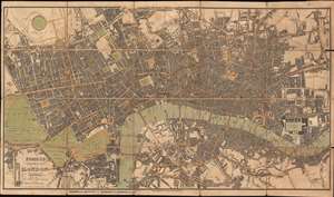
Fores's New Plan of London Including the New Improvements.
sold
- Digital Map Information
- Suitable for large format printing
- Full resolution TIFF file
- ICC color profile embedded
- Delivered instantly via download link
This is an 1822 Samuel William Fores city plan or map of London, England. Focusing on central London in the vicinity of the Thames River, the map depicts from Hyde Park to Bethnal Green and from Regent's Park to Rotherhithe. Numerous landmarks, including the Tower of London, London Bridge, St. Paul's Cathedral, the British Museum, and Buckingham Palace (labeled here as Buckingham House), all appear. Streets, squares, and other buildings are identified. (more details)
Jehoshaphat Aspin's rare map illustrating the discoveries of John Oxley and George Evans in New South Wales, Australia.
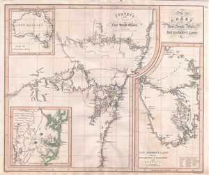
A Chart of New South Wales, Van Diemen's Land, &c. / Surveys of the Interior of New South Wales. / Van Diemen's Land from the Most Recent Authorities and Surveys. / British Settlements of Port Jackson, & C.
sold
- Digital Map Information
- Suitable for large format printing
- Full resolution TIFF file
- ICC color profile embedded
- Delivered instantly via download link
This rare and important 1827 map by the mysterious female cartographer Jehoshaphat Aspin is one of the earliest obtainable separate maps of New South Sales, Australia, to illustrate the explorations undertaken by John Oxley and George Evans between 1817 and ... (more details)
The first American map about Coffee!
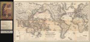
A Chart of the Globe Showing the Several Places Where Coffee is or May be Produced and Where it is also used together with The Telegraph Lines in operation or contemplated for completing the Circuit of the Globe.
sold
- Digital Map Information
- Suitable for large format printing
- File Size: 25.84 MB
- File Type: ZIP / TIFF
- ICC color profile embedded
- Delivered instantly via download link
A fascinating 1872 thematic map of the world by Robert Hewitt detailing the global production and traffic in coffee - considered the first American map related to Coffee - accompanied by a signed first edition of Hewitt's important book on coffee. Presented on Mercator's projection, the map dually identifies coffee production and consumption, and telegraph lines. A series of color codes referenced in the lower right breaks down the region according to the ability to grow and use coffee, and its rate of consumption, with places like Rio de Janeiro, Colombo (Sri Lanka), and Sumatra as centers of both production and consumption, places of increasing consumption, like Melbourne (Australia), the United States, places of limited consumption (mostly Scandinavian countries), and everything in between. (more details)