
Köllner, Augustus Theodore Frederick (A. Kollner)
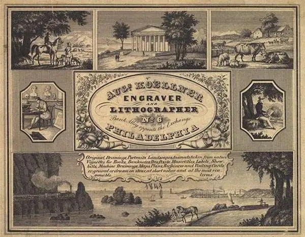
Augustus Theodore Frederick Köllner (1812 - December 10, 1906) was an artist, engraver, and lithographer based in Philadelphia. Born in Wurttemberg, Germany, Köllner began his career in Germany, working as a book illustrator in Stuttgart and Paris in the late 1820s and 1830s before immigrating to the United States in 1839. After settling in Washington, D.C., Köllner worked as a lithographer for the Haas firm, working on advertisements, bank notes, and city views. He moved to Philadelphia in 1840 and tried unsuccessfully to establish himself as a portrait painter. After this misstep, Köllner became the second chief artist of P.S. Duval and William Huddy's 'U.S. Military Magazine' (1839 - 1842). Throughout the 1840s, Köllner worked as a lithographer for many different Philadelphia based lithographic firms, including Duval, J.T. Bowen, Frederick Kuhl, Thomas Sinclair, and Wagner and McGuigan. Between 1847 and 1848, Köllner began working for the lithographic firm Brechemin and Camp, for whom he designed all genres of lithographs and advertised his own lithographic views based on his annual summer sketching trips along the East Coast. His work also began to be published in the seminal series 'View of American Cities', published between 1848 and 1851 by Goupil, Vibert, and Company. While working for Brechemin and Camp, Köllner was responsible for creating the multi-foot Dripp's map of New York City. Kollner established his own firm in 1851 and worked on a wide range of projects, including advertisements, labels, city and landscape views, and maps. During the Civil War, Köllner enlisted in the cavalry in 1863 and later sold photographic reproductions of the etchings he did as a soldier. He produced his last series of landscape lithographs entitled 'Bits of Nature' in 1878, but focused mostly on his watercolor work during the late 1870s. Köllner retired in the early 1880s, but continued to make sketching trips around the Philadelphia area. Köllner married Mary Sheek (c. 1821 - 1899) in 1843, and they had several children, three of which survived infancy: William, Clara, and Josephine. Köllner died on December 10, 1906.
AKA: A. Kollner
On the cover of Ristow's 'Maps and Mapmakers.'
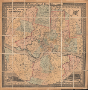
Map of the Circuit of Ten Miles Around the City of Philadelphia With the names of Villages, Roads, Milles, Property Owner, Taverns, etc. / Sidney's Map of Ten Miles round.
$3,800.00
Acquire
- Digital Map Information
- Suitable for large format printing
- File Size: 35.64 MB
- File Type: ZIP / TIFF
- ICC color profile embedded
- Delivered instantly via download link
This is an attractive example of J. C. Sidney's 1847 map of Philadelphia, covering the city and its vicinity 'Ten Miles round'. Smith, the publisher, considered this one of the 'most successful of his maps'. Water Ristow, in American Maps and Mapmakers, placed this map on the cover, devoted a full-page illustration to it, and included several pages of text, underscoring its significance as an example of mid-19th-century American map publishing. Indeed, its producers were a who's who of Philadelphia map publishing: Robert Persall Smith, Norman Friend, Augustus Köllner, Peter Steven Duval, and James Charles Sidney. (more details)
Chromolithograph view of Washington's tomb at Mount Vernon.
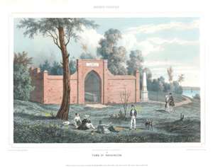
Tomb of Washington.
$375.00
Acquire
- Digital Map Information
- Suitable for large format printing
- Full resolution TIFF file
- ICC color profile embedded
- Delivered instantly via download link
This is an 1848 Augustus Köllner view of George Washington's tomb at Mount Vernon, Virginia. Depicting the New Tomb at Mount Version, the tomb's brick façade dominates the view, and the inscription above the archway is legible and reads 'Within this Enclosure Rest the remains of Genl. George Washington.' Washington's marble casket is seen through the steel gate barring entry to the tomb. A white obelisk (described as a marble shaft by Mount Vernon) appears to the right and was erected in memory of Bushrod Washington, a proprietor of Mount Vernon. Two men and one woman are illustrated lounging under a tree and are seen conversing with another man in the foreground. A couple strolling through the ground are seen further back, and the Potomac River can just be seen along the right side. (more details)
Andover, educational Mecca.
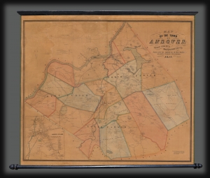
Map of the Town of Andover, Essex County, Massachusetts.
$2,000.00
Acquire
- Digital Map Information
- Suitable for large format printing
- Full resolution TIFF file
- ICC color profile embedded
- Delivered instantly via download link
This is a scarce 1852 Henry F. Walling wall map of Andover and North Andover, Massachusetts. Like most Walling town maps, the cartographer has taken great pains to identify the homes of individual families and landowners, as well as important roads, rail lines, municipal buildings, and businesses. Walling sold his maps by subscription, often going door to door, so the presence of individual property owners was doubtless intended as an enticement to buyers. Both Phillips Andover Academy and the Andover Theological Seminary are identified in the inset in the lower left. (more details)
Pennsylvania Coal Boom!
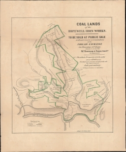
Coal Lands of the Hopewell Iron Works.
$800.00
Acquire
- Digital Map Information
- Suitable for large format printing
- File Size: 15.3 MB
- File Type: ZIP / TIFF
- ICC color profile embedded
- Delivered instantly via download link
This is an unrecorded and likely unique 1853 promotional broadside with significant manuscript annotations, printed by Augustus Köllner for a land auction held in Philadelphia. The land being sold, located in Bedford County in southern Pennsylvania, was rich in coal deposits and historically supplied the Hopewell Furnace, a legendary American ironworks located in Berks County which supplied cannon and other war materials during American Revolution. By this time, the Hopewell Furnace had long ceased to operate, but its valuable coal-land, as here, took on new significance with the emergence of the Industrial Revolution. (more details)