
Phillips, Augustus Dewey

Augustus Dewey Phillips (May 6, 1898 - December 14, 1975), a.k.a. 'Gus', was an American artist, cartographer, and publisher. Born on Mount Desert Island, Maine, as a boy Augustus and his brother Luther Savage Phillips (1891 - 1960) helped their dad in a variety of odd jobs, including maintaining a boat rental business and harvesting and selling ice. Augustus graduated from Hebron Academy and then attended the University of Maine for a short time. After leaving university, Phillips became a Maine Guide and worked as a carpenter and draftsman in the South Portland and Boothbay Harbor ship and boat yards. The brothers traveled together widely throughout Maine. Luther went on to start a popular map and postcard business out of Northeast Harbor, Maine. After Luther died in 1960, Augustus took over the map businesses. In a tragic turn of events, in 1973 an out of control bush fire destroyed the Phillips studio and much of the surviving stock, making all Phillips' maps issued prior to that date rare. His passion for landscapes helped Augustus create his own map style. Augustus expanded the business and continued making new maps until he died in 1975. Augustus' son, Donald Beekman Phillips (1935 - 2009) continued the business after his father's death. Augustus married Mary Fletcher on April 26, 1922, with whom he had four children.
Pictorial map of Maine by a Northeast Harbor local.
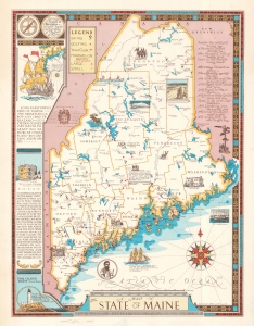
This is the 1963 second edition of Northeast Harbor artist Luther S. Phillips' pictorial map of Maine. (more details)
The Birth of Maine's Modern Conservation Movement.
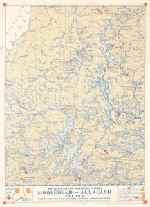
Phillips' Map of Northern Maine's Moosehead-Allagash Region Headwaters of the Kennebec, St. John and Penobscot Rivers.
$250.00
Acquire
This is a scarce 1963 pictorial map of the Moosehead - Allagash region of northern Maine prepared by Augustus Phillips and Sons. It portrays the region in a period when it was in danger of being substantially altered by proposed hydroelectric dams, and a nascent conservation movement was emerging. (more details)
Popular summer tourism destination near Mount Desert Island.
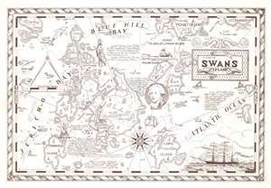
This is a 1963 Augustus Phillips pictorial map of Swan's Island, Maine. Swan's Island is situated to the left of center with the towns of Swan's Island, Minturn, and Atlantic labeled. Burnt Coat Harbor, Seal Cove, and other coastal features are illustrated and labeled. The region's numerous islands, including Harbor Island, Marshall Island, and the extreme southern portion of Mount Desert Island, are noted. Short texts provide historical context. One states that Colonel James Swan bought the island in 1786, while another impresses that Sieur de la Mothe Cadillac sold enough timber from Swan's Island (then known as 'Brule Cote') to absolve himself from bankruptcy in the eyes of the French Courts. (more details)
'The Greatest Mountain.' -Penobscot Peoples
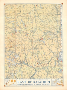
Phillips' Map of the Part of Northern Maine 'East of Katahdin' Showing Approaches to Baxter State Park.
$400.00
Acquire
This is Augustus D. Phillips' scarce 1964 map of northeastern Maine showing Mount Katahdin and Baxter State Park. It is among the rarest maps issued by the Maine artist, with only two other examples known. (more details)
Northern Terminus of the Appalchian Trail - made by a Mainer.
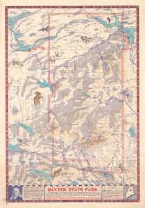
This is a 1965 Augustus Phillips and Son pictorial map of Baxter State Park and environs in Maine, including Mt. Katahdin, Maine's highest peak and the northern terminus of the Appalachian Trail. The pictorial maps of Luther S. Phillips and his son, Augustus, are much beloved in Maine, where they have a strong local following. (more details)
Charming pictorial map of Penobscot Bay.
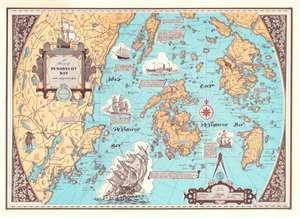
This is a 1970 'Augustus Phillips and Son' pictorial map of Penobscot Bay, Maine. Islands throughout the bay are illustrated in detail, including North Haven, Deer Isle, Little Deer Isle, and the Isle au Haut. Maine's coastline appears in detail as well, with coves, harbors, points, and other landmarks noted. The highway network winds its way through the countryside. Vignette views of sailing ships from 1603 through the 20th century decorate the bay. (more details)
Beautifully detailed pictorial map of the Upper Penobscot Bay region.
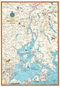
This is a charming 1972 Augustus D. Phillips pictorial map of the upper Penobscot Bay. Featuring illustrations of ships and local wildlife, Phillips's many iconic Maine maps combine practical information, history, humor, and beautiful detail, making them a favorite of 'in the know' collectors. (more details)