
Valentijn, Francois
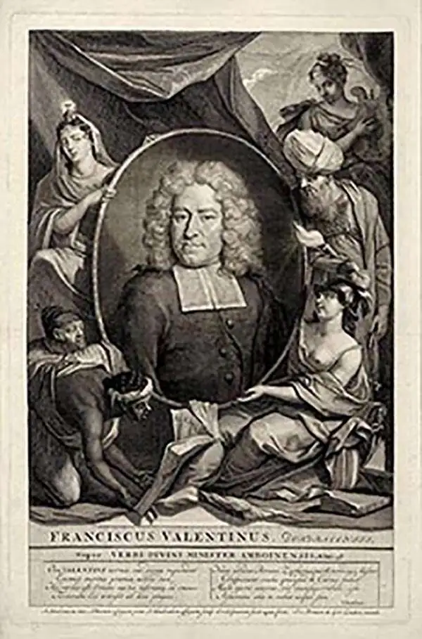
Francois Valentijn (April 17, 1666 - August 6, 1727) was a Dutch minister, naturalist, colonial administrator, and historian active in Holland and the East Indies, in the late 17th and early 18th centuries. Valentijn was born in Dordrecht, Holland and studied at the Universities and Leiden and Utrecht before, in 1685, taking a position with the Dutch East India Company (VOC). He remained in the East Indies for about 10 years before returning to Dordrecht. Unable to adjust to life in Europe, he returned to the East Indies in 1705 where he remained for another 9 years. After 19 total years in the Orient working for the VOC, Valentijn once again returned to Holland where he composed his eight volume five part masterwork Oud en Nieuw Oost-Indien. The scope and detail of this work, including over 1000 engraved images and numerous maps was unprecedented with regards to Asia. The work contained some of the finest and most detailed large scale maps of the East Indies ever published. The most important of these focus on Taiwan and Malaya. Valentijn most likely drew on secret VOC manuscript maps and documents, a fact that makes it exceptionally surprising that his works were actually published. Valentijn academic scholarship, in sharp contrast to his cartographic work, is often highly criticized as being self-aggrandizing and, more often than not, plagiarized.
Charting the Spice Islands.
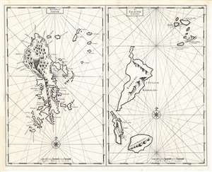
Het Eyland Sangir./ De Talautse Eylanden.
$350.00
Acquire
- Digital Map Information
- Suitable for large format printing
- DPI: 600
- File Size: 48.24 MB
- File Type: ZIP / TIFF
- ICC color profile embedded
- Delivered instantly via download link
This is a 1724 François Valentijn engraving comprised of two nautical charts, one of the Indonesian archipelagos of the Sangihe Islands, and other of the Talaud Islands. The charts are elegantly and simply engraved, with rhumb lines and compass roses. The islands themselves incorporate coastal views oriented to assist in approaches to their anchorages, which are marked as well, along with depth soundings. The island of Sangihe in particular identifies many settlements, along with pictorial forests. Sangihe was a major nutmeg and clove-producing island, making these forests more important than mere decorations. Also marked on Sangihe is the massive stratovolcano Gunung Awu. Although not named here, it is identified with its smoking peak. (more details)
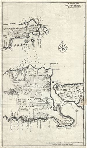
S. Sevende bestek 'T Vorstendom of Landschap Balamboang.
$450.00
Acquire
- Digital Map Information
- Suitable for large format printing
- Full resolution TIFF file
- ICC color profile embedded
- Delivered instantly via download link
This is a rare and exquisite 1726 map of eastern Java by Francois Valentijn. It covers the eastern tip of Java as well as the western portions of Bali including the modern day Bondowosa Regency, Situbondo Regency, Jember Regency and the Banyuwangi Regency ... (more details)
Earliest and most desirable printed map of Taiwan / Formosa.
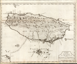
Kaart van het Eyland Formosa en de Eylanden van Piscadores.
$3,000.00
Acquire
- Digital Map Information
- Suitable for large format printing
- File Size: 22.09 MB
- File Type: ZIP / TIFF
- ICC color profile embedded
- Delivered instantly via download link
Printed in 1726 by Francois Valentijn, this is the earliest and most desirable printed map of Formosa (Taiwan). It is considered the first specific printed map of Formosa. (more details)
First map to show modern polities in Malaya.
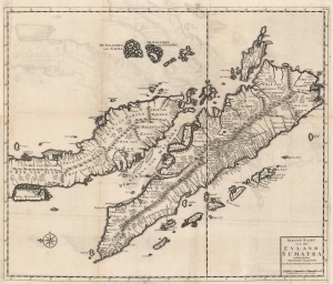
Nieuwe Kaart van het Eyland Sumatra verbeterd door Francois Valentyn.
$2,000.00
Acquire
- Digital Map Information
- Suitable for large format printing
- Full resolution TIFF file
- ICC color profile embedded
- Delivered instantly via download link
This is a superb example of Francois Valentijn's 1726 map of Malaya (Malaysia and Singapore) and Sumatra. This is the earliest published map to present a sophisticated treatment of Malaya and Sumatra, and the model upon which most subsequent maps through the late 18th century were based. It is, moreover, one of the earliest maps to expound upon the indigenous polities of Malaya. (more details)