
Vancouver, George
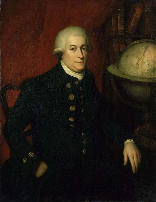
George Vancouver (June 22, 1750 - May 10, 1798) was a British naval officer and explorer active in the late 18th century. Vancouver was the last of the great naval explores of the 18th century and, along with Captain James Cook and Perouse, is credited with the first accurate mapping of the Northwest Coast of America. Vancouver was born in King's Lynn, England and joined the Royal Navy at age 13 as a seaman. While little is known of Vancouver's early life, he first appears in the annals of history as a midshipmen aboard the HMS Resolution of Captain Cook's second voyage in search of Terra Australis. On this expedition Vancouver claimed to have "been nearer the south pole than any other man" (after climbing the bowsprit before the ship turned back in the face of mountains of Antarctic ice). He also accompanied the third Cook expedition as a midshipman on the HMS Discovery where he witnessed the discovery of the Hawaiian Islands as well as Cooks tragic death on those same islands. Returning to England under Cook's second, Captain Clerke recommended Vancouver for promotion to Lieutenant. Under his new commission he spent several years learning surveying in the Caribbean aboard the HMS Martin, where he also distinguished himself in a number of military altercations with the French. In 1790 Vancouver received an appointment as the Captain of the HMS Discovery and was commissioned to complete the exploration of American's Northwest Coast begun by Cook and Perouse. Between 1791 and 1795 Vancouver's remarkable diligence and attention to detail created the first truly accurate cartographic picture of the American Coast between San Francisco Bay and California. Vancouver was the first to map countless rivers and inlets and to identify Vancouver Island. During his four years of exploration he also spent three winters in Hawaii, creating in the process the first accurate map of the islands. Unlike many earlier explorers Vancouver generally maintained good and respectful relations with the indigenous peoples he encountered. In Hawaii Vancouver allegedly negotiated the cession of Hawaii to England as well as introduced beneficial flora and fauna to the archipelago. Vancouver returned to England in 1795 where he immediately ran afoul of the powers that be. During his voyages Vancouver excited the ire of more than one crew member, including the well-connected naturalist Archibald Menzies, the sailing master Joseph Whidbey, and Thomas Pitt, the powerful Baron of Camelford. Slandered and assaulted by these influential enemies, one of Britian's greatest explorers fell into obscurity. He died shortly after in 1798 and was buried in an unremarkable grave at St. Peter's Churchyard, Petersham, Surrey, England. The journals of Vancouver's expedition, as well as his all-important maps, were published posthumously in the same year as his death. Robin Fisher, the academic Vice President of Mount Royal University in Calgary and author of two books on Vancouver, writes:
He [Vancouver] put the northwest coast on the map...He drew up a map of the north-west coast that was accurate to the 'nth degree,' to the point it was still being used into the modern day as a navigational aid. That's unusual for a map from that early a time.Today Vancouver is memorialized by Vancouver Island, which he discovered, the Hudson Bay Company's Fort Vancouver, the city of Vancouver, Vancouver Peninsula Australia, Mount Vancouver, the 8th highest mountain in Canada, Vancouver Bay in Jervis Inlet, and the Vancouver Maritime Museum. For his 250th birthday, the Canada Post issued a special postage stamp in his honor.
Vancouver's Exploration of Cook Inlet.

Cote Nord-Ouest de L'Amerique Reconnue par le Cape. Vancouver. VIIe Partie.
$1,900.00
Acquire
- Digital Map Information
- Suitable for large format printing
- DPI: 600
- File Size: 29.43 MB
- File Type: ZIP / TIFF
- ICC color profile embedded
- Delivered instantly via download link
One of the great navigator George Vancouver's most important and influential maps, this is Vancouver's 1799 mapping of Kodiak Island and Cook Inlet, near Anchorage, Alaska. Cook Inlet was one of the primary objectives of the Vancouver Expedition, as it remained unexplored after James Cook's initial tenuous mapping, it was considered a possible outlet for the Northwest Passage. Centered on the entrance to Cook Inlet, this map covers from Knik Arm and Turnagain Arm southwards as far as the southernmost tip of Kodiak Island. It evokes the rugged topography of the region, showing mountains and rough ground pictorially, albeit without precise elevations. Mount St. Augustin and several volcanoes are noted. An inset of Port Chatham, at the southern tip of the Kenai Peninsula, appears in the upper left quadrant. (more details)
Largest, most beautiful, and most important early map of Hawaii.

Carte des Iles Sandwich d'apres la reconnoissance qui en a ete faite dans les differentes relaches de la corvette La Decouverte et de sa conserve Le Chatham commandes par le Capt. Vancouver en 1792, 1793 et 1794.
$5,000.00
Acquire
- Digital Map Information
- Suitable for large format printing
- Full resolution TIFF file
- ICC color profile embedded
- Delivered instantly via download link
This is a beautiful example of George Vancouver's seminal 1799 map of the Hawaiian Islands, considered the largest, most important, and most beautiful map of Hawaii to appear in the 18th century. (more details)
Most detailed 18th century mapping of northern California and Oregon.

Cote Nord-Ouest de L'Amérique Reconnue par le Cape. Vancouver. 2e. Partie.
$1,500.00
Acquire
- Digital Map Information
- Suitable for large format printing
- File Size: 22.12 MB
- File Type: ZIP / TIFF
- ICC color profile embedded
- Delivered instantly via download link
This is an example of George Vancouver's 1799 map of the northern California and Oregon coastline, which is considered the most detailed and authoritative mapping of the region in the late 18th century. Vancouver mapped this coastline in 1792, identifying it as New Albion in recognition of England's territorial claims dating to the 1579 exploration of Sir Francis Drake. (more details)
Anchorage, Valdez, and Cordova.

Cote Nord-Ouest de L'Amérique Reconnue par le Cape. Vancouver. VIe. Partie.
$1,000.00
Acquire
- Digital Map Information
- Suitable for large format printing
- File Size: 25.99 MB
- File Type: ZIP / TIFF
- ICC color profile embedded
- Delivered instantly via download link
This is George Vancouver's 1799 map of the southern Alaskan coast in the vicinity of Prince William Sound - this includes modern-day Anchorage, Valdez, and Cordova, as well as the Chugach National Forest, Eagle River Nature Center, and Alaska Wildlife Conservation Center. (more details)
First scientific survey of the Alexander Archipelago.

Cote Nord-Ouest de L'Amérique Reconnue par le Cape. Vancouver. Ve. Partie.
$1,000.00
Acquire
- Digital Map Information
- Suitable for large format printing
- File Size: 28.04 MB
- File Type: ZIP / TIFF
- ICC color profile embedded
- Delivered instantly via download link
This is George Vancouver's 1799 map of the southern Alaskan coast in the vicinity of Sitka. It is considered the first scientific survey of the southern Alaska panhandle and would remain so for nearly 90 years. (more details)
First English reconnaissance of Spanish settlement in California.
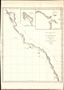
Cote Nord-Ouest de L'Amerique Reconnue par le Cape. Vancouver. 1e Partie.
$1,500.00
Acquire
- Digital Map Information
- Suitable for large format printing
- DPI: 600
- File Size: 24.66 MB
- File Type: ZIP / TIFF
- ICC color profile embedded
- Delivered instantly via download link
One of the great navigator George Vancouver's most important and influential maps, this is his 1799 charting of the California coastline roughly from Santo Domingo, Mexico, to San Francisco Bay. Vancouver's exploration of the California coastline was significant, breaking the Spanish wall of silence and producing the first English reconnaissance on Spanish settlement and colonization of the West Coast. Vancouver's mapping of California generated the finest coastal chart of the region to date. (more details)
Some of the earliest nautical views of the Hawaiian Islands.
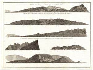
Vues des Iles Sandwich et Autres Iles.
$900.00
Acquire
- Digital Map Information
- Suitable for large format printing
- DPI: 300
- File Size: 9.37 MB
- File Type: ZIP / TIFF
- ICC color profile embedded
- Delivered instantly via download link
A fine example of George Vancouver's 1799 view sheet for the Hawaiian Islands and Galapagos. This sheet features six beautifully rendered views detailing, from top: Waikiki Bay, Ohau (Baie Whyteete); Waimea Bay, Ohau (Baie Whymea a Atooi); Lahaina, Maui (Code de ... (more details)