
Allodi, Pietro (sold)

Pietro Allodi (fl. 1859-1878) was an Italian author, engraver, and illustrator; despite his having been apparently prolific in Milan - working for a number of different publishers, including Ferdinand Artaria - virtually nothing is known of his life and his training.
A superbly executed map of Lake Como and its region.
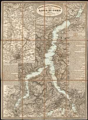
Nuova Carta Topografica Del Lago Di Como.
sold
- Digital Map Information
- Suitable for large format printing
- Full resolution TIFF file
- ICC color profile embedded
- Delivered instantly via download link
This is a rare 1864 Artaria map of Lake Como and its vicinity, produced shortly after Giuseppe Garibaldi's campaign recaptured the territory from Austria. It masterfully evokes the mountainous terrain, shown with some of the finest hachure-engraving we have seen in this medium. The map includes the area surrounding the cities of Como and Lecco, and the Lago di Pusiano, Lago di Annone, Lago di Mezzola, and the smaller lakes surrounding Lake Como. An inset map in the upper left details the route between Como and Milan, showing the rail connection between the two cities via Monza. The map includes detailed descriptive text for both the city of Como and the lake, its towns and its attractions. (more details)