
Asahi Shimbun
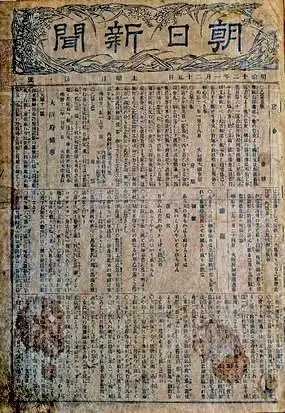
The Asahi Shimbun (朝日新聞; January 25, 1879 – Present), translated Morning Sun Newspaper, is one of Japan's oldest and most venerable daily newspapers. The Asahi Shimbun began publication in Osaka on January 25, 1879 as a small-print, four-page illustrated paper. The paper was founded by Kimura Noboru (company president), Murayama Ryōhei (owner), and Tsuda Tei (managing editor). In 1888 the newspaper expanded with a branch in Tokyo and began issuing the Tokyo Asahi Shimbun. The the Osaka and Tokyo papers formally merged under a single imprint in 1940. Almost from its inception the newspaper was known for its liberal views. The Asahi Shimbun continues to publish from Osaka today.
Board game made to celebrate the Anglo-Japanese Alliance.
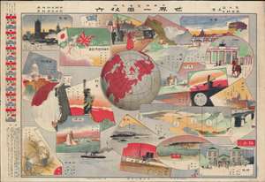
日英博覽會見物 世界一周双六 / [Japan-Britain Exhibition Showpiece – 'Around the World' Sugoroku].
$750.00
Acquire
- Digital Map Information
- Suitable for large format printing
- File Size: 45.54 MB
- File Type: ZIP / TIFF
- ICC color profile embedded
- Delivered instantly via download link
This is a rare and whimsical 1910 (Meiji 43) sugoroku game board published in the Tokyo Asahi Shimbun. It was produced for the 1910 Japan-British Exhibition (日英博覽會) held in London, an event designed to bolster the Anglo-Japanese Alliance forged in 1902. (more details)
Karafuto to Korea.
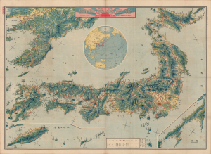
新日本鳥瞰圖 / [Bird's eye view of the New Japan].
$950.00
Acquire
- Digital Map Information
- Suitable for large format printing
- Full resolution TIFF file
- ICC color profile embedded
- Delivered instantly via download link
This is a stunning, large-format Taisho 9 (1920) map of the Japanese Empire, including Taiwan and Korea, issued by the daily Tokyo Asahi Shimbun. It highlights growing rail and maritime networks linking the Japanese Empire together. (more details)
An iconic map of Shanghai, China, featuring a dramatic panoramic photograph of the Bund.
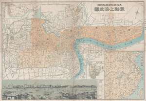
Saishin Shanhai chizu. Ōsaka Asahi Shinbunsha tokusen. / 大阪朝日新聞社特撰 . 最新上海地圖. / Osaka Asahi Shimbun Special Selection. Newest Map of Shanghai.
$600.00
Acquire
- Digital Map Information
- Suitable for large format printing
- File Size: 19.52 MB
- File Type: ZIP / TIFF
- ICC color profile embedded
- Delivered instantly via download link
This is a rare and attractive Showa 7 or 1932 Osaka Asahi Shimbun map of Shanghai, China. Printed in the 7th year of Hirohito's reign (Showa 7), it depicts downtown Shanghai including the Chinese Quarter, the French Concession, the English Quarter (along the Bund), etc. Important buildings along the Bund are carefully noted, including the first HSBC Bank, the British Club, the Palace Hotel (Swatch Art Peace Hotel), Sassoon House (Fairmont Peace Hotel), and the Customs House. There is also a lovely vintage panoramic photo of the Bund along the bottom of the map. A small inset map of Nanjing or Nanking is also included in the lower right quadrant of the map. Another larger inset shows a regional map. Most of the text is written in both Japanese and English. (more details)
An Alliance of Non-White Peoples.
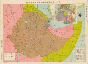
エチオピア及隣接英佛伊殖民地最新地圖 / [Latest Map of Ethiopia and Adjacent British, French and Italian Colonies].
$750.00
Acquire
- Digital Map Information
- Suitable for large format printing
- File Size: 29.93 MB
- File Type: ZIP / TIFF
- ICC color profile embedded
- Delivered instantly via download link
This is a 1935 Japanese-language map of Ethiopia and its environs published by the Tokyo Asahi Shimbun in tandem with the Abyssinian Crisis at the outbreak of the Second Italo-Ethiopian War (1935 -1937). The map illustrates a little-known episode in pre-WWII history wherein Japan and Ethiopia considered the creation of an 'Alliance of Non-White Peoples.' (more details)
Map of Shanghai illustrating the situation in the city between the first and second phases of the Battle of Shanghai.
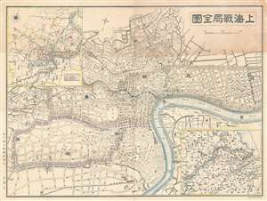
上海戰局全圖 / Shanghai Full War Map. / Shànghǎi zhànjú quán tú.
$600.00
Acquire
- Digital Map Information
- Suitable for large format printing
- File Size: 16.19 MB
- File Type: ZIP / TIFF
- ICC color profile embedded
- Delivered instantly via download link
A scarce pre-World War II map of Shanghai, China, issued by the Osaka Asahi Shimbun in 1937 or Showa 12, during the Battle of Shanghai (August 13, 1937). Centered on the riverfront Bund Distract, this map covers the heart of modern Shanghai including the International Settlement and French Concession. Larger scale regional maps appear in the upper left and lower right corners. (more details)
Seeds of Japan's Stalemate in China.
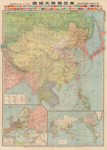
東亞現勢大地圖 / [Large Map of Current Situation in East Asia].
$950.00
Acquire
- Digital Map Information
- Suitable for large format printing
- Full resolution TIFF file
- ICC color profile embedded
- Delivered instantly via download link
This is a 1938 large-format map of East Asia prepared by the Imperial Cartography Institute (Teikoku Chizu Gakkan) and published as a supplement to the Tokyo Asahi Shimbun. Produced in the midst of the Second Sino-Japanese War (part of WWII), it presents Japanese military advances in China at a time when the war was ostensibly going very much in Japan's favor, though early signs of later problems were already becoming apparent. (more details)