
Bliss, Whitney Carleton (sold)

Whitney Carleton Bliss (February 7, 1886 - May 26, 1964) was an American Civil Engineer active in Miami, Florida, in the early 20th century. Bliss was born in Providence, Rhode Island. He was educated as a Civil Engineer and Surveyor, but it is unclear where. He married Lavina Ellen Crews (April 25, 1888 - 1891). The Bliss family relocated to Miami in 1914, presumably to take advantage of the need for civil engineers at the height of the Florida Land Boom. He surveyed and laid out development plans for multiple Miami area developments, including Star Island, Palm Island, Sunset Island, Bay Point, and Biscayne Point. He became involved with George Edgar Merrick (1886 - 1942) and in 1921, along with Frank Button (1866 - 1938), laid out the initial master plan for Coral Gables - where he was the 3rd resident. Curiously, although his name is on the earliest plans of Coral Gables, he is rarely referenced in historical studies of Coral Gables and its early development. He nonetheless, remained there for the remainder of his life. He appears in directories as a Civil Engineer until about 1940, when presumably he went into retirement.
Miami's Greatest Achievement? The first printed map of Coral Gables.
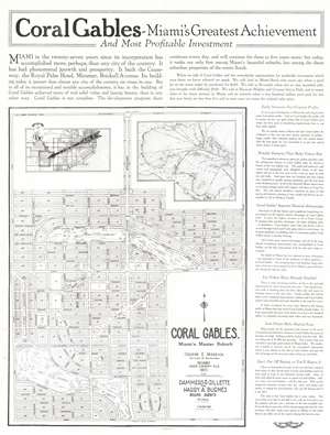
Coral Gables - Miami's Greatest Achievement and Most Profitable Investment. / Coral Gables. Miami's Master Suburb.
sold
- Digital Map Information
- Suitable for large format printing
- Full resolution TIFF file
- ICC color profile embedded
- Delivered instantly via download link
This 1922 double-sided broadside, likely the first printed map of Coral Gables, Miami, Florida, was issued to promote investment and development in the emerging suburb. The broadside, touting Coral Gables as 'Miami's Greatest Achievement', features a large map of the planned community, dated 1922 - an updated and revised version of the unpublished Bliss/Button masterplan drawn in 1921. The verso features illustrations of the just-built country club walls, as well Spanish colonial style model homes. Other than the manuscript masterplans preserved at History Miami, this is the earliest map of Coral Gables known and the first published map. (more details)