
Chatelain, Henri Abraham
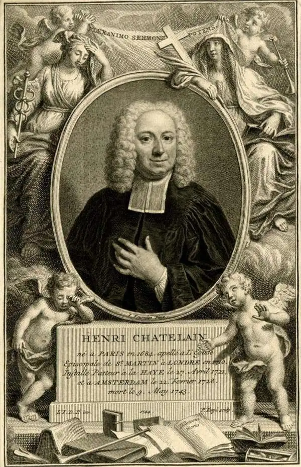
Henri Abraham Chatelain (1684 - 1743) was a Huguenot pastor of Parisian origins. He lived consecutively in Paris, St. Martins, London (c. 1710), The Hague (c. 1721) and Amsterdam (c. 1728). He is best known as a Dutch cartographer and more specifically for his cartographic contribution in the seminal seven volume Atlas Historique, published in Amsterdam between 1705 and 1720. Innovative for its time, the Atlas Historique combined fine engraving and artwork with scholarly studies of geography, history, ethnology, heraldry, and cosmography. Some scholarship suggests that the Atlas Historique was not exclusively compiled by Henri Chatelain, as is commonly believed, but rather was a family enterprise involving Henri, his father Zacharie and his brother, also Zacharie.
One of the most decorative maps of the 18th century.
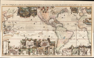
Carte très curieuse de la Mer du Sud, contenant des Remarques Nouvelles et très utiles non seulement sur des Ports et Îles de cette Mer, mais aussy sur les principaux Pays de l'Amerique tant Septentrionale que Méridionale en a été faite.
$15,500.00
Acquire
- Digital Map Information
- Suitable for large format printing
- Full resolution TIFF file
- ICC color profile embedded
- Delivered instantly via download link
One of the most spectacularly decorative maps of the 18th century, this is Henri Chatelain's magnificent 1719 map of the Americas and the Pacific. This sumptuously engraved map is centered on the American continent but extends west to include all of the Pacific as far as Beijing (Peking), China and Australia, and eastward to include much of Europe and the western half of Africa. Longitudinally it extends from the Hudson Bay to the southern tip of Tierra del Fuego. The map is graphically rich with a wealth of lush inset maps and vignette illustrations throughout. The whole is further embellished with copious annotations offering Chatelain's insights on local traditions, flora and fauna, political commentary, and notes on trade. (more details)
One of the most decorative maps of the 18th century - here in a pristine uncolored examples.
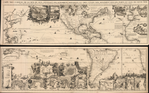
Carte très curieuse de la Mer du Sud, contenant des Remarques Nouvelles et très utiles non seulement sur des Ports et Îles de cette Mer, mais aussy sur les principaux Pays de l'Amerique tant Septentrionale que Méridionale en a été faite.
$18,000.00
Acquire
- Digital Map Information
- Suitable for large format printing
- File Size: 293.48 MB
- File Type: ZIP / TIFF
- ICC color profile embedded
- Delivered instantly via download link
One of the most spectacularly decorative maps of the 18th century, this is Henri Chatelain's magnificent 1719 map of the Americas and the Pacific. The map emerged on the cusp of a new age of global exploration wherein world-spanning trade routes offered Europeans unprecedented exposure to new cultures, peoples, and trade opportunities. It is no mistake that his map of America, as seen here, presents the continent as the center of a staggering array of trade networks reaching from Europe to America itself, the South Pacific, and Africa. (more details)
Detailing the Empires of the East.
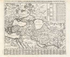
Nouvelle carte pour servir a l'Histoire de l'Empire d'Orient Depuis les Premiers Empereurs Romains.
$500.00
Acquire
- Digital Map Information
- Suitable for large format printing
- DPI: 600
- File Size: 66.62 MB
- File Type: ZIP / TIFF
- ICC color profile embedded
- Delivered instantly via download link
A superbly engraved 1719 Chatelain map of the Middle and Near East, presenting the ancient cities and kingdoms of those regions in the time of the Persian Empire and early Roman Empire. It spans from the eastern Mediterranean to the mouth of the Indus River. It centers on the Black and Caspian Seas, and embraces from the Persian Gulf to the full course of the Volga River. The map applies what was state-of-the-art geographical information to the place names of antiquity, thus placing the ancient eastern world in a more understandable context. The map shows ancient administrative divisions, regional names, major cities, towns and forts. Mountains and forests are shown pictorially. Extensive tables - one listing cities and towns, the other listing the prefectures and Dioceses at that time under the dominion of the Ottoman Empire - use a coordinate system to aid in finding the listed places on the map itself. The map was included in Chatelain's seven-volume historical atlas of the world, one of the largest and broadest Dutch encyclopedias of the early eighteenth century. In addition to its geographical information, it was a treasure trove of historical, political and even genealogical information. Chatelain's maps drew on the work of his day's finest geographers, including De l'Isle and De Fer. (more details)
World history on one sheet!
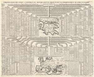
Chronologie des Etats et Empires du Monde depuis Adam Jusqu'au Commencement de l'Ere Vulgaire.
$350.00
Acquire
- Digital Map Information
- Suitable for large format printing
- DPI: 600
- File Size: 76.08 MB
- File Type: ZIP / TIFF
- ICC color profile embedded
- Delivered instantly via download link
This is a 1720 Henri Abraham Chatelain chart of historical empires and nations before the Common Era. The chart chronicles thousands of years of human history and separates nations and empires into columns. Among the histories recounted are those of Rome, Egypt, China, Sparta (Lacedemone), Athens, Corinth, Judea, and Persia. Two maps accompany the chart, with one focusing on the Peloponnesus and southern Greece and the other on Europe, the Mediterranean, and the Middle East. In a short description, Chatelain explains that they used the year 4000 to represent the year of the birth of Jesus Christ, allowing viewers to better understand how the numbers next to each ruler's name provide a chronological understanding of events. (more details)
Knightly orders.
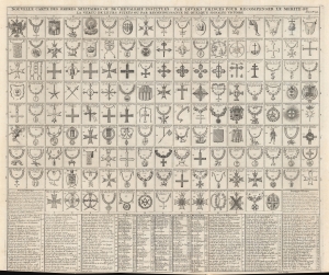
Nouvelle carte des ordres militaires ou de chevalerie institués par divers princes pour recompenser le merite ou la vertu de leurs sujets ou par reconnoissance de quelque signalée victoire.
$400.00
Acquire
- Digital Map Information
- Suitable for large format printing
- Full resolution TIFF file
- ICC color profile embedded
- Delivered instantly via download link
This is a 1720 Henri Abraham Chatelain chart of military and chivalric orders. Organized as a table, each order has its own space and is identified both my name and by number, allowing the viewer to more easily identify each order. Both religious and courtly orders are included. (more details)
Navigational instruments and construction of a sailing ship.
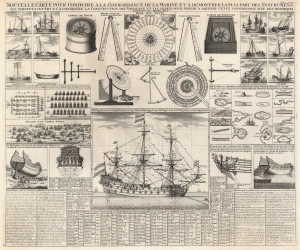
Nouvelle carte pour conduire à la connoissance de la Marine et à demontrer la plus part des instrumens qui servent à cet art et à connoitre la construction de vaisseaux et les agrets pour servir à aquerir cette connoissance avec des remarques tendant au meme but.
$1,000.00
Acquire
- Digital Map Information
- Suitable for large format printing
- DPI: 600
- File Size: 74.37 MB
- File Type: ZIP / TIFF
- ICC color profile embedded
- Delivered instantly via download link
This is a 1720 Henri Abraham Chatelain chart of ships, ship construction, and naval instruments. (more details)
Vexillology.
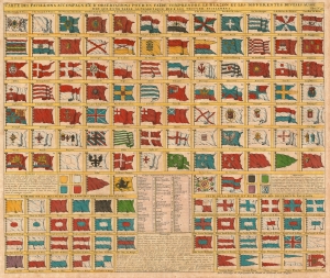
Carte des Pavillons Accompagneé D' Observatioons Pour En Faire Comprendre le Blazon et les Differentes Devises Aussy bien que d'une Table Alphabetique Pour les Trouver Facilement.
$950.00
Acquire
- Digital Map Information
- Suitable for large format printing
- DPI: 600
- File Size: 30.42 MB
- File Type: ZIP / TIFF
- ICC color profile embedded
- Delivered instantly via download link
This 1720 Chatelain flag chart illustrates the world's flags during The War of the Spanish Succession (1701 - 1714) and the Great Northern War (1700 - 1720). (more details)
History of Ancient Rome in a single map.
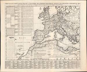
Nouvelle Carte pour servir à l'Histoire de l'Empire d'Occident…
$500.00
Acquire
- Digital Map Information
- Suitable for large format printing
- DPI: 600
- File Size: 26.7 MB
- File Type: ZIP / TIFF
- ICC color profile embedded
- Delivered instantly via download link
This is a superbly engraved 1720 Henri Châtelain map of the Western Roman Empire from Châtelain's Atlas Historique. It is a rich, well-researched source that ambitiously aims to represent some 500 years of Roman history and geography. (more details)