
Des Barres, Joseph Frederick Wallet

Joseph Frederick Wallet Des Barres. National Gallery, London, by Spiridione Gambardella (c.1815-1886)
Joseph Frederick Wallet Des Barres (November 22, 1721 - October 24, 1824) was a Swiss-British hydrographer active with the Royal Navy in the second half of the 18th century. Des Barres was born in Switzerland. He attended the University of Basel, where he tutored under the great mathematician Daniel Bernoulli. Following his studies in Basel, Des Barres immigrated to Great Britain, where he continued his education at the Royal Military College of Woolwich. Sometime in the 1850s, Des Barres joined the American Regiment of the Royal Army as a military engineer. He was assigned to the team surveying the St. Lawrence River, where he worked with the legendary cartographer Samuel Holland and the young James Cook. Afterward, Des Barres surveyed and mapped the Maritime Provinces of New Brunswick, Nova Scotia, and Newfoundland. Des Barres's work is known for its stunning combination of accuracy and aesthetic appeal. Augustyn, in Manhattan in Maps, writes that with Des Barres, "nautical charting took an unprecedented leap toward greater precision and graphic sophistication". Upon his return to England in 1774, Des Barres was assigned to compile all of the most current cartographic information on the New World into the seminal Atlantic Neptune, which has been described as the "most splendid collection of charts, plates and views ever published" (National Maritime Museum Catalogue). Des Barres eventually returned to Canada, where he lived another 40 years as a wealthy landowner and active political figure. He died at the ripe old age of 103, one of the few centenarians of the early 19th century.
Charting the Graveyard of the Atlantic.
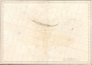
[Sable Island.]
$3,500.00
Acquire
- Digital Map Information
- Suitable for large format printing
- Full resolution TIFF file
- ICC color profile embedded
- Delivered instantly via download link
This extraordinary 1776 Joseph Frederick Wallet Des Barres navigational map suite devoted to Sable Island combines the first scientifically surveyed chart of the notorious Atlantic hazard with coastal recognition views and detailed sailing instructions. Sable Island haunted North Atlantic navigation for centuries, appearing on European charts since the early age of transatlantic exploration. Yet, its low profile, shifting sands, enormous surrounding shoals, fog, currents, and violent seas made it extraordinarily difficult to map - and easy to wreck upon. Acting under orders of the British Admiralty, Des Barres spent the summers of 1766 and 1767 surveying the island and its surrounding waters in unprecedented detail. Published for his monumental Atlantic Neptune, these sheets transformed Sable Island from a vaguely understood menace at the edge of earlier charts into a comprehensively documented navigational landscape: charted hydrographically, pictured in profile, and explained in precise sailing instructions. (more details)
Earliest detailed mapping of western Martha's Vineyard.
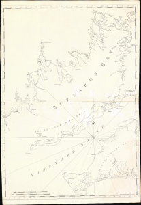
[Buzzard's Bay and Vineyard Sound.]
$17,000.00
Acquire
- Digital Map Information
- Suitable for large format printing
- Full resolution TIFF file
- ICC color profile embedded
- Delivered instantly via download link
This beautifully engraved map is the earliest acquirable issue of J. F. W. Des Barres' 1776 map of Buzzard's Bay and Vineyard Sound, capturing western Martha's Vineyard and the southern harbors of the Massachusetts mainland at the outbreak of the American Revolutionary War (1775 - 1783). It contains the first detailed mapping of the western part of Martha's Vineyard and the most accurate chart of the waters of Buzzard's Bay and Vineyard Sound. It remained authoritative for nearly 50 years. (more details)
Jamaica During the Maroon Wars.
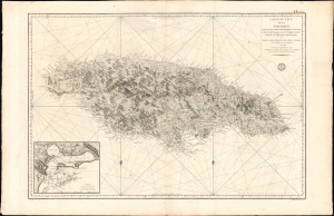
Carte de l'Ile de la Jamaique, extraite des Cartes topographiques Anglaises de T. Craskell... et de J. Simpson. Rédigée en 1786, corrigée et augmentée en 1799.
$1,500.00
Acquire
- Digital Map Information
- Suitable for large format printing
- Full resolution TIFF file
- ICC color profile embedded
- Delivered instantly via download link
This is a rare, large-format 1799 chart and map of Jamaica with an inset of Kingston Harbor. Issued in the wake of the Second Maroon War (1795), and overshadowed by the imminent French loss of Haiti to Toussaint Louverture, this map represents an effort by the French to absorb and utilize the best British information pertinent to Jamaica during a period in which both the British and the French were experiencing slave rebellion in the West Indies. Despite decades of war with each other, the Caribbean territories of these two slave-holding empires found common ground in the face of their respective revolts. British forces fought in Haiti in support of French planters until 1798; it may be that this work was produced in anticipation of returning the favor. (more details)
Monumental Sea Chart of the Coast of the Northeastern United States.
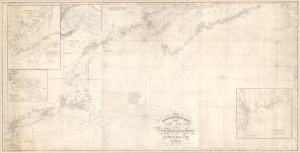
The north eastern coast of North America from New York to Cape Canso, including Sable Island.
$2,000.00
Acquire
- Digital Map Information
- Suitable for large format printing
- DPI: 600
- File Size: 102 MB
- File Type: ZIP / TIFF
- ICC color profile embedded
- Delivered instantly via download link
This is Edmund Blunt's rare, monumental 1840 nautical chart or map of the northeast United States, extending from New York to Cape Canso in Nova Scotia, and is the most authoritative American chart of these waters available at the time. It provides not only granular detail of the coastline, but also detailed soundings for the crucial sailing lanes from Halifax to Boston. It is a working chart - typically referred to as a 'blueback chart' due to the color of the reinforcing paper it was originally mounted to. Rather than contend with multiple charts, mariners typically preferred large charts composed of several sheets: hence the impressive expanse of the present chart. (more details)