
Des Barres, Joseph Frederick Wallet (sold)

Joseph Frederick Wallet Des Barres (November 22, 1721 - October 24, 1824) was a Swiss-British hydrographer active with the Royal Navy in the second half of the 18th century. Des Barres was born in Switzerland. He attended the University of Basel, where he tutored under the great mathematician Daniel Bernoulli. Following his studies in Basel, Des Barres immigrated to Great Britain, where he continued his education at the Royal Military College of Woolwich. Sometime in the 1850s, Des Barres joined the American Regiment of the Royal Army as a military engineer. He was assigned to the team surveying the St. Lawrence River, where he worked with the legendary cartographer Samuel Holland and the young James Cook. Afterward, Des Barres surveyed and mapped the Maritime Provinces of New Brunswick, Nova Scotia, and Newfoundland. Des Barres's work is known for its stunning combination of accuracy and aesthetic appeal. Augustyn, in Manhattan in Maps, writes that with Des Barres, "nautical charting took an unprecedented leap toward greater precision and graphic sophistication". Upon his return to England in 1774, Des Barres was assigned to compile all of the most current cartographic information on the New World into the seminal Atlantic Neptune, which has been described as the "most splendid collection of charts, plates and views ever published" (National Maritime Museum Catalogue). Des Barres eventually returned to Canada, where he lived another 40 years as a wealthy landowner and active political figure. He died at the ripe old age of 103, one of the few centenarians of the early 19th century.
Premier general chart of New England at the outbreak of the Revolutionary War.
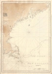
The Coast of New England.
sold
- Digital Map Information
- Suitable for large format printing
- File Size: 47.49 MB
- File Type: ZIP / TIFF
- ICC color profile embedded
- Delivered instantly via download link
This is J. F. W. Des Barres' 1776 nautical map of New England. This was the best and most accurate general chart of New England issued at the outbreak of the American Revolutionary War (1775 - 1783). (more details)
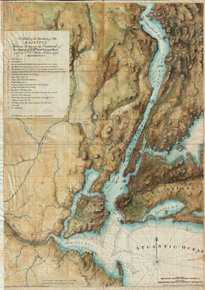
A sketch of the operations of His Majesty's fleet and army : under the command of Vice Admiral the Rt. Hble. Lord Viscount Howe and Genl. Sr. Wm. Howe, K.B., in 1776.
sold
- Digital Map Information
- Suitable for large format printing
- File Size: 22.02 MB
- File Type: ZIP / TIFF
- ICC color profile embedded
- Delivered instantly via download link
A rare and stunning reissue of the Des Barres famous 1777 Map of New York City and Harbor prepared for the 1864 issue of Valentine's Manual of New York. Covers from Sandy Hook northward as far as Haverstraw and the Croton River. Includes Staten Island, all of ... (more details)