
Drew, Charles H. (sold)

Charles H. Drew (January 25, 1855 - ????) was a Duluth, Minnesota, based draughtsman with the City Engineer's Office. He also worked for the Duluth Department of Public Works. Little is known of his life.
One of the earliest obtainable separate issue maps of Duluth, Minnesota.
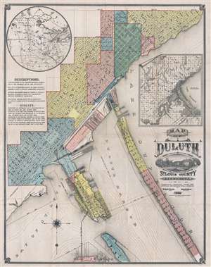
Map of Duluth St. Louis County Minnesota.
sold
- Digital Map Information
- Suitable for large format printing
- File Size: 24.4 MB
- File Type: ZIP / TIFF
- ICC color profile embedded
- Delivered instantly via download link
An exceptionally rare 1886 Map of Duluth, Minnesota by William Baird Paton and Charles H. Drew. This is one of the earliest obtainable separate issue maps of Duluth, Minnesota. The map covers roughly from Forest Hill Cemetery to Connors Point and includes ... (more details)