
Duncan, Francis (sold)

Francis Duncan (fl. 1788 - 1805) was a British surgeon and author. Virtually all that is known of him derives from his 1805 A Description of the Island of St. Helena, the earliest monograph of that island. Nothing is known of his youth or his death. He joined the British East India Company as a surgeon in 1788 and served in India. His journey home in 1801 took him to St. Helena, where he stayed for five weeks. It was this visit that provided the occasion for his book. The book included a view of the island and its primary town, which is presumably Duncan's composition.
Napoleon's Place of Exile.
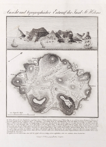
Ansicht und topographischer Entwurf der Insel St. Helena.
sold
- Digital Map Information
- Suitable for large format printing
- File Size: 384.24 MB
- File Type: ZIP / TIFF
- ICC color profile embedded
- Delivered instantly via download link
This beautifully engraved, extremely rare, 1815 view and map of the island of St. Helena was produced by Leipzig illustrator Henrich Leutemann. It presented an up-to-date image of the island to a readership eager to learn more of the remote island to which Napoleon had, famously, been exiled. The view is derived from a first-hand observation by British surgeon Francis Duncan, in whose book it appeared. The map's author, on the other hand, is unknown. It is the only such map of which we are aware to appear in an edition of Duncan's book. (more details)