
Floercky, Herbert Edward (sold)

Herbert Edward Floercky (fl. c. 1929 - 1933) was a California-based geographer, cartographer, and illustrator. An engineer by training, he turned to maps after the stock market crash of 1929. He is best known for this 1929 'Amusement Map of Los Angeles County' and his popular, richly-illustrated 1933 book A Visual Geography of California, originally drawn and written for his own children, which became a textbook in the state's schools.
Guns, golf, and movie stars, and of course the beach.
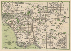
Amusement Map of Los Angeles County / Places of Interest, Amusement, Sport, Los Angeles County.
sold
- Digital Map Information
- Suitable for large format printing
- Full resolution TIFF file
- ICC color profile embedded
- Delivered instantly via download link
An entertaining 1929 Herbert Edward Floercky pictorial map of Los Angeles County. It highlights the many 'amusements' and 'divertisements' available throughout the county, ranging from beachside attractions to skiing, polo, movie theaters, a plethora of golf courses, and more. (more details)