
Gräf, Carl (sold)

Carl Gräf (1822 – 1902), sometimes cataloged as 'Carl Graef,' was a German cartographer ('engineer-geographer') and publisher associated with the Geographisches Institut in Weimar. Over 200 maps are attributed to his name, generally as an editor, most of which appeared in the popular atlases published by the Insitut, such as Hand-Atlas der Erde und des Himmels. Several maps produced by the Geographisches Institut include the name 'Adolf Gräf,' likely a relative of Carl.
German-made map of Central America.
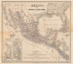
Mexico und die Republiken von Central-America.
sold
- Digital Map Information
- Suitable for large format printing
- Full resolution TIFF file
- ICC color profile embedded
- Delivered instantly via download link
This is a beautifully engraved and colored c. 1879 map of Mexico and Central America, edited by Carl Gräf and published by the Weimar Geographisches Institut. It shows the Mexico region stretching from the southern United States to Panama and includes a wealth of information on geography, administrative divisions, and infrastructure. (more details)