
Edmond Halley (sold)
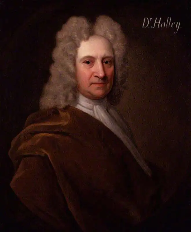
Edmond (Edmund) Halley (November 8, 1656 - January 25, 1742) was an English astronomer, geophysicist, mathematician, meteorologist, and physicist. As Halley was such an accomplished individual, this biography will only be concerned with his contributions to cartography, of which there were many. Today, Halley is credited with the development of the earliest meteorological chart and the first printed isoline map. He also produced a map of the shadow of a solar eclipse that passed through London and a tidal chart. These maps are considered to be major contributions in thematic cartography. During the year 1686, Halley published four papers in the Philosophical Transactions. One of these, entitled 'An Historical Account of the Trade Winds, and Monsoons, observable in the Seas between and Near the Tropicks; with an attempt to assign the Phisical cause of the said Winds' was illustrated what has become known as the first meteorological chart. Although untitled, this map has come to be known as 'Halley's Chart of the Trade Winds'. Unaccompanied by a legend or a key, the only way to understand this map is to read Halley's article. The map lacks a scale, and the size of the grid varies, making Halley's first important map of the Earth difficult to interpret. In 1698, Halley was granted a temporary commission as a Captain in the Royal Navy and given command of the Paramour, a newly-built ship with the express purpose of test his magnetic theory in the southern hemisphere. Halley's voyage has become known as 'the first sea journey undertaken for a purely scientific object'. After being forced to return to Britain to deal with a mutinous crew, Halley set off anew in 1699 to test his theories. Following his return from more than a year aboard the Paramour, Halley published one of the most important maps in the history of cartography. Titled, 'A New and Correct Chart showing the Variations of the Compass in the Western and Southern Oceans' and based on over 150 observations on magnetic declination, this map is said to be the first printed map showing isotopes (lines of equal magnetic attraction). Per Norman ThrowerMore than thirty arrows showing direction and over fifty Roman numerals indicating time are spread over the Channel from the coast of Kent to Cornwall. Halley's information is in approximate agreement with present day measurements of tidal phenomenon in this area. Halley's tidal chart is a cartographic achievement of great originality and utility. (Thrower)
Halley's final cartographic contribution deals with a map entitled 'A Description of the Passage of the Shadow of the Moon over England in the Total Eclipse of the Sun on the 22nd Day of April 1715 in the Morning'. The general map, in itself, is unremarkable, but the map's theme is both interesting and original. The map traces the path and shadow of the eclipse and indicates the time it took the eclipse to cross England.
Halley's Atlantic chart is not only the first printed map of isogones, which were known as Halleyan lines for about a century, but it appears to be the earliest published isarithmic map of any kind. In quantitative cartography, isarithms (isolines) are lines, in series, connecting points of equal intensity of phenomena which have transitional degrees of intensity.Halley's Atlantic chart was not published to accompany an article, it was actually published as a sheet map and measured 22.5 x 19 inches. Halley's next contribution to the history of cartography was a much larger world chart along the same lines as his Atlantic chart. This chart measured 20 x 57 inches on a Mercator projection. Most of the innovations associated with the world chart are similar to those of the Atlantic chart, just on a larger scale. Halley also undertook a survey off the English Channel, entitled ' A New and Correct Chart of the Channel between England and France with considerable Improvements not extant in any Draughts hitherto Publish'd shewing the sands, shoals, depths of Water and Anchorage, with yet flowing of the Tydes, and the setting of the Current; as observed by the Learned Dr. Halley.' Spanning two sheets, each measuring 25 x 19 inches, this chart was likely published in 1702. The chart bears numerous notations and conventions common by Halley's time, but the feature that sets it apart from 'all previous charts' is the inclusion of the tides
Halley's final cartographic contribution deals with a map entitled 'A Description of the Passage of the Shadow of the Moon over England in the Total Eclipse of the Sun on the 22nd Day of April 1715 in the Morning'. The general map, in itself, is unremarkable, but the map's theme is both interesting and original. The map traces the path and shadow of the eclipse and indicates the time it took the eclipse to cross England.
Bringing the Baroque into the Scientific Age: Precursor to Zurner's famous map.
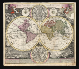
Planiglobii Terrestris Cum Utroq. Hemisphaerio Caelesti Generalis Exhibitio.
sold
- Digital Map Information
- Suitable for large format printing
- DPI: 600
- File Size: 77.87 MB
- File Type: ZIP / TIFF
- ICC color profile embedded
- Delivered instantly via download link
This is the scarce first plate of Johann Baptist Homann's 1707 map of the world in a double hemisphere projection. It is both long misunderstood and mis-identified: it was a novel and influential adaptation of up-to-date cartographic information (including the explorations of Dampier and the studies of Edmund Halley). Moreover, the present example is the first plate, engraved by or for the elder Homann in 1707. Most examples of the map of this title appearing on the market are a different plate, engraved by Homann's son no earlier than 1724 (identified by the Imperial privilege.) Thus the present example is the most desirable of Homann's world maps. (more details)
One of the Earliest Meteorological Maps.
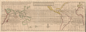
A View of ye General and Coasting Trade-Winds, Monsoons or ye Shifting Trade Winds through ye World, Variations and c. According to the Newest and Most Exact Observations.
sold
- Digital Map Information
- Suitable for large format printing
- File Size: 8.11 MB
- File Type: ZIP / TIFF
- ICC color profile embedded
- Delivered instantly via download link
This is Herman Moll's 1711 chart of world trade winds, an early example of a meteorological chart based on Edmond Halley's seminal 1686 map. This first printing of the map is notable for reflecting the state of European geographic and scientific knowledge at the time, making new discoveries but with many uncertainties remaining, as with the coasts of Australia, New Zealand, and California. (more details)
One of the Earliest Meteorological Maps.
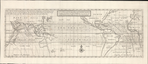
A View of ye General and Coasting Trade-Winds, Monsoons or ye Shifting Trade Winds through ye World, Variations and c. According to the Newest and Most Exact Observations.
sold
- Digital Map Information
- Suitable for large format printing
- File Size: 10.97 MB
- File Type: ZIP / TIFF
- ICC color profile embedded
- Delivered instantly via download link
This is Herman Moll's 1711 chart of world trade winds, an early example of a meteorological chart based on Edmond Halley's seminal 1686 map. This first printing of the map is notable for reflecting the state of European geographic and scientific knowledge at the time, making new discoveries but with many uncertainties remaining, as with the coasts of Australia, New Zealand, and California. (more details)
The first English Trade Atlas.
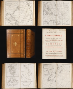
Atlas Maritimus et Commercialis or, A General View of the World, so far as relates to trade and navigation.
sold
This 1728 nautical atlas is the first openly published commercial geography produced for a general audience. 'No previous work in English had offered a survey of the world's trading sites on this scale' (Rogers, 2023). It was an ambitious project brought to completion by a consortium of mapmakers, printers, and writers. While it is conventionally credited to Nathaniel Cutler and the illustrious Edmond Halley, these supplied only portions of the monumental work. The maps can be assigned to John Senex, drawing extensively on a new projection provided by Henry Wilson; much of the descriptive content of the first part of the work has been attributed to the prolific Daniel Defoe, while the second portion - A General Coasting Pilot; Containing Directions for Sailing - is attributed to Cutler. (more details)