
Holmes, L. Carl (sold)

L. Carl Holmes (fl. c. 1910 - c. 1924) worked for the Bureau of Soils of the U.S. Department of Agriculture for many years where he oversaw soil survey work for California. He was recognized as one of the best soils specialists in the western United States. While working for the Bureau of Soils, Holmes coauthored numerous studies and helped created several soil maps of regions in California. In March 1922 Holmes became the Assistant Farm Advisor for the Agricultural Extension Service and the Citrus Growers Department of the Los Angeles County Farm Bureau.
Geology is SoCal.
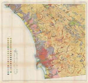
Soil Map. California. Reconnoissance Survey - San Diego Sheet.
sold
- Digital Map Information
- Suitable for large format printing
- File Size: 82.1 MB
- File Type: ZIP / TIFF
- ICC color profile embedded
- Delivered instantly via download link
This is a 1915 U.S. Department of Agriculture soil map of southern California, depicting from Dana Point and Mussel Cove to San Diego Bay, and from the Pacific Ocean to the San Felipe Valley. As a geological map, some thirty-five color and pattern combinations mark soil types and terrain is illustrated by hachure. Cities and towns are noted (including San Diego, Oceanside, and Carlesbad) and major roads appear. The region's Indian Reservations are delineated. (more details)