
L'Institut Géographique du Congo (sold)

L'Institut géographique du Congo (1949 - present) is a Congolese government body tasked with producing maps and spreading geographic knowledge. It was founded in 1949 under the Belgian colonial regime and has continued to operate under the same name in the post-independence era. Today, it is part of the Congolese government's ministère de la Recherche scientifique et technologie.
Last Days of the Belgian Congo.
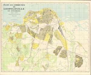
Plan des communes de Leopoldville et environs.
sold
- Digital Map Information
- Suitable for large format printing
- Full resolution TIFF file
- ICC color profile embedded
- Delivered instantly via download link
An impressive 1959 large-format folding map of Léopoldville, now Kinshasa, produced by the Institut Géographique du Congo. It presents the city in the last days of Belgian rule, as anti-colonial tensions were building, resulting in the country's independence the following year. (more details)