
Jefferys, Thomas
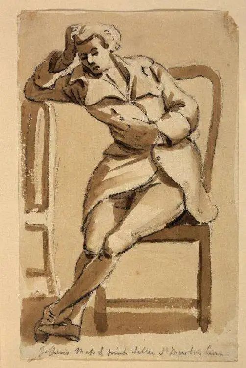
Thomas Jefferys (1695 - November 20, 1771) was one of the most prominent and prolific map publishers and engravers of his day. Jefferys was born in Birmingham and was apprenticed to the engraver Emmanuel Bowen in 1735. Later, in the 1740s he engraved several maps for the popular periodical Gentleman's Magazine. Around 1740 Jefferys was finally able to go into business for himself and in 1746 received an appointment as 'Geographer to Fredrick, Prince of Wales,' which shortly after translated to the position of 'Royal Cartographer to King George III.' Jefferys initially specialized in compiling and re-engraving the works of earlier cartographers into more coherent cartographic wholes. Later, while not salaried position, Jefferys' appointment as 'Royal Cartographer' guaranteed preferential access to the most up to date cartographic material available, allowing him to produce new and updated charts of exceptional accuracy. He his best known for his maps of the Americas, particularly the posthumously published 1775 American Atlas, which included some of the finest and most important late colonial era maps of America ever made. Despite his prolific publishing history, royal appointments, and international publishing fame, Jefferys lived most of his life in dire economic straits. He was bailed out of bankruptcy by Robert Sayer during the production of the American Atlas. In the end, Jefferys died suddenly with very little to his name. Nonetheless, his cartographic legacy survived, and even after his death in 1771, many of his important maps continued to be published and republished by Sayer and Bennet, Conrad Lotter, Georges Louis Le Rouge, Laurie and Whittle, and others. Many attribute some of Jefferys best maps to the colorful and criminally inclined Irish cartographic genius Braddock Mead (John Green, c. 1688 - 1757), who is considered the 'secret behind Jefferys.' Jefferys was succeeded by his son, also Thomas, who had little success as a cartographer and eventually partnered with, then sold his stock and plates to William Faden - Jefferys' true heir.
Predicts a Solar Eclipse and reveals Arctic Explorations.
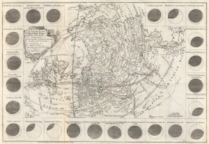
The geography of the great solar eclipse of July 14 MDCCXLVIII. : exhibiting an accurate map of all parts of the Earth in which it will be visible with the North Pole according to the latest discoveries.
$950.00
Acquire
- Digital Map Information
- Suitable for large format printing
- File Size: 12.65 MB
- File Type: ZIP / TIFF
- ICC color profile embedded
- Delivered instantly via download link
This elegant 1748 north polar projection map was drawn by the English astronomer and writer George Smith and engraved by the great English mapmaker Thomas Jefferys. It was produced for inclusion in Smith's pamphlet describing and predicting the path of the July 14, 1748, solar eclipse. (more details)
Jefferys map of the strategic stronghold of Callao.
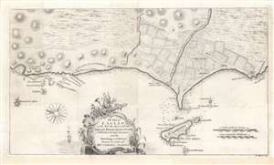
The Port of Callao, in the South Sea...
$500.00
Acquire
- Digital Map Information
- Suitable for large format printing
- DPI: 600
- File Size: 20.14 MB
- File Type: ZIP / TIFF
- ICC color profile embedded
- Delivered instantly via download link
This is a rare work by the British cartographer Thomas Jefferys, a 1753 map of Callao and Lima in Peru. It depicts the coastline of the Lima region while also serving as a nautical chart, noting soundings, islets, and other features. (more details)
Unobtainable first state of one of the most influential maps of New England ever made.
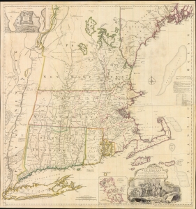
A MAP of the most INHABITED part of NEW ENGLAND, containing the PROVINCES of MASSACHUSETS BAY and NEW HAMPSHIRE, with the COLONIES of KONEKTIKUT AND RHODE ISLAND. Divided into Counties and Townships: The whole composed of Actual Surveys and its situation adjusted by ASTRONOMICAL OBSERVATIONS.
$55,000.00
Acquire
- Digital Map Information
- Suitable for large format printing
- File Size: 35.46 MB
- File Type: ZIP / TIFF
- ICC color profile embedded
- Delivered instantly via download link
This is the rare 1755 first state of Braddock Mead's French and Indian War Era map of New England - one of the most significant and iconic American maps ever produced. It is one of the first large-format regional maps of any part of North America and was the most comprehensively researched and detailed map of contemporary New England. (more details)
Victim of the French and Indian War.
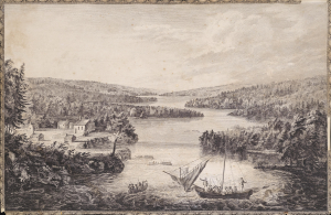
[A View of Miramichi, a French Settlement in the Gulf of St Laurence, destroyed by Brigadier Murray detached by General Wolfe for that purpose, from the Bay of Gaspe / Vue de Miramichi Établissement François dans le Golfe de St Laurent, détruit par le Brigadier Murray, détaché à cet e effet de la Baye de Gaspé, par le Général Wolfe].
$1,500.00
Acquire
- Digital Map Information
- Suitable for large format printing
- Full resolution TIFF file
- ICC color profile embedded
- Delivered instantly via download link
This is Hervey Smyth and Paul Sandby's portrayal of the settlement of Miramichi on the Miramichi River in New Brunswick that appeared in the 1760 Six Views of the Most Remarkable Places of the Gulf and River St. Laurence (later Scenographia Americana), published in London. The strategically located settlement was targeted by the British during the French and Indian War (Seven Years' War) and completely sacked. (more details)
'the origin of the log cabin as a symbol of the American experience.' - Gilbron
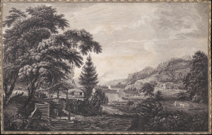
A Design to Represent the Beginning and Completion of an American Settlement or Farm.
$3,250.00
Acquire
- Digital Map Information
- Suitable for large format printing
- Full resolution TIFF file
- ICC color profile embedded
- Delivered instantly via download link
This is Thomas Pownall and Paul Sandby's illustration of the evolution of an American farmstead, from log cabin to gentlemanly estate. It is arguably the most famous and impactful image from the 1761 Six Remarkable Views in the Provinces of New York, New Jersey and Pennsylvania, published in London. This view is not only one of the earliest illustrations of American settler life, but it has also been credited by Gilbron as 'the origin of the log cabin as a symbol of the American experience.' (more details)
England and France Wrestle over Nova Scotia.
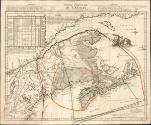
Partie Occidentale du Canada.
$2,850.00
Acquire
- Digital Map Information
- Suitable for large format printing
- File Size: 25.75 MB
- File Type: ZIP / TIFF
- ICC color profile embedded
- Delivered instantly via download link
This is the 1762 first state of Georges-Louis Le Rouge's scarce, informative map of maritime Canada, Nova Scotia, and New England. It details conflicting French and English territorial claims, particularly in Acadia. Although its topography is derived from Thomas Jefferys' 1755 A New Map of Nova Scotia, Le Rouge marshals a wealth of detail not present in that source in order to focus on international territorial concerns. (more details)
Seminal view of Quebec shortly after the French and Indian War.
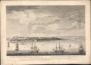
A View of the City of Quebec, the capital of Canada, taken partly from the Pointe des Peres, and partly on Board the Vanguard Man of War. / Vue de la Ville de Québec, capitale du Canada, prise en partie de la Pointe des Peres, et en partie abord de l'Avantgarde Vaisseau de Guerre.
$5,500.00
Acquire
- Digital Map Information
- Suitable for large format printing
- File Size: 25.18 MB
- File Type: ZIP / TIFF
- ICC color profile embedded
- Delivered instantly via download link
This is the rare 1868 Hervey Smyth view of Quebec City, published in 1768. It is one of the earliest obtainable views of Quebec City, offering a look at the city shortly after the French and Indian War (1754 - 1763). The view was published for the Scenographia Americana, one of the most influential and monumental pre-Revolutionary graphic works on North America. (more details)
A region which has gained infamy due to the War on Terror.
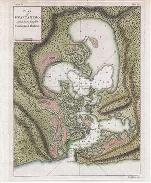
Plan of Guantanimo, called by the English Cumberland Harbour.
$350.00
Acquire
- Digital Map Information
- Suitable for large format printing
- DPI: 300
- File Size: 3.95 MB
- File Type: ZIP / TIFF
- ICC color profile embedded
- Delivered instantly via download link
This is a 1768 Thomas Jefferys map or plan of Guantanamo Bay, Cuba. The map depicts the entirety of Guantanamo Bay and the surrounding area. Highly detailed, the shoreline of the bay is meticulously illustrated, including where the mouths of several rivers enter ... (more details)
Capital of New England - one of the earliest views of Boston based on actual observation.

A View of the City of Boston the Capital of New England, in North America. / Vue de la Ville de Boston Capitale de la Nouvelle Angleterre, dans l'Amérique Septentrionale.
$6,500.00
Acquire
- Digital Map Information
- Suitable for large format printing
- File Size: 29.58 MB
- File Type: ZIP / TIFF
- ICC color profile embedded
- Delivered instantly via download link
This is the rare Thomas Pownall view of Boston, published in 1768. It is one of the earliest obtainable views of Boston, offering a glimpse of the city shortly after the French and Indian War (1754-1763). (more details)
First specific published map of Amelia Island.

Plan of Amelia Island In East Florida. / A Chart of The Entrance Into St. Mary's River. / A Chart of The Mouth of Nassau Rivers. / To the Right Honourable John Earl of Egmont, and c. This Plate is most humbly Inscribed by his Lordships most Obedient Humble Servant Willm. Fuller.
$4,000.00
Acquire
- Digital Map Information
- Suitable for large format printing
- DPI: 600
- File Size: 733.91 MB
- File Type: ZIP / TIFF
- ICC color profile embedded
- Delivered instantly via download link
This is Thomas Jeffery's 1770 map of Amelia Island, considered the first specific published chart of that part of British East Florida. The map is based upon the William Gerard De Brahm and William Fuller surveys, which followed shortly after the 1763 British takeover of Florida. It illustrates the significance of Amelia's natural deep-water harbor, long a haunt of pirates, slavers, and smugglers, and details British attempts by John Perceval, 2nd Earl of Egmont, to establish a plantation colony. (more details)
Cartographic game of telephone.
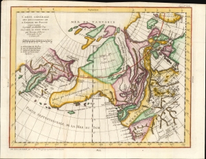
Carte Generale Des Decouvertes de L'Amiral de Fonte representant la grand porbabilite d'un Passage Au Nord Ouest par Thomas Jefferys Geographe du Roi a Londres 1768.
$500.00
Acquire
- Digital Map Information
- Suitable for large format printing
- File Size: 10.24 MB
- File Type: ZIP / TIFF
- ICC color profile embedded
- Delivered instantly via download link
This is Robert de Vaugondy's 1772 map of the northwestern parts of North America and the northeastern extremes of Asia, issued in the supplement to Diderot's groundbreaking Encyclopédie. The map summarizes a blend of new discoveries and wild speculations regarding the coastlines of the North Pacific and the possibilities of a navigable Northwest Passage. (more details)
Fallout of the French and Indian War.
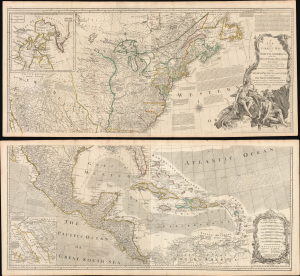
A New and Correct Map of North America, with the West India Islands...
$5,500.00
Acquire
- Digital Map Information
- Suitable for large format printing
- File Size: 129.89 MB
- File Type: ZIP / TIFF
- ICC color profile embedded
- Delivered instantly via download link
This is the 1777 edition of Robert Sayer and John Bennet's two-sheet wall map of North America, published near the start of the American Revolutionary War (1775 - 1783). It is the first 'Pownall' edition of the map, incorporating new surveys and information on the American interior, providing a comprehensive overview of the continent in the aftermath of the French and Indian War. (more details)
Britain's Most Important Colony in the Americas
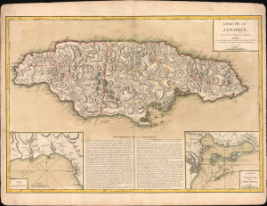
L'isle de la Jamaïque.
$1,200.00
Acquire
- Digital Map Information
- Suitable for large format printing
- Full resolution TIFF file
- ICC color profile embedded
- Delivered instantly via download link
This is Jean Lattré's 1779 map of Jamaica, based on a slightly earlier map by Thomas Jefferys. It presents Jamaica during the American Revolutionary War (1775 - 1783), when it was a central pillar of Britain's global empire and associated commercial network. (more details)
Barbados, the heart of a global sugar empire.
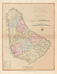
Barbadoes, surveyed by William Mayo, Engraved and Improved by Thomas Jefferys, Geographer to the King.
$1,500.00
Acquire
- Digital Map Information
- Suitable for large format printing
- Full resolution TIFF file
- ICC color profile embedded
- Delivered instantly via download link
A striking 1794 Thomas Jefferys map of Barbados in fine original color, capturing the island at the height of its extraordinary wealth as the powerhouse of Britain's Caribbean sugar empire. Based on the first systematic survey of Barbados, the map reveals a landscape intensively organized around sugar production, with hundreds of plantations, an extensive road network, coastal fortifications, and one of the densest populations in the British West Indies. (more details)