
Jefferys, Thomas (sold)
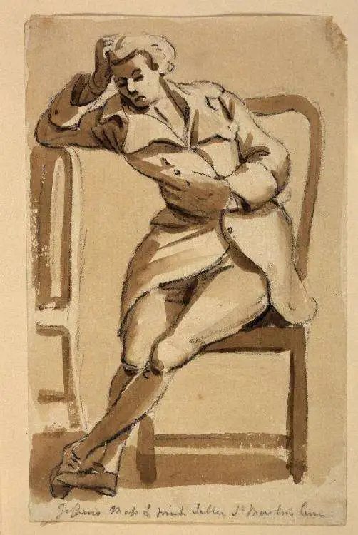
Thomas Jefferys (1695 - November 20, 1771) was one of the most prominent and prolific map publishers and engravers of his day. Jefferys was born in Birmingham and was apprenticed to the engraver Emmanuel Bowen in 1735. Later, in the 1740s he engraved several maps for the popular periodical Gentleman's Magazine. Around 1740 Jefferys was finally able to go into business for himself and in 1746 received an appointment as 'Geographer to Fredrick, Prince of Wales,' which shortly after translated to the position of 'Royal Cartographer to King George III.' Jefferys initially specialized in compiling and re-engraving the works of earlier cartographers into more coherent cartographic wholes. Later, while not salaried position, Jefferys' appointment as 'Royal Cartographer' guaranteed preferential access to the most up to date cartographic material available, allowing him to produce new and updated charts of exceptional accuracy. He his best known for his maps of the Americas, particularly the posthumously published 1775 American Atlas, which included some of the finest and most important late colonial era maps of America ever made. Despite his prolific publishing history, royal appointments, and international publishing fame, Jefferys lived most of his life in dire economic straits. He was bailed out of bankruptcy by Robert Sayer during the production of the American Atlas. In the end, Jefferys died suddenly with very little to his name. Nonetheless, his cartographic legacy survived, and even after his death in 1771, many of his important maps continued to be published and republished by Sayer and Bennet, Conrad Lotter, Georges Louis Le Rouge, Laurie and Whittle, and others. Many attribute some of Jefferys best maps to the colorful and criminally inclined Irish cartographic genius Braddock Mead (John Green, c. 1688 - 1757), who is considered the 'secret behind Jefferys.' Jefferys was succeeded by his son, also Thomas, who had little success as a cartographer and eventually partnered with, then sold his stock and plates to William Faden - Jefferys' true heir.
Predicts a Solar Eclipse and reveals Arctic Explorations.
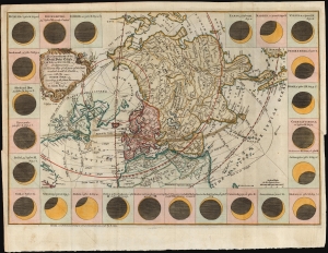
The geography of the great solar eclipse of July 14 MDCCXLVIII. : exhibiting an accurate map of all parts of the Earth in which it will be visible with the North Pole according to the latest discoveries.
sold
- Digital Map Information
- Suitable for large format printing
- DPI: 600
- File Size: 29.39 MB
- File Type: ZIP / TIFF
- ICC color profile embedded
- Delivered instantly via download link
This elegant 1748 north polar projection map was drawn by the English astronomer and writer George Smith and engraved by the great English mapmaker Thomas Jefferys. It was produced for inclusion in Smith's pamphlet describing and predicting the path of the July 14, 1748, solar eclipse. (more details)
Predicts a Solar Eclipse and reveals Arctic Explorations.
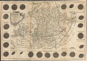
The geography of the great solar eclipse of July 14 MDCCXLVIII. : exhibiting an accurate map of all parts of the Earth in which it will be visible with the North Pole according to the latest discoveries.
sold
- Digital Map Information
- Suitable for large format printing
- File Size: 12.19 MB
- File Type: ZIP / TIFF
- ICC color profile embedded
- Delivered instantly via download link
This elegant 1748 north polar projection map was drawn by the English astronomer and writer George Smith and engraved by the great English mapmaker Thomas Jefferys. It was produced for inclusion in Smith's pamphlet describing and predicting the path of the July 14, 1748, solar eclipse. (more details)
Presenting the Predicted Effects of a Solar Eclipse and Revealing the Explorations of the North
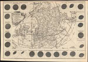
The geography of the great solar eclipse of July 14 MDCCXLVIII. : exhibiting an accurate map of all parts of the Earth in which it will be visible with the North Pole according to the latest discoveries.
sold
- Digital Map Information
- Suitable for large format printing
- DPI: 600
- File Size: 18.25 MB
- File Type: ZIP / TIFF
- ICC color profile embedded
- Delivered instantly via download link
This elegant, 1748 north polar projection map, was drawn by the English astronomer and writer George Smith and engraved by the great English mapmaker Thomas Jefferys. It was produced for inclusion in Smith's pamphlet describing, and predicting the path of, the July 14, 1748 solar eclipse. Twenty-four diagrams show the expected appearance of the eclipsed sun as viewed from different cities, and the map's notation shows both the areas from which partial or full eclipses might be seen. The map’s polar projection is presented obliquely in order to show all the parts of the known world from which the eclipse would be visible. As a result, Smith and Jefferys provide a snapshot of the general state-of-the-art of geographical knowledge of the northernmost parts of the globe to be reached by Europeans, during a period in which the English were active in their attempts to navigate those waters. (more details)
Predicts a Solar Eclipse and reveals Arctic Explorations.
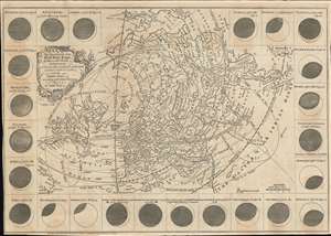
The geography of the great solar eclipse of July 14 MDCCXLVIII. : exhibiting an accurate map of all parts of the Earth in which it will be visible with the North Pole according to the latest discoveries.
sold
- Digital Map Information
- Suitable for large format printing
- Full resolution TIFF file
- ICC color profile embedded
- Delivered instantly via download link
This elegant, 1748 north polar projection map was drawn by the English astronomer and writer George Smith and engraved by the great English mapmaker Thomas Jefferys. It was produced for inclusion in Smith's pamphlet describing and predicting the path of the July 14, 1748, solar eclipse. Twenty-four diagrams show the expected appearance of the eclipsed sun as viewed from different cities, and the map's notation shows both the areas from which partial or full eclipses might be seen. The map's polar projection is presented obliquely to show all the parts of the known world from which the eclipse would be visible. As a result, Smith and Jefferys provide a snapshot of the general state-of-the-art of geographical knowledge of the northernmost parts of the globe to be reached by Europeans, during a period in which the English were active in their attempts to navigate those waters. (more details)
Predicts a Solar Eclipse and reveals Arctic Explorations.
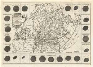
The geography of the great solar eclipse of July 14 MDCCXLVIII. : exhibiting an accurate map of all parts of the Earth in which it will be visible with the North Pole according to the latest discoveries.
sold
- Digital Map Information
- Suitable for large format printing
- Full resolution TIFF file
- ICC color profile embedded
- Delivered instantly via download link
This elegant, 1748 north polar projection map was drawn by the English astronomer and writer George Smith and engraved by the great English mapmaker Thomas Jefferys. It was produced for inclusion in Smith's pamphlet describing and predicting the path of the July 14, 1748, solar eclipse. Twenty-four diagrams show the expected appearance of the eclipsed sun as viewed from different cities, and the map's notation shows both the areas from which partial or full eclipses might be seen. The map's polar projection is presented obliquely to show all the parts of the known world from which the eclipse would be visible. As a result, Smith and Jefferys provide a snapshot of the general state-of-the-art of geographical knowledge of the northernmost parts of the globe to be reached by Europeans, during a period in which the English were active in their attempts to navigate those waters. (more details)
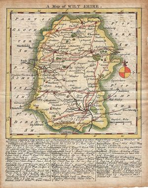
A Map of Wilt Shire.
sold
- Digital Map Information
- Suitable for large format printing
- DPI: 300
- File Size: 1.85 MB
- File Type: ZIP / TIFF
- ICC color profile embedded
- Delivered instantly via download link
This is a scarce 1749 example of Thomas Kitchin and Thomas Jefferys map of the County of Wiltshire, England. It features a detailed map of the County of Wilts or Wiltshire in elaborate detail including the city of Salisbury. Several roads, rivers, towns, forests, ... (more details)
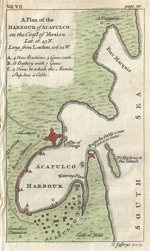
A Plan of the Harbour of Acapulco on the Coast of Mexico.
sold
- Digital Map Information
- Suitable for large format printing
- DPI: 300
- File Size: 0.72 MB
- File Type: ZIP / TIFF
- ICC color profile embedded
- Delivered instantly via download link
This is a beautiful c.1756 map or plan of the harbor of Acapulco, Mexico by Thomas Jefferys. Oriented to the east, the plan details Acapulco Bay and its fortified port. In the 18th century Acapulco was the strategically important starting point for all Spanish ... (more details)
Frontier of the French and Indian War.
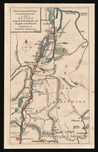
The Country between Crown Point and Albany being the Great Pass from the English to the French Settlements in North America.
sold
- Digital Map Information
- Suitable for large format printing
- DPI: 600
- File Size: 4.83 MB
- File Type: ZIP / TIFF
- ICC color profile embedded
- Delivered instantly via download link
This is a rare 1858 map of a key theatre of the French and Indian War, engraved by Thomas Phinn in Edinburgh to satisfy readers hungry for news. Although of broader scope, it is remarkable in pre-dating the famous Brasier map of Lakes Champlain and George, the earliest separate map specifically of those lakes. The Brasier surveys began after the publication of the present map. (more details)
An extremely scarce stunning wall map of England and Ireland.
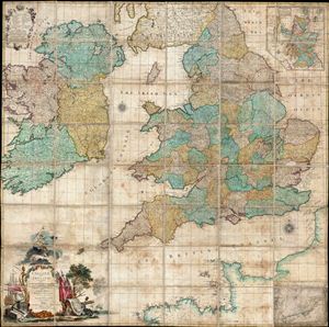
England and Ireland, Containing all the Cities, Boroughs, Market-Towns, & principal Villages, with the Coast of France from Calais to Brest.
sold
- Digital Map Information
- Suitable for large format printing
- Full resolution TIFF file
- ICC color profile embedded
- Delivered instantly via download link
An impressive and extremely scarce folding c. 1760 wall map of england and Ireland by Richard W. Seale. Covers all of england and about 98% of Ireland excepting only a small part of western Kerry and western Connaught. Part of the adjacent French coast is ... (more details)
The first large scale map of Devonshire or any other English county.
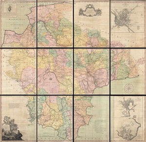
A Map of the County of Devon, with the City & County of Exeter.
sold
- Digital Map Information
- Suitable for large format printing
- DPI: 300
- File Size: 724.64 MB
- File Type: ZIP / TIFF
- ICC color profile embedded
- Delivered instantly via download link
This is a very rare and highly important 1765 wall map of Devonshire by Benjamin Donn. Drawn in twelve panels, this map covers the entirety of Devonshire or Devon from the English Channel to Barnstaple (Bideford) Bay and from Cornwall to Somerset at a scale ... (more details)
The rarest and earliest state of a seminal map.
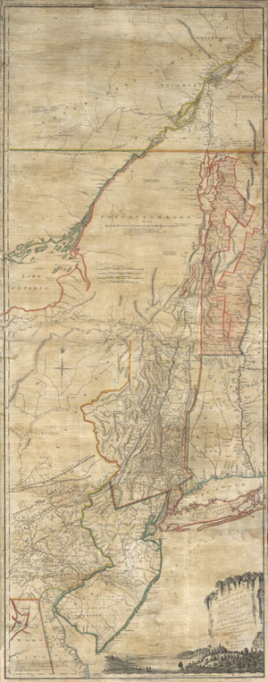
The Provinces of NEW YORK and NEW JERSEY with part of PENSILVANIA, and the Governments of TROIS RIVIERES, and MONTREAL: drawn by Capt. Holland. / A Chorographical Map of the Country between Albany, Oswego, Fort Frontenac, and Les Trois Rivieres; Exhibing all the Grands made by the French Governors on Lake Champlain; & between that Lake & Montreal.
sold
- Digital Map Information
- Suitable for large format printing
- Full resolution TIFF file
- ICC color profile embedded
- Delivered instantly via download link
A first issue first edition example of a seminal map. This is a rare and unusual version of the 1768 first edition of Holland and Jefferys seminal map of New York and New Jersey. Depicts the important trade corridor between New York and Montreal, ... (more details)
Staggering wall map of India.
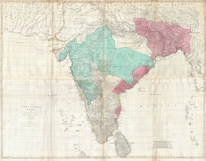
The East Indies, with the Roads.
sold
- Digital Map Information
- Suitable for large format printing
- DPI: 300
- File Size: 71.28 MB
- File Type: ZIP / TIFF
- ICC color profile embedded
- Delivered instantly via download link
This is a staggering wall size map of India and Ceylon issued in 1768 by Thomas Jeffreys. Covers the Indian subcontinent from Mekran in the west to Assam and Aracan in the east, and from Bhutan in the north, south to Ceylon and the Maldives. ... (more details)
Capital of New England - one of the earliest views of Boston based on actual observation.
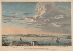
A View of the City of Boston the Capital of New England, in North America. / Vue de la Ville de Boston Capitale de la Nouvelle Angleterre, dans l'Amérique Septemtrionale.
sold
- Digital Map Information
- Suitable for large format printing
- DPI: 600
- File Size: 387.91 MB
- File Type: ZIP / TIFF
- ICC color profile embedded
- Delivered instantly via download link
This is the rare Thomas Pownall view of Boston, published in 1768. It is one of the earliest obtainable views of Boston offering a look at the city shortly after the French and Indian War (1754 - 1763). (more details)
A fascinating 17th century pre-Cook speculation on the configuration of northwestern America.
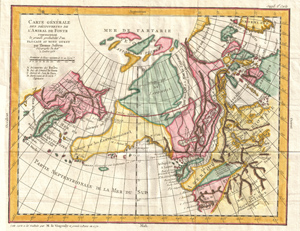
Carte Generale Des Decouvertes de L'Amiral de Fonte representant la grand porbabilite d'un Passage Au Nord Ouest par Thomas Jefferys Geographe du Roi a Londres 1768.
sold
- Digital Map Information
- Suitable for large format printing
- DPI: 300
- File Size: 15.19 MB
- File Type: ZIP / TIFF
- ICC color profile embedded
- Delivered instantly via download link
A truly fascinating 1772 map of the northwestern parts of North America by Robert de Vaugondy and Thomas Jefferys. Essentially depicts the north eastern parts of Asia, speculations on northwestern America, and Admiral De Fonte's mythical ... (more details)
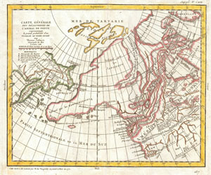
Carte Generale Des Decouvertes de L'Amiral de Fonte representant la grand porbabilite d'un Passage Au Nord Ouest par Thomas Jefferys Geographe du Roi a Londres 1768.
sold
- Digital Map Information
- Suitable for large format printing
- DPI: 300
- File Size: 7.1 MB
- File Type: ZIP / TIFF
- ICC color profile embedded
- Delivered instantly via download link
A truly fascinating 1772 map of the northwestern parts of North America by Robert de Vaugondy. Essentially depicts the north eastern parts of Asia, speculations on northwestern America and Admiral De Fonte's mythical conception of a ... (more details)
Cartographic game of telephone.
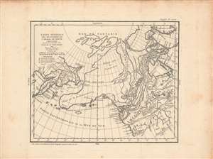
Carte Generale Des Decouvertes de L'Amiral de Fonte representant la grand porbabilite d'un Passage Au Nord Ouest par Thomas Jefferys Geographe du Roi a Londres 1768.
sold
- Digital Map Information
- Suitable for large format printing
- DPI: 600
- File Size: 41.16 MB
- File Type: ZIP / TIFF
- ICC color profile embedded
- Delivered instantly via download link
A fascinating 1772 map of the northwestern parts of North America by Robert de Vaugondy. It depicts the northeastern parts of Asia, speculations on northwestern America and Admiral De Fonte's mythical conception of a Northwest Passage. Robert de Vaugondy prepared this map prior to James Cook's voyages, when Europe was rampant with speculation both regarding the existence of a Northwest Passage and the northwestern parts of America in general. The discoveries of Admiral de Fonte and Juan de Fuca, though now known to be mythical, inspired the European imagination. (more details)
The most important and influential 18th century Colonal Era map of New England.
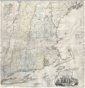
A Map of the most Inhabited part of New England containing the Provinces of Massachusets Bay and New Hampshire, with the Colonies of Connecticut and Rhode Island, divided into Counties and Townships: The whole composed form Actual Surveys and its Situation adjusted by Astronomical Observations.
sold
- Digital Map Information
- Suitable for large format printing
- Full resolution TIFF file
- ICC color profile embedded
- Delivered instantly via download link
A highly significant map, this is the 1774 'Jefferys' Map' of the Most Inhabited Part of New england . Centered on the Massachusetts Bay Colony, this map covers from Long Island to Lake Champlain and from the Hudson River to Cape Cod ... (more details)
Most important and influential 18th century Colonial Era map of New England.
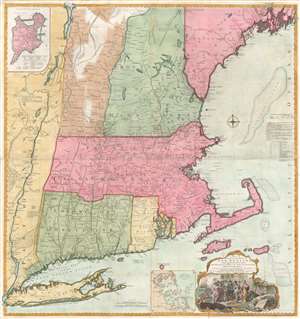
A Map of the most Inhabited part of New England containing the Provinces of Massachusets Bay and New Hampshire, with the Colonies of Connecticut and Rhode Island, divided into Counties and Townships: The whole composed form Actual Surveys and its Situation adjusted by Astronomical Observations.
sold
- Digital Map Information
- Suitable for large format printing
- Full resolution TIFF file
- ICC color profile embedded
- Delivered instantly via download link
A highly significant map, this is the 1774 'Jefferys' Map' of the Most Inhabited Part of New England. Centered on the Massachusetts Bay Colony, this map covers from Long Island to Lake Champlain and from the Hudson River to Cape Cod and Kennebec Bay, Maine. There is an inset of Boston in the upper left corner and another of Boston Harbor near the cartouche in the lower right quadrant. This scarce map was drawn by Braddock Mead (a.k.a. John Green) and published by Thomas Jefferys. It was first published in 1755 and went through at least six subsequent revisions, the present example being the third edition issued in 1774 for Thomas Jefferys' American Atlas. From the publication of the American Atlas onwards, this significant map, the most important in the Atlas, became known as the 'Jefferys Map'. (more details)
The most important and influential 18th century Colonial Era map of New England.
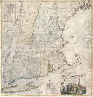
A Map of the most Inhabited part of New England containing the Provinces of Massachusets Bay and New Hampshire, with the Colonies of Connecticut and Rhode Island, divided into Counties and Townships: The whole composed form Actual Surveys and its Situation adjusted by Astronomical Observations.
sold
- Digital Map Information
- Suitable for large format printing
- Full resolution TIFF file
- ICC color profile embedded
- Delivered instantly via download link
A highly significant map, this is the 1774 'Jefferys' Map' of the Most Inhabited Part of New england . Centered on the Massachusetts Bay Colony, this map covers from Long Island to Lake Champlain and from the Hudson River to Cape Cod ... (more details)
The most important and influential 18th century Colonial Era map of New England.
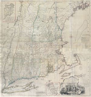
A Map of the most Inhabited part of New England containing the Provinces of Massachusets Bay and New Hampshire, with the Colonies of Connecticut and Rhode Island, divided into Counties and Townships: The whole composed form Actual Surveys and its Situation adjusted by Astronomical Observations.
sold
- Digital Map Information
- Suitable for large format printing
- Full resolution TIFF file
- ICC color profile embedded
- Delivered instantly via download link
A highly significant map, this is the 1774 'Jefferys' Map' of the Most Inhabited Part of New england . Centered on the Massachusetts Bay Colony, this map covers from Long Island to Lake Champlain and from the Hudson River to Cape Cod ... (more details)
The most important and influential 18th century Colonial Era map of New England.
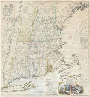
A Map of the most Inhabited part of New England containing the Provinces of Massachusets Bay and New Hampshire, with the Colonies of Connecticut and Rhode Island, divided into Counties and Townships: The whole composed form Actual Surveys and its Situation adjusted by Astronomical Observations.
sold
- Digital Map Information
- Suitable for large format printing
- Full resolution TIFF file
- ICC color profile embedded
- Delivered instantly via download link
A highly significant map, this is the 1774 'Jefferys' Map' of the Most Inhabited Part of New england . Centered on the Massachusetts Bay Colony, this map covers from Long Island to Lake Champlain and from the Hudson River to Cape Cod ... (more details)
Scarce 1775 English Map Prefiguring A British Colonial Presence in Central America.
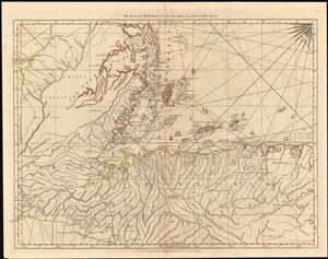
The Bay of Honduras. By Thos. Jefferys Geographer to His Majesty.
sold
- Digital Map Information
- Suitable for large format printing
- DPI: 600
- File Size: 51 MB
- File Type: ZIP / TIFF
- ICC color profile embedded
- Delivered instantly via download link
This 1775 Jefferys map of Belize, Honduras, Guatemala and El Salvador is the earliest, acquirable, detailed map to focus on the region. It is informationally rich, showing anchorages, depth soundings and common sailing routes (replete with dozens of ships.) The region’s plentiful reefs, islands and lagoons are shown and named. This map brings into sharp focus coastal Belize and Honduras where English privateers and merchants had long operated – shortly after Spain began to tolerate their presence, but just prior to Britain’s official administration of Belize as a colony. (more details)
Remarkable map showing Alaska as an Island.
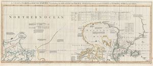
A Chart of North and South America, including the Atlantic and Pacific Oceans, with the nearest Coasts of Europe, Africa, and Asia. Chart containing part of the Icy Sea with the adjacent Coast of Asia and America. Chart comprizing Greenland with the Countries and Islands about Baffins Bay and part of Hudsons Bay.
sold
- Digital Map Information
- Suitable for large format printing
- DPI: 300
- File Size: 28.3 MB
- File Type: ZIP / TIFF
- ICC color profile embedded
- Delivered instantly via download link
A wonderful 1775 map of the Arctic regions of the Western Hemisphere by John Green or Braddock Mead. Focusing on Alaska (Bering Strait) and the Canadian Arctic, map covers from the Sea of Okhotsk (Penschinaska Guba) to Iceland and ... (more details)
Best colonial map of Virginia and Maryland.
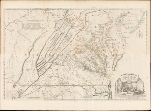
A Map of the most Inhabited part of Virginia containing the whole Province of Maryland with Part of Pensilvania, New Jersey and North Carolina drawn by Joshua Fry and Peter Jefferson in 1775.
sold
- Digital Map Information
- Suitable for large format printing
- Full resolution TIFF file
- ICC color profile embedded
- Delivered instantly via download link
This is the monumental 1775 Fry/Jefferson map of Virginia and Maryland, the most important colonial map of Virginia, in its original four-sheet English version. Drawn by Joshua Fry and Peter Jefferson in 1751 and first printed in 1753, this was the first accurate survey of the interior of Virginia. It was the first printed map to approximate the parallel ridges and valleys of the Appalachian Mountains, and the first to accurately depict the Blue Ridge Mountains. Following the revision of the map in 1755, this was the first map to include Virginia's road system, also marking routes used by frontier traders and Native Americans. Following that revision, it contained the best mapping of the Upper Ohio Valley and the Virginia frontier produced during the French and Indian War (1754 - 1763) and remained the prototype for all subsequent maps of Virginia until the 19th century. As both Fry and Jefferson were denizens of the colony, this further represents the first map of Virginia produced by Virginians. (more details)
Best British Chart of the St. Lawrence on the Eve of the American Revolution.
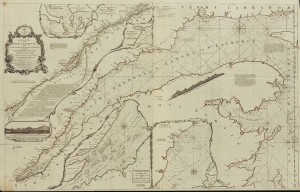
An Exact Chart of the River St. Laurence from Fort Frontenac to the Island of Anticosti shewing the Soundings, Rocks, Shoals and c with Views of the Lands and all necessary Instructions for navigating that River to Quebec.
sold
- Digital Map Information
- Suitable for large format printing
- File Size: 2028.51 MB
- File Type: ZIP / TIFF
- ICC color profile embedded
- Delivered instantly via download link
This significant 1775 chart of the St. Larence River appeared in Thomas Jefferys' The American Atlas, the most important 18th-century atlas for America. (more details)
Most important late 18th century map of Cuba. Illustrates the Spanish Treasure Fleet wreck of the 'Santiago el Grande.'
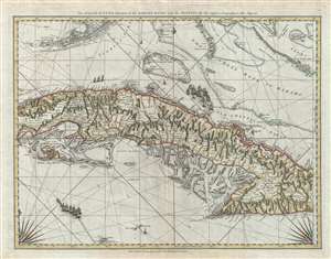
The Island of Cuba with part of the Bahama Bank and the Martyrs.
sold
- Digital Map Information
- Suitable for large format printing
- Full resolution TIFF file
- ICC color profile embedded
- Delivered instantly via download link
A rare and important 1775 Thomas Jeffreys and Robert Sayer sea chart or nautical map of Cuba, the Florida Keys, and the Grand Bahama Bank. The map's coverage extends from just west of Havana down to the Sierra Maestra, the Cayman ... (more details)
New York, New Jersey, and the Hudson Valley on the brink of the American Revolutionary War.
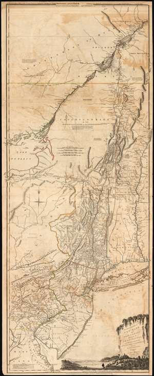
The Provinces of NEW YORK, and NEW JERSEY; with part of PENSILVANIA, and the Governments of TROIS RIVIERES, and MONTREAL: drawn by Capt. Holland. / A Chorographical Map of the Country between Albany, Oswego, Fort Frontenac, and Les Trois Rivieres; Exhibiting all the Grants made by the French Governors on Lake Champlain; and between that Lake and Montreal.
sold
- Digital Map Information
- Suitable for large format printing
- DPI: 300
- File Size: 32.59 MB
- File Type: ZIP / TIFF
- ICC color profile embedded
- Delivered instantly via download link
One of the most important, influential, and comprehensive American Revolutionary War Era maps of New York, New Jersey, Vermont, and the Hudson Valley corridor, this is an early 1775 edition of Capt. Samuel Holland and Thomas Jeffrey's Provinces of New York and New Jersey… Holland's map illustrates the important strategic and trade corridor between New York and Montreal, specifically detailing from Delaware Bay northward including parts of eastern Pennsylvania, New Jersey, Long Island, New York, Connecticut, Massachusetts and Vermont as well as the Iroquois League, the Trois Rivieres territories, and Montreal, as far as Lac St. Pierre in modern-day Quebec. In the lower right, a scenic cartouche illustrates the wide and easily navigable expanse of the Hudson River - surely an enticement to the region. (more details)
An open invitation to Piracy?
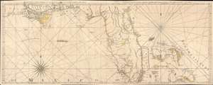
The Coast of West Florida and Louisiana. / The Peninsula and Gulf of Florida or Channel of Bahama with the Bahama Islands.
sold
- Digital Map Information
- Suitable for large format printing
- DPI: 600
- File Size: 44.18 MB
- File Type: ZIP / TIFF
- ICC color profile embedded
- Delivered instantly via download link
This is the 1775 first edition of Thomas Jeffreys' seminal map of Florida and the Gulf Coast - considered the first large-scale map to address the region in any detail. The map is significant for its accessible delineation of Florida and the Gulf, but is made more interesting through its graphic illustration of the Spanish Treasure Fleet and its route from Havana, around Florida, and then through the Bahamas - an unspoken but open invitation to pirates and privateers. (more details)
Scarce final issue of the important Holland-Jefferys Map New York, New Jersey, and the Hudson Valley on the brink of the American Revolutionary War. The best obtainable Revolutionary War Era map of this region.
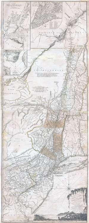
The Provinces of NEW YORK, and NEW JERSEY; with part of PENSILVANIA, and the Governments of TROIS RIVIERES, and MONTREAL: drawn by Major Holland, Surveyor General, of the Norther District in America. / A Chorographical Map of the Country between Albany, Oswego, Fort Frontenac, and Les Trois Rivieres; Exhibiting all the Grants made by the French Governors on Lake Champlain; & between that Lake & Montreal.
sold
- Digital Map Information
- Suitable for large format printing
- DPI: 300
- File Size: 26.6 MB
- File Type: ZIP / TIFF
- ICC color profile embedded
- Delivered instantly via download link
One of the most important, influential, and comprehensive American Revolutionary War Era map of New York, New Jersey, Vermont, and the Hudson Valley corridor, this is an final 1776 state of Major Samuel Holland and Thomas ... (more details)
One month after the Declaration of Independence.
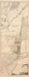
The Provinces of NEW YORK, and NEW JERSEY; with part of PENSILVANIA, and the Governments of TROIS RIVIERES, and MONTREAL: drawn by Capt. Holland. / A Chorographical Map of the Country between Albany, Oswego, Fort Frontenac, and Les Trois Rivieres; Exhibiting all the Grants made by the French Governors on Lake Champlain; and between that Lake and Montreal.
sold
- Digital Map Information
- Suitable for large format printing
- File Size: 55.63 MB
- File Type: ZIP / TIFF
- ICC color profile embedded
- Delivered instantly via download link
This is one of the most important, influential, and comprehensive American Revolutionary War Era maps of New York, New Jersey, Vermont, and the Hudson Valley corridor. It was issued a little over one month after the adoption of the Declaration of Independence and represents the most contested theaters of the American Revolutionary War (1775 - 1783). (more details)
Revolutionary War Map for the Hessian Market.
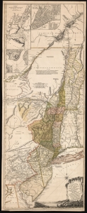
The Provinces of NEW YORK, and NEW JERSEY; with part of PENSILVANIA, and the Province of Quebec. Drawn by Major Holland, Surveyor General, of the Northern District in America. Corrected and Improved, from the Original Materials, By Governr. Pownall, Member of Parliament. Published by Harry Lodowick Broenner, Book-seller to Franckfort upon the Mayn. 1777.
sold
- Digital Map Information
- Suitable for large format printing
- DPI: 600
- File Size: 162.27 MB
- File Type: ZIP / TIFF
- ICC color profile embedded
- Delivered instantly via download link
This is a rare, separately issued German edition of the best-informed map available focusing on the northern theatre of the American Revolution: Samuel Holland's 1775 map of The Provinces of New York and New Jersey, in its final version corrected by Governor Thomas Pownall. This map was published by the heirs of Harry Lodowick Broenner, a Frankfurt-am-Main bookseller, whose forays into cartography were characterized by the swift reproduction of up-to-date maps, topically relevant to Frankfurter interests. As the Holland-Pownall map provided the best available view of the American war zone in which Hessian mercenaries were expected to be active, it would have been an apt target for the Broenners. (more details)
Richly-detailed Surveys of St. Kitts and Nevis.
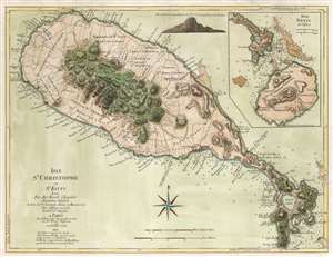
Isle St. Christophe ou St. Kitts Leve Par Ant: Ravell Chevalier Arpenteur Général des Isles de St. Christophe, Nevis et Montserrat. Par Jefferys en 1775. Traduit de l'Anglais A Paris par le Rouge Ingr. Geographe du Roi rue des Grands Augustus 1779 avec Privilege du Roi.
sold
- Digital Map Information
- Suitable for large format printing
- DPI: 600
- File Size: 22.65 MB
- File Type: ZIP / TIFF
- ICC color profile embedded
- Delivered instantly via download link
This Anthony Ravell’s survey map of the islands of St. Christopher and Nevis, in its 1779 French translation published by George-Louis Le Rouge. The map is based on the best 18th century survey of the islands, executed by Anthony Ravell, probably in 1717. Ravell's survey of St. Kitts was not committed to print until Jefferys engraved it for Robert Sayer in 1768; Jefferys would produce a further map of the island (combined with an inset map of Nevis) for his 1775 The West-India Atlas. It is this 1775 Jefferys map that Le Rouge copied to produce the present work. While the gap between 1717 and 1779 seems vast to our sensibility, at the time Ravell's survey remained the most current available: consider that the Mount and Page map of St. Christopher, published as late as 1783, was based on the surveys of Andrew Norwood, who died nearly a century prior in 1685. Norwood's survey also provided the source material for maps by Moll, Bowen, and Bellin. (more details)
Prepared for French participation in the American Revolutionary War.
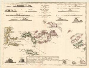
Les Vierges, Levées Par Les Anglais, et Par Les Dannois, Traduit de l'Anglais.
sold
- Digital Map Information
- Suitable for large format printing
- Full resolution TIFF file
- ICC color profile embedded
- Delivered instantly via download link
A rare 1779 map of the Virgin Islands by Georges-Louis Le Rouge prepared in anticipation of French participation in the American Revolutionary War (1775 - 1783). (more details)
British Foothold in the African Slave Trade.
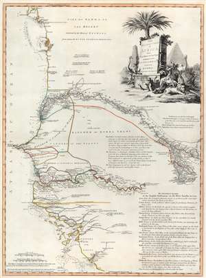
The Western Coast of Africa from Cape Blanco to Cape Vigo, Exhibiting Senegambia Proper by T. Jefferys, Geographer to His Majesty.
sold
- Digital Map Information
- Suitable for large format printing
- DPI: 600
- File Size: 29.76 MB
- File Type: ZIP / TIFF
- ICC color profile embedded
- Delivered instantly via download link
This is a beautiful example of Robert Sayer's 1789 map of western coastal Africa. It is focused on Senegal, but includes parts of modern Mauritania, Mali, Guinea-Bissau, and Guinea. It reaches from as far north as Cap Blanco and the Arguin Banks to the mouth of the Rio Nuñez and Cap Virgo in the south. The map traces the course of the Senegal River as far east as the Felou Rocks, present site of the Félou Hydroelectric Plant in Mali. (more details)
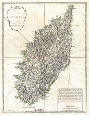
A New Map of the Island and Kingdom of Corsica.
sold
- Digital Map Information
- Suitable for large format printing
- DPI: 300
- File Size: 17.48 MB
- File Type: ZIP / TIFF
- ICC color profile embedded
- Delivered instantly via download link
An extraordinary 1794 map of the Island and Kingdom of Corsica. Covers the entire island in extraordinary detail offering both topographical and political information. With its unique blend of dramatic mountains and ... (more details)
Impressive wall map of India.
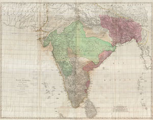
The East Indies, with the Roads.
sold
- Digital Map Information
- Suitable for large format printing
- DPI: 300
- File Size: 90.75 MB
- File Type: ZIP / TIFF
- ICC color profile embedded
- Delivered instantly via download link
This is a staggering wall size map of India and Ceylon originally issued in 1768 by Thomas Jeffreys. Covers the Indian subcontinent from Mekran in the west to Assam and Aracan in the east, and from Bhutan in the ... (more details)
Best 18th century map of the Turks Islands.
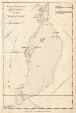
Turks Islands, from a survey made in 1753, by the Sloops l'Aigle and l'Emeraude by order of the French Governor of Hispaniola.
sold
- Digital Map Information
- Suitable for large format printing
- Full resolution TIFF file
- ICC color profile embedded
- Delivered instantly via download link
This is the 1794 Laurie and Whittle edition of Thomas Jeffrys' map of the Turks Islands, among the earliest maps to focus on the islands. The map shows not only Grand Turk, Salt Key, and Sand Key but also the shallows linking these islands, as well as several smaller. As such, the map - with copious depth soundings, anchorages, and notations - is able to emphasize the many localized navigational hazards. As small as they are, the Turks were an important resource: its tiny population produced salt from sea brine. (Indeed, the only settlements noted on the map are 'Salt rakers' huts.' During the American Revolution the Continental Army depended on Turks and Caicos salt for food preservation, and American fishing vessels used Turks salt to preserve their catches. Jefferys credited the a 1753 survey attributed to the French schooners l'Aigle and l'Emeraude, further amended in 1770 by the British sloop Sir Edward Hawke (the sloop, not Sir Edward himself, who was by this time First Lord of the Admiralty and above such chores.) (more details)
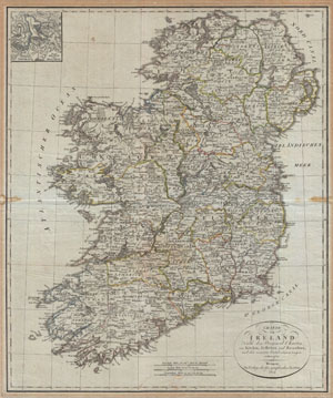
Charte von Ireland Nach den Original-Charten von Kitchin, Jefferys, und Beaufort, und den neuesten Ortsbestimmungen entworfen.
sold
- Digital Map Information
- Suitable for large format printing
- DPI: 300
- File Size: 19.79 MB
- File Type: ZIP / TIFF
- ICC color profile embedded
- Delivered instantly via download link
An uncommon map of Ireland dating to 1804. Though published by the German Geographical Institute, this map references the earlier work of Thomas Kitchin, Thomas Jefferys, and Daniel Beaufort. Covers the ... (more details)
A beautifully engraved map of Corsica.
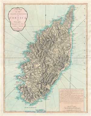
A New Map of the Island and Kingdom of Corsica.
sold
- Digital Map Information
- Suitable for large format printing
- DPI: 300
- File Size: 14.74 MB
- File Type: ZIP / TIFF
- ICC color profile embedded
- Delivered instantly via download link
This is an 1823 Thomas Jefferys and Richard Holmes Laurie map of Corsica. Beautifully engraved, the map depicts the entire island in considerable detail along with the extreme northern region of Sardinia. ... (more details)