
Kiepert, Heinrich

Heinrich Kiepert (July 31, 1818 - April 21, 1899) was a German cartographer and historian active in the mid to late 19th century. Kiepert was born into generous circumstances that allowed him to develop his childhood interest in geography and history into a serious profession. The Berlin-born Kiepert traveled widely in his youth and was encouraged in his studies by the historian Leopold von Ranke, a family friend. He was a student of classical antiquity under August Meineke and worked with Carl Ritter (1779 - 1859). He studied history, philology, and geography at the Humboldt University of Berlin - he would eventually teach geography there, and would remain there until his death. Disappointed by the poor quality of maps in historical schoolbooks, Kiepert set out to correct the problem. His first major work, the Atlas von Hellas und den hellenischen Kolonien, was published with Carl Ritter in 1840. The work immediately won accolades from the academic community. Several similar publications followed, including the 1848 Historisch-geographischer Atlas der alten Welt, the 1854 Atlas Antiquus, and the 1894 Formae Orbis Antiqui. Kiepert specialized in the historical geography of the classical world at the University of Berlin. This developed into a geographical interest in the Ottoman Empire, which was poorly mapped at the time. He traveled to Asia Minor four times between 1841 and 1848, using his journeys to collect and compile geographical data and to produce several outstanding regional maps with wide-ranging coverage extending from the Mediterranean to the Caucasus. Thanks in large part to these works, Kiepert became the recognized expert on Ottoman geography, his works representing the best obtainable reconnaissances of their respective regions. From 1845 until 1852, Kiepert served as the head of the Geographisches Institut in Weimar. In 1854, he took a position as professor of Geography at the University of Berlin and, for nearly 50 years, was considered the go-to man for cartography of classical and biblical antiquity. Kipert formed a long-lasting professional association with Dietrich Reimer, a Berlin publisher. Kiepert's maps are known for b being clear, easy to read, and as accurate as possible for the time in which they were produced. In addition to his landmark work in mapping the Ottoman Empire, Kiepert also published the first detailed ethnic maps of Austria-Hungary, the Balkan Peninsula, and Germany. Kiepert died in Berlin on April 21, 1899.
A detailed map of the Portuguese colony in modern-day Angola.
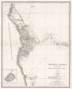
Nieder-Guinea und das Innere Westlichen Mittel-Africa.
$300.00
Acquire
- Digital Map Information
- Suitable for large format printing
- DPI: 300
- File Size: 7.4 MB
- File Type: ZIP / TIFF
- ICC color profile embedded
- Delivered instantly via download link
This is an 1846 Carl Ferdinand Weiland and Heinrich Kiepert map of southwestern Africa. The map depicts the Atlantic coast of Africa from approximately modern-day Gabon to central Namibia, including parts of the modern-day countries of Angola and the Democratic ... (more details)
The Pirate Coast.
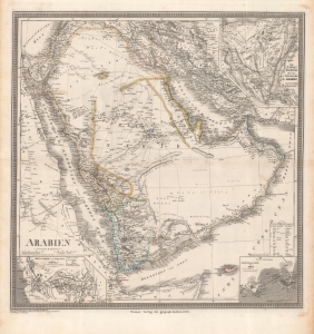
Arabien.
$1,500.00
Acquire
- Digital Map Information
- Suitable for large format printing
- Full resolution TIFF file
- ICC color profile embedded
- Delivered instantly via download link
This is an 1848 Heinrich Kiepert map of the Arabian Peninsula. It displays the region, only poorly understood by Europeans, in impressive detail. Of note is the controversial term 'Pirate Coast' (roughly the UAE), and the route of Finnish Arabist George August Wallin. (more details)
A pause in the Caucasian War.
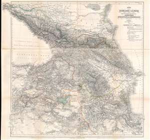
Karte der Kaukasus - Länder und der Angränzenden Türkischen und Persischen Provinzen Armenien, Kurdistan, und Azerbeidjan.
$1,000.00
Acquire
- Digital Map Information
- Suitable for large format printing
- Full resolution TIFF file
- ICC color profile embedded
- Delivered instantly via download link
This is an 1854 map of the Caucasus, published during the Caucasian War (1817 - 1864) and the Crimean War (1853 - 1856) by Heinrich Kiepert, the most accomplished 19th-century cartographer working in the Caucasus and Trans-Caucasus. For 50 years, this served as a definitive map used for treaty negotiation, military activity, and administration. (more details)
By the greatest German cartographer of the 19th century.
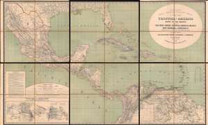
H. Kiepert's Karte des Nördlichen Tropischen America. A New Map of Tropical - America North of the Equator Comprising the West - Indies, Central - America, Mexico, New Cranada and Venezuela.
$3,500.00
Acquire
- Digital Map Information
- Suitable for large format printing
- Full resolution TIFF file
- ICC color profile embedded
- Delivered instantly via download link
This is a large and impressive 1858 map of Florida, the Gulf of Mexico, Central America, the West Indies, and northern South America, compiled by Heinrich Kiepert, the greatest German cartographer of the 19th century. The map presents the region in detail, with color coding to differentiate between countries and a key situated in the lower left. (more details)
Battle of Puebla and the Second French Intervention in Mexico.
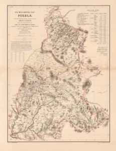
Der Mexicanische Stat Puebla.
$4,500.00
Acquire
- Digital Map Information
- Suitable for large format printing
- File Size: 22.32 MB
- File Type: ZIP / TIFF
- ICC color profile embedded
- Delivered instantly via download link
This is a scarce 1862 H. Kiepert map of Puebla, Mexico, issued in Germany in the wake of the Battle of Puebla, in which Mexican forces repulsed a French invasion, placing Mexico and Puebla on the global stage. In 1863, one year after this map was issued, French interventionists established the Second Mexican Empire, placing the Austrian Archduke Maximilian I on the throne and creating widespread interest in Mexico throughout the German-speaking world. (more details)
Large Educational Map.
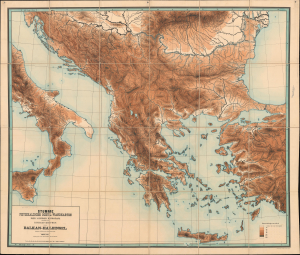
Stumme Physikalische Schul-Wandkarten der Länder Europas. Balkan-Halbinsel.
$950.00
Acquire
- Digital Map Information
- Suitable for large format printing
- File Size: 166.65 MB
- File Type: ZIP / TIFF
- ICC color profile embedded
- Delivered instantly via download link
This is a monumental 1884 Richard Kiepert chromolithograph topographic map of Greece and the Balkan Peninsula. Such maps were introduced for school use and, with their bright colors and large size, became popular throughout Europe. The map depicts the region from central Italy east to the Bosporus and from the Danube Delta on the Black Sea to Crete. Kiepert employs a systematic color model to illustrate topography, river systems, and coastlines. Cities are marked but left unnamed. (more details)
A monumental and striking topographic map of central Europe by the greatest German cartographer of the 19th century.
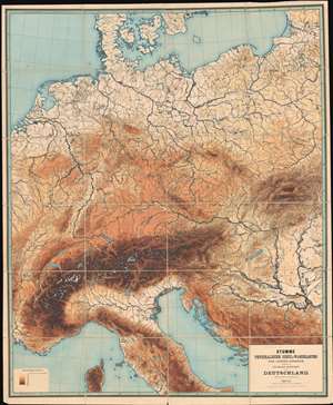
Stumme Physikalische Schul-Wandkarten der Länder Europas. Deutschland.
$1,500.00
Acquire
- Digital Map Information
- Suitable for large format printing
- File Size: 208.58 MB
- File Type: ZIP / TIFF
- ICC color profile embedded
- Delivered instantly via download link
An amazing piece created by the most celebrated 19th-century German cartographer, this is a massive and impressive 1886 Richard Kiepert topographic map of central Europe. The map depicts the region from eastern France east across the continent to the Baltic states and the Balkans and from the Baltic Sea to Corsica. Kiepert employs eight different colors to illustrate the region's topography. He details the region's river systems, lakes, and coastlines, and marks, although without identifying them by name, many of the region's cities and towns. (more details)
An unforgettable wall map of Russia and Eastern Europe.
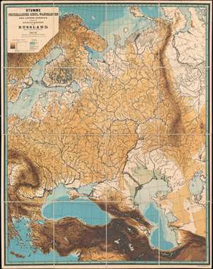
Stumme Physikalische Schul-Wandkarten der Länder Europas. Russland.
$1,500.00
Acquire
- Digital Map Information
- Suitable for large format printing
- File Size: 158.37 MB
- File Type: ZIP / TIFF
- ICC color profile embedded
- Delivered instantly via download link
This is an unforgettable 1888 Richard Kiepert topographic map of Russia and Eastern Europe. The map depicts the region from Sweden and the Balkans to the Ob River and from the Arctic Ocean to the Middle East. Kiepert employs eight different colors to illustrate the region's topography and three shades of blue for ocean depth. He details the region's river systems and coastlines, along with both the Aral Sea and Caspian Sea. Green appears along the shores of the Caspian Sea and denotes areas below sea level. Although without identifying any by name, many of the region's cities and towns are marked as well. (more details)