
Kiepert, Heinrich (sold)

Heinrich Kiepert (July 31, 1818 - April 21, 1899) was a German cartographer and historian active in the mid to late 19th century. Kiepert was born into generous circumstances that allowed him to develop his childhood interest in geography and history into a serious profession. The Berlin-born Kiepert traveled widely in his youth and was encouraged in his studies by the historian Leopold von Ranke, a family friend. He was a student of classical antiquity under August Meineke and worked with Carl Ritter (1779 - 1859). He studied history, philology, and geography at the Humboldt University of Berlin - he would eventually teach geography there, and would remain there until his death. Disappointed by the poor quality of maps in historical schoolbooks, Kiepert set out to correct the problem. His first major work, the Atlas von Hellas und den hellenischen Kolonien, was published with Carl Ritter in 1840. The work immediately won accolades from the academic community. Several similar publications followed, including the 1848 Historisch-geographischer Atlas der alten Welt, the 1854 Atlas Antiquus, and the 1894 Formae Orbis Antiqui. Kiepert specialized in the historical geography of the classical world at the University of Berlin. This developed into a geographical interest in the Ottoman Empire, which was poorly mapped at the time. He traveled to Asia Minor four times between 1841 and 1848, using his journeys to collect and compile geographical data and to produce several outstanding regional maps with wide-ranging coverage extending from the Mediterranean to the Caucasus. Thanks in large part to these works, Kiepert became the recognized expert on Ottoman geography, his works representing the best obtainable reconnaissances of their respective regions. From 1845 until 1852, Kiepert served as the head of the Geographisches Institut in Weimar. In 1854, he took a position as professor of Geography at the University of Berlin and, for nearly 50 years, was considered the go-to man for cartography of classical and biblical antiquity. Kipert formed a long-lasting professional association with Dietrich Reimer, a Berlin publisher. Kiepert's maps are known for b being clear, easy to read, and as accurate as possible for the time in which they were produced. In addition to his landmark work in mapping the Ottoman Empire, Kiepert also published the first detailed ethnic maps of Austria-Hungary, the Balkan Peninsula, and Germany. Kiepert died in Berlin on April 21, 1899.
Features an inset map of the environs of Mecca.
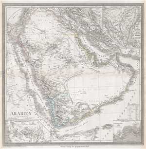
Arabien.
sold
- Digital Map Information
- Suitable for large format printing
- DPI: 300
- File Size: 11.31 MB
- File Type: ZIP / TIFF
- ICC color profile embedded
- Delivered instantly via download link
This is an 1848 Heirich Kiepert map of the Arabian Peninsula. The map depicts the region from eastern Africa to Isfahan and from Lebanon, Syria, and Iraq to the Horn of Africa and the Indian Ocean. Highly detailed, myriad locations along the region's coastlines are ... (more details)
Created by one of the world's foremost experts on the Ottoman Empire at the time - Heinrich Kiepert.
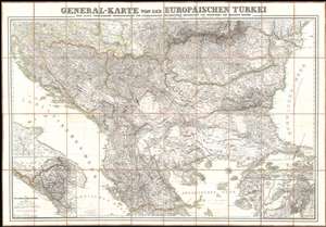
General-Karte von der Europäischen Türkei.
sold
- Digital Map Information
- Suitable for large format printing
- DPI: 600
- File Size: 104.6 MB
- File Type: ZIP / TIFF
- ICC color profile embedded
- Delivered instantly via download link
This is an 1853 Heinrich Kiepert map of the Balkans at the height or the Crimean War. The map depicts the region from southern Italy and the Adriatic Sea to the Black Sea and Istanbul and from Hungary, Moldova, and Bessarabia to the island of Skiros in the Aegean Sea. An inset map in the lower left corner illustrates the autonomous region of Montenegro in detail, while two inset maps in the lower right corner highlight the Dardanelles, also known as the Hellespont, and the Bosporus. (more details)
First German map of the state of California.
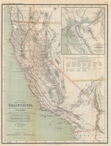
Karte des states California nach er officiellen Karte des State Surveyor General W. M. Eddy (approved and declared to be the official Map of the State of California by act of the Legislature, passed March 25th 1853) mit Berichtigung der Küste und einzelner Pässe nach den in den Jahren 1855-4 asusgeführten Künstenaufnahmen der V. St. Marine unde Recognoscirugen projectirter Eisenbahnlinien durch die Ingenieur Oficiere Gunnison, Beckwith, Williamson, u. a. gezeichnet von H. Kiepert Berlin 1856.
sold
- Digital Map Information
- Suitable for large format printing
- File Size: 10.6 MB
- File Type: ZIP / TIFF
- ICC color profile embedded
- Delivered instantly via download link
This is a rare 1856 H. Kiepert German edition of William M. Eddy's first official map of California. This is the first German-language map specifically of the state of California. (more details)
Important biblical map of Lebanon by the founder of 'Palestinology'.
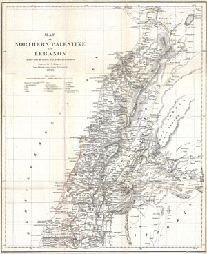
Map of Northern Palestine and Lebanon Chiefly from the Routes of E. Robinson & others.
sold
- Digital Map Information
- Suitable for large format printing
- File Size: 9.11 MB
- File Type: ZIP / TIFF
- ICC color profile embedded
- Delivered instantly via download link
An uncommon map of Lebanon by the classical scholar and cartographer H. Kiepert. Covers all of modern day Lebanon as well as parts of adjacent Israel, Palestine, Jordan and Syria. This map is based on the 1838 travels of E. Robinson and E. Smith in this area. ... (more details)
Important biblical map of the Sinai by the founder of 'Palestinology'.
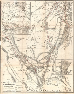
Map of the Peninsula of Mount Sinai and Arabia Petraea from the itineraries of E. Robinson and E. Smith.
sold
- Digital Map Information
- Suitable for large format printing
- File Size: 11.95 MB
- File Type: ZIP / TIFF
- ICC color profile embedded
- Delivered instantly via download link
An uncommon map of the Sinai Peninsula by the classical scholar and cartographer H. Kiepert. Covers from the Red Sea to the Arabian Peninsula. This map is based on the 1838 travels of E. Robinson and E. Smith in this area. Robinson and Smith, in search of ... (more details)
Most authoritative Map of Armenia, Kurdistan and Azerbaijan of the 19th Century.
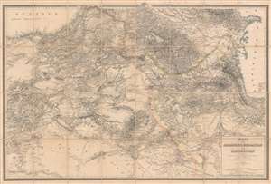
Karte von Armenien, Kurdistan und Azerbeidschan in vier blatt im Anschluss an die IV westlichen und mittleren Blätter der Karte von Klein-Asien, entworfen und bearbeitet 1852-55.
sold
- Digital Map Information
- Suitable for large format printing
- File Size: 93.53 MB
- File Type: ZIP / TIFF
- ICC color profile embedded
- Delivered instantly via download link
A seminal production, this is Heinrich Kiepert's 1858 map of Armenia, Kurdistan, and Azerbaijan, the definitive map of the region for more than 50 years. This map was used for treaty negotiation, military activity, and administration. In order to create it, Kiepert travelled the region many times - constantly sketching maps. His own observations were supplemented by diligent scholarship, resulting in a deep understanding local exploratory history and earlier survey work - note how throughout are noted, and dated, the tracks of earlier voyagers. The result is the finest area map available for most of the second half of the 19h century. The dense hachuring testifies to the areas daunting topography, underscoring the greatness of Kiepert's achievement. (more details)
The British invade Afghanistan, again.
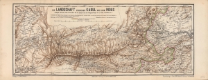
Die Landschaft zwischen Kabul und dem Indus.
sold
- Digital Map Information
- Suitable for large format printing
- File Size: 15.42 MB
- File Type: ZIP / TIFF
- ICC color profile embedded
- Delivered instantly via download link
A scarce and highly detailed 1878 topographical map by Heinrich Kiepert of a portion of eastern Afghanistan and surroundings, highlighting the lands between Kabul and Peshawar. It was made as tensions between Britain and Afghanistan peaked, a side effect of the 'Great Game' competition between Britain and Russia, which led to the Second Anglo-Afghan War. (more details)
Best 19th century general map of the Ottoman Empire.
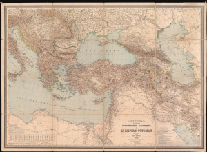
Carte Générale des Provinces Européennes et Asiatiques de l'Empire Ottoman (sans l'Arabie).
sold
- Digital Map Information
- Suitable for large format printing
- File Size: 150.63 MB
- File Type: ZIP / TIFF
- ICC color profile embedded
- Delivered instantly via download link
This is an 1892 Heinrich Kiepert wall map of the Ottoman Empire. The work of Europe's finest cartographer, this is without question the best large scale general map of the Ottoman dominions to appear in the 19th century. (more details)