
Kobayashi Kanetaka (sold) (小林監峻)

Kobayashi Kanetaka (小林監峻; fl. c. 1874 - 1904) was a Japanese geographer and cartographer of the Meiji period based in Asakusa, Tokyo. He was known for his maps of Japan and its regions, including several parts of a highly detailed eight-part set of maps covering Japan's major regions (明細大日本切圖). Late in his career, in 1904, he also published a map of the Russo-Japanese War.
AKA: 小林監峻
Educating for national identity.
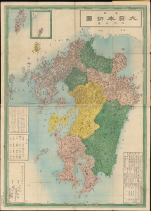
明細大日本切圖九州之部 / [Detailed Sectional Map of Japan - Kyushu].
sold
- Digital Map Information
- Suitable for large format printing
- File Size: 74.37 MB
- File Type: ZIP / TIFF
- ICC color profile embedded
- Delivered instantly via download link
An impressive 1877 Kobayashi Kanetaka map of the island of Kyushu and several smaller neighboring islands in Japan, published by Aoki Sukekiyo of Dōmeisha. It was part of a series of highly detailed maps of Japan's regions, and the involvement of Aoki and Dōmeisha strongly suggest that it was intended for educational purposes. (more details)