
Lannoy, Ferdinand de (sold)

Ferdinand de Lannoy (1510 - 1579) was a Flemish duke, soldier, engineer and cartographer in the service of Spain and the the Holy Roman Empire. He was born in Italy to Charles de Lannoy, governor of Tournai and viceroy of Naples. Ferdinand was educated in Italy, focusing on mathematics, topography and mapmaking. He began a military career, primarily serving in the religious wars fighting German Protestants. He rose to a generalship of artillery during his wars in Germany, Italy and Flanders. In 1560 he returned to a domestic, academic life, devoting himself to cartography. He completed in 1563 a map of the county of Burgundy - the first known map of Franche-Comté - and earned recommendations which won him the governorship of the city of Gray the following year. The appointment gave him abundant opportunity to improve his map, which he intended to publish. In 1565 he began negotiations with Antwerp engraver Hierronymus Cock to cut the plates, and the printed maps were even completed when, at the behest of the Duke of Alba, the map - detailing as it did a region crucial to Spain's efforts in the Eighty Years' War - was suppressed and the plates destroyed. At least one copy survived, however: Abraham Ortelius was aware of the map as far back as 1570, and on the year of de Lannoy's death the Antwerp mapmaker would publish his version of the map in his atlas.
First atlas map of the Franche-Comte.
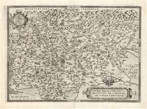
Burgundiae Comitatus Recentiss. Descriptio Dno. Ferdinando Lannoyo auctore.
sold
- Digital Map Information
- Suitable for large format printing
- DPI: 600
- File Size: 61.61 MB
- File Type: ZIP / TIFF
- ICC color profile embedded
- Delivered instantly via download link
This is Abraham Ortelius' 1579 map of the County of Burgundy in France - as distinct from the Duchy of Burgundy, which lay to the west. The map follows Ferdinand de Lannoy's unacquirable 1563 map, the first to depict Franche-Comté. Shortly after publication, De Lannoy's cartography was officially suppressed, so Ortelius' version is the earliest acquirable derivative. The map conforms to the eastern part of modern-day Bourgogne-Franche-Comté. (more details)