
Lotter, Tobias Conrad

Tobias Conrad Lotter (1717 - 1777) was a German engraver and map publisher. Lotter was the son of a baker and city guardsman, but married Euphrosina (1709 - 1784) Seutter, elder daughter of the prominent map publisher Matthäus Seutter. He began working at his is father-in-law's map business about 1740. Between 1740 and 1744 he produced, under Seutter's imprint, the Atlas minor, Praecipua orbis terrarum imperia, regna et provincias, Germania potissimum tabelli. Upon Seutter's death, in 1757, the firm's stock was taken over by his son, Albrecht Karl Seutter (1722 - 1762), who himself died in 1762, just a few years later. The remaining Seutter map plates were subsequently divided between Lotter and the publisher Johan Mitchell Probst (1727 - 1776). With the support of his sons, Matthäus Albrecht (1741 - 1810), Georg Friedrich (1744 - 1801) and Gustav Conrad (1746-1776), Tobias Conrad Lotter succeeded in building on the economic success and professional reputation of his father-in-law. In time, Lotter became one of the most prominent mid-18th century map publishers working in the German school. After Lotter's death in 1777, the business was taken over by his two eldest sons, who, lacking their father's business acumen, presided over the firm's slow decline. It was nonetheless passed on to a subsequent generation of Lotters, Matthäus Albrecht Lotter's sons, Gabriel (1776 - 1857) and Georg Friedrich (1787 - 1864), who pushed it into further decline until it faded out in the early-19th century.
War and Privateering in the West Indies.
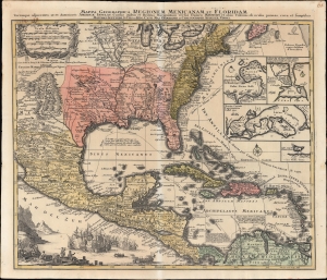
Mappa Geographica Regionem Mexicanam et Floridam Terrasque adjacentes, ut et Anteriores Americae Insulas, Cursus itidem et Reditus Navigantium versus flumem Missisipi et alias Colonias ob oculos ponens cura et sumtibus.
$1,000.00
Acquire
- Digital Map Information
- Suitable for large format printing
- File Size: 28.51 MB
- File Type: ZIP / TIFF
- ICC color profile embedded
- Delivered instantly via download link
An old-color example of Mattheus Seutter's c. 1740 map of North America below the Great Lakes, including Mexico and the Caribbean. It reflects improvements in European cartography of the New World in the late 17th and early 18th centuries, as well as the ongoing competition between colonial empires, namely the contemporaneous War of Jenkins' Ear (1739-1748). (more details)
The Holy City for the Armchair Pilgrim.
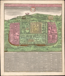
Ierusalem, cum suburbiis prout tempore Christi floruit...
$1,500.00
Acquire
- Digital Map Information
- Suitable for large format printing
- File Size: 39.56 MB
- File Type: ZIP / TIFF
- ICC color profile embedded
- Delivered instantly via download link
This is an attractive example of Matthias Seutter's c. 1745 map of Jerusalem following the influential 1584 model of Christian van Adrichem's. For centuries, Adrichem's portrayal of Jerusalem provided the basis for a sort of 'virtual pilgrimage' to the holy sites when actual travel there was, for most, impossible. Seutter's version of the plan here appears in its Lotter imprint of 1756. (more details)
One of the few views of to show a walled New York.
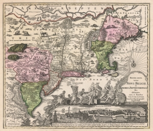
Recens Edita Totius Novi Belgii, in America Septentrionali siti, delineatio cura et sumtibus Tob. Conr. Lotteri, Sac. Caes. Maj. Geographi August. Vind.
$3,500.00
Acquire
- Digital Map Information
- Suitable for large format printing
- DPI: 600
- File Size: 74.88 MB
- File Type: ZIP / TIFF
- ICC color profile embedded
- Delivered instantly via download link
This is Conrad Tobias Lotter's 1757 map of New York, New England, and the mid-Atlantic colonies. It represents the final map in the Jansson-Visscher series. Despite the map's cartography being over a century old, this map continued to capture the idea of this part of the world for Europeans in general and a German audience in particular. (more details)
The Silver Mines of Saxony.
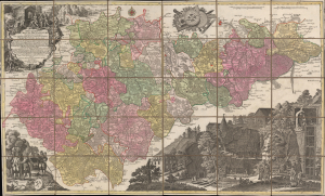
Mappa Geographica Circuli Metalliferi Electoratus Saxoniae cum omnibus quae in eo comprehenduntur Praefecturis...
$1,600.00
Acquire
- Digital Map Information
- Suitable for large format printing
- Full resolution TIFF file
- ICC color profile embedded
- Delivered instantly via download link
A spectacular c. 1760 map of Saxony by Matthäus Seutter, engraved by Tobias Conrad Lotter. Brightly colored and richly illustrated, it focuses on the region's important silver mining operations, which were a major source of silver throughout Europe dating back to the Middle Ages. (more details)
Superb 18th century flag chart identifying the flags of the Dutch East India Company and Dutch West India Company.
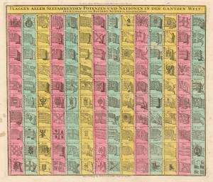
Flaggen aller Seefahrenden Potenzen und Nationen in der gantzen Welt.
$950.00
Acquire
- Digital Map Information
- Suitable for large format printing
- DPI: 600
- File Size: 28.9 MB
- File Type: ZIP / TIFF
- ICC color profile embedded
- Delivered instantly via download link
An attractive c. 1765 flag chart by Matthias Seutter and Tobias Conrad Lotter. The chart features 139 flags of various nations, factions, and trading companies. Among the more interesting flags are those of the Dutch West India Company (G.W.C. / Geoctroyeerde Westindische Compagnie) and the Dutch East India Company (V.O.C. / Vereenigde Oostindische Compagnie). The premier placement of English flags in the upper left quadrant suggests that this chart may have been originally derived from an English source. (more details)
The mythical lands of Jean de Gama.
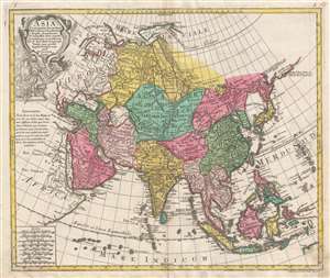
Asia Concinnata Secundum Observationes Academiae Regalis Scientiarum et nonnullas alias, et iuxta annotationes recentissimas.
$850.00
Acquire
- Digital Map Information
- Suitable for large format printing
- DPI: 300
- File Size: 13.36 MB
- File Type: ZIP / TIFF
- ICC color profile embedded
- Delivered instantly via download link
A rare and attractive old color 1770 map of Asia by Tobias Conrad Lotter. Centered on Independent Tartary, this map covers the entire continent from Africa and the Mediterranean east to the Bering Sea and south as far as Java and New Guinea. The map renders the entire region in detail offering both topographical and political information with forests and mountains beautifully rendered in profile. (more details)
Superior example with a bold strike and rich color.
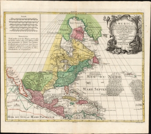
America Septentrionalis. Concinnata juxta observationes Dnn Academiæ Regalis Scientiarum et nonnullorum aliorum, et juxta annotationes recentissimas.
$950.00
Acquire
- Digital Map Information
- Suitable for large format printing
- File Size: 28.01 MB
- File Type: ZIP / TIFF
- ICC color profile embedded
- Delivered instantly via download link
This is a beautiful example of Conrad Tobias Lotter's c. 1772 map of North America. It is an expanded yet faithful rendition of Guillaume De l'Isle's 1700 L'Amerique Septentrionale - a 'foundation map' recognized by scholars and publishers throughout the 18th century. (more details)
Thirteen Colonies on the Brink of Revolution.
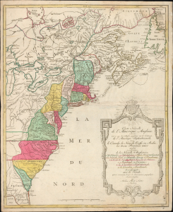
Carte Nouvelle de L'Amerique Angloise contenant tout ce que les Anglois possedent sur le Continent de L'Amerique Septentrionale savoir le Canada, la Nouvelle Ecosse ou Acadie, les treize Provinces unies
$1,800.00
Acquire
- Digital Map Information
- Suitable for large format printing
- Full resolution TIFF file
- ICC color profile embedded
- Delivered instantly via download link
This is an uncommon 1776 French-language map of the Thirteen Colonies and emerging United States by Augsburg cartographer Matthias Albrecht Lotter, published at the outbreak of the American Revolutionary War. Drawing heavily on French cartographic traditions, the map presents British North America at the very moment the colonies declared independence and the United States began to take shape. Issued two years before France formally entered the Revolutionary War on the American side, it captures the continent on the cusp of a geopolitical transformation that would redraw North America. (more details)
German interest in the American Revolution.
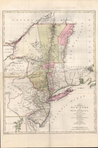
A Map of The Provinces of New-York and New-Jersey, with a part of Pennsylvania and the Province of Quebec from the Topographical Observations of C. J. Sauthier.
$2,250.00
Acquire
- Digital Map Information
- Suitable for large format printing
- DPI: 600
- File Size: 937.14 MB
- File Type: ZIP / TIFF
- ICC color profile embedded
- Delivered instantly via download link
An important 1777 Revolutionary War era map of New York and New Jersey by Claude Joseph Sauthier and Matthäus Albrecht Lotter. The map reflects significant German interest in the war related to widespread participation by Germans on both sides of the conflict. (more details)