
Lotter, Tobias Conrad (sold)

Tobias Conrad Lotter (1717 - 1777) was a German engraver and map publisher. Lotter was the son of a baker and city guardsman, but married Euphrosina (1709 - 1784) Seutter, elder daughter of the prominent map publisher Matthäus Seutter. He began working at his is father-in-law's map business about 1740. Between 1740 and 1744 he produced, under Seutter's imprint, the Atlas minor, Praecipua orbis terrarum imperia, regna et provincias, Germania potissimum tabelli. Upon Seutter's death, in 1757, the firm's stock was taken over by his son, Albrecht Karl Seutter (1722 - 1762), who himself died in 1762, just a few years later. The remaining Seutter map plates were subsequently divided between Lotter and the publisher Johan Mitchell Probst (1727 - 1776). With the support of his sons, Matthäus Albrecht (1741 - 1810), Georg Friedrich (1744 - 1801) and Gustav Conrad (1746-1776), Tobias Conrad Lotter succeeded in building on the economic success and professional reputation of his father-in-law. In time, Lotter became one of the most prominent mid-18th century map publishers working in the German school. After Lotter's death in 1777, the business was taken over by his two eldest sons, who, lacking their father's business acumen, presided over the firm's slow decline. It was nonetheless passed on to a subsequent generation of Lotters, Matthäus Albrecht Lotter's sons, Gabriel (1776 - 1857) and Georg Friedrich (1787 - 1864), who pushed it into further decline until it faded out in the early-19th century.
A land of plenty.
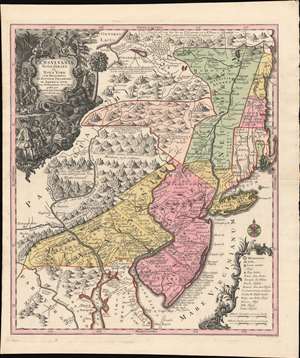
Pensylvania Nova Jersey et Nova York cum Regionibus Ad Fluvium Delaware In America Sitis, Nova Delinatione ob oculos posita ...
sold
- Digital Map Information
- Suitable for large format printing
- DPI: 600
- File Size: 40.3 MB
- File Type: ZIP / TIFF
- ICC color profile embedded
- Delivered instantly via download link
A c. 1750 example of Matthäus Seutter's map of the Middle Atlantic and New England regions during the British colonial period. It encompasses the Middle English Colonies, particularly New York, New Jersey, and Pennsylvania, capturing a period of rapid westward expansion and encouraging German emigration and settlement. (more details)
Details the extensive road network in the region, connecting Baghdad to Kabul.
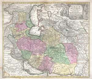
Opulentissimi Regni Persiæ juxta suas Provincias recentissima et accuratissima Designatio. Studio et Sumtibus.
sold
- Digital Map Information
- Suitable for large format printing
- DPI: 300
- File Size: 18.36 MB
- File Type: ZIP / TIFF
- ICC color profile embedded
- Delivered instantly via download link
This is a scarce c. 1750 Tobias Conrad Lotter map of Persia, the Caspian Sea, and the Caucasus. The map depicts the region from the Black Sea to Kashmir and the Indus River and from the Sea of Azov and the Caspian Sea to the Persian Gulf, the Strait of Hormuz, and ... (more details)
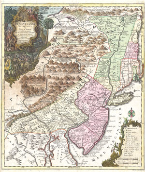
Pensylvania Nova Jersey et Nova York cum Regionibus Ad Fluvium Delaware In America Sitis, Nova Delinatione ob oculos posita . . .
sold
- Digital Map Information
- Suitable for large format printing
- DPI: 300
- File Size: 10.35 MB
- File Type: ZIP / TIFF
- ICC color profile embedded
- Delivered instantly via download link
A fine and rare 1756 example of Tobias Conrad Lotter's important map of the Middle Atlantic and New England regions during the British colonial period. One of the most desirable, interesting and attractive pre-Revolutionary maps of the Middle English Colonies, ... (more details)
One of Lotter's most iconic maps.
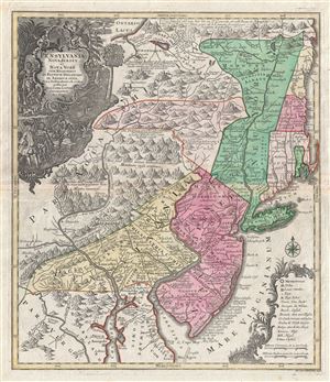
Pensylvania Nova Jersey et Nova York cum Regionibus Ad Fluvium Delaware In America Sitis, Nova Delinatione ob oculos posita . . .
sold
- Digital Map Information
- Suitable for large format printing
- DPI: 300
- File Size: 24.1 MB
- File Type: ZIP / TIFF
- ICC color profile embedded
- Delivered instantly via download link
A fine c. 1756 example of one of Tobias Conrad Lotter's most iconic maps. This is Lotter's important map of the Middle Atlantic and New England regions during the British colonial period. One of the most desirable, interesting and attractive ... (more details)
The 1755 Great Earthquake of Lisbon.
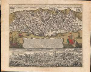
Lisabona magnificentissima Regia Sedes Portugalliae et florentissimum Emporium ad ostia Tagi situm... / Lisabon die prächtige Konigl. Residenz. Statt in Portugall ù florisanteste Handels Plaz am Ausfluss des Tagi.../ Ruinae eversae olysipponis. / Ruin der Stadt Lisabona.
sold
- Digital Map Information
- Suitable for large format printing
- Full resolution TIFF file
- ICC color profile embedded
- Delivered instantly via download link
An extraordinary 1756 Seutter / Lotter map and view of Lisbon, Portugal, in the wake of its near total destruction by the Great Lisbon Earthquake of 1755. The map is divided into two sections. The upper section features a view and map of Lisbon as it appeared in 1735, 20 years prior. The lower section, entitled 'Ruinae Eversae Olysipponis' is a dramatic bird's eye view of Lisbon being consumed by the Great Earthquake and related fires. (more details)
First edition, first state of Lotter's stunning map of northern Poland.
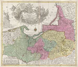
Borussiae Regnum Complectens Circulos Sambiensem, Natangiensem et Hockerlandiae nec non Borussia Polonica Exhibens Palatinatus Culmiensem, Marienburgensem, Pomerelliae et Varmiae.
sold
- Digital Map Information
- Suitable for large format printing
- DPI: 300
- File Size: 20.15 MB
- File Type: ZIP / TIFF
- ICC color profile embedded
- Delivered instantly via download link
A stunning 1759 first edition, first state, map of northern Poland (Borussiae) by the Augsburg cartographer Tobias Conrad Lotter. The map covers from German Pomerania eastward to Lithuania and Belarus and from the Baltic Sea to Torun (Thorn). ... (more details)
Beautifully engraved miniature world map.
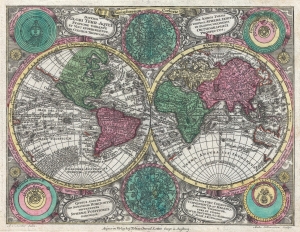
Diversi Globi Terr-Aquei Statione Variante et Visu Intercedente, Per Coluros Tropicorum Per Ambos Polos et Particul, Sphaerae Zenith in Planum Deleati Orthographici Prospectus.
sold
- Digital Map Information
- Suitable for large format printing
- DPI: 300
- File Size: 3.44 MB
- File Type: ZIP / TIFF
- ICC color profile embedded
- Delivered instantly via download link
A full-color c. 1762 double-hemisphere map of the world by Tobias Conrad Lotter. Published for the Atlas Minor, this is a small yet dense map, with the hemispheres surrounded by two celestial charts and four conflicting cosmographical hypotheses (Ptolemaica, Copernicana, Decarta, and Tychonica), as well as rich decorative embellishments. The map includes several oddities and cartographic anomalies, including an illustration of Insular California on the Luke Foxe / Sanson model, an expanse of land leading west from northwestern North America associated with Juan de Gama, an ephemeral New Zealand, the routes of various important explorers, and a loosely defined Australian coastline. (more details)
Superb 18th century flag chart identifying the flags of the Dutch East India Company and Dutch West India Company.
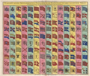
Flaggen aller Seefahrenden Potenzen und Nationen in der gantzen Welt.
sold
- Digital Map Information
- Suitable for large format printing
- DPI: 300
- File Size: 12.76 MB
- File Type: ZIP / TIFF
- ICC color profile embedded
- Delivered instantly via download link
A c. 1765 flag chart issued by Matthias Seutter and Tobias Conrad Lotter. The flag features 139 flags of various nations, factions, and trading companies. Among the more interesting flags are those of the Dutch West India Company (G.W.C. /Geoctroyeerde Westindische Compagnie) and the Dutch East India Company (V.O.C. / Vereenigde Oostindische Compagnie). The premier placement of English flags in the upper left quadrant suggest that this chart may have been copied from an English source. (more details)
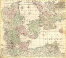
Daniae Regnum
sold
- Digital Map Information
- Suitable for large format printing
- Full resolution TIFF file
- ICC color profile embedded
- Delivered instantly via download link
This is a spectacular and 1770 Lotter map of the Kingdom of Denmark. Formally titled 'Daniae Regnum.' Features an elaborate title cartouche bearing the Danish royal crest. Includes parts of modern day Sweden and ... (more details)
Illustrates St. Brenden's Island and Post-French and Indian War political configuration.
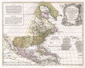
America Septentrionalis, concinnata juxta observationes Dñn Academiæ Regalis Scientiarum et nonnullorum aliorum, et juxta annotationes recentissimas…
sold
- Digital Map Information
- Suitable for large format printing
- DPI: 300
- File Size: 10.91 MB
- File Type: ZIP / TIFF
- ICC color profile embedded
- Delivered instantly via download link
A visually striking c. 1772 old color Tobias Conrad Lotter map of North America. Centered roughly on New York City, the map covers from Baffin Bay to the northern part of South America and from California to the ... (more details)
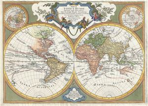
Mappa totius mundi : adornata juxta observationes dnn. academiae regalis scientiarum et nonnullorum aliorum secundum annotationes recentissimas.
sold
- Digital Map Information
- Suitable for large format printing
- DPI: 300
- File Size: 21.58 MB
- File Type: ZIP / TIFF
- ICC color profile embedded
- Delivered instantly via download link
This is a stunning double hemisphere map of the world prepared by Guillaume De L'Isle and published by Tobias Conrad Lotter in 1775. The map consists of two central hemispheres, eastern and western, surrounded by smaller polar projections. Cartographically this map is altogether fascinating and exemplifies De L'Isle's careful scientific style of cartography. (more details)
Full color 18th century double hemisphere map.
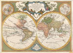
Mappa totius mundi Adornata juxta Observationes Dnn Academiae Regalis Scientiarum et nonnullorum aliorum, secundum annotationes recentissimas.
sold
- Digital Map Information
- Suitable for large format printing
- Full resolution TIFF file
- ICC color profile embedded
- Delivered instantly via download link
This is a stunning double hemisphere map of the world prepared by Guillaume De L'Isle and published by Tobias Conrad Lotter in 1775. The map consists of two central hemispheres, eastern and western, surrounded by smaller polar projections. Cartographically this map is altogether fascinating and exemplifies De L'Isle's careful scientific style of cartography. (more details)
Unusual German map illustrating the outbreak of the American Revolutionary War to a French Audience.
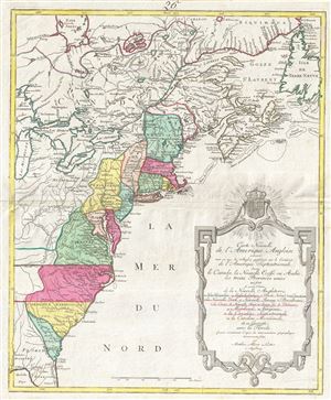
Carte Nouvelle de L'Amerique Angloise contenant tout ce que les Anglois possedent sur le Continent de L'Amerique Septentrionale savoir le Canada, la Nouvelle Ecosse ou Acadie, les treize Provinces unies
sold
- Digital Map Information
- Suitable for large format printing
- DPI: 300
- File Size: 68.49 MB
- File Type: ZIP / TIFF
- ICC color profile embedded
- Delivered instantly via download link
An uncommon 1776 Mathais Albrecht Lotter map of the United States on the cusp of the American Revolutionary War. Focused on the 13 original British Colonies, this map covers from Florida to Newfoundland and t ... (more details)
Unusual German map illustrating the outbreak of the American Revolutionary War to a French Audience.
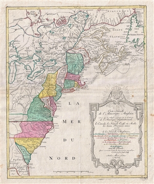
Carte Nouvelle de L'Amerique Angloise contenant tout ce que les Anglois possedent sur le Continent de L'Amerique Septentrionale savoir le Canada, la Nouvelle Ecosse ou Acadie, les treize Provinces unies
sold
- Digital Map Information
- Suitable for large format printing
- DPI: 300
- File Size: 17.72 MB
- File Type: ZIP / TIFF
- ICC color profile embedded
- Delivered instantly via download link
An uncommon 1776 Mathais Albrecht Lotter map of the United States on the cusp of the American Revolutionary War. Focused on the 13 original British Colonies, this map covers from Florida to Newfoundland and t ... (more details)
The American Colonies on the Brink of Revolution.
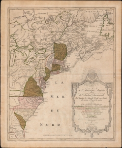
Carte Nouvelle de L'Amerique Angloise contenant tout ce que les Anglois possedent sur le Continent de L'Amerique Septentrionale savoir le Canada, la Nouvelle Ecosse ou Acadie, les treize Provinces unies
sold
- Digital Map Information
- Suitable for large format printing
- Full resolution TIFF file
- ICC color profile embedded
- Delivered instantly via download link
An uncommon French-language 1776 Mathais Albrecht Lotter map of the American colonies on the cusp of the American Revolutionary War. (more details)
German edition of Sauthier's influential Revolutionary War Era map of New York and New Jersey.
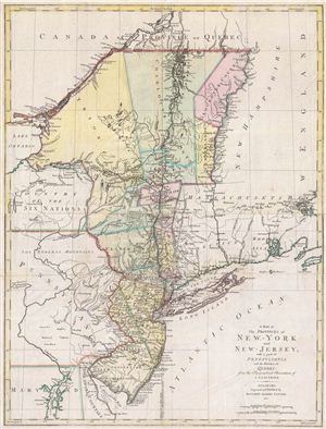
A Map of The Provinces of New-York and New-Jersey, with a part of Pennsylvania and the Province of Quebec from the Topographical Observations of C. J. Sauthier.
sold
- Digital Map Information
- Suitable for large format printing
- DPI: 300
- File Size: 23.99 MB
- File Type: ZIP / TIFF
- ICC color profile embedded
- Delivered instantly via download link
An important 1777 Revolutionary War era map of New York and New Jersey by Claude Joseph Sauthier and Matthew Lotter. This map is Lotter's German edition of Sauthier's map of 1776. The map covers from Quebec ... (more details)
One of the few views of to show a walled New York.
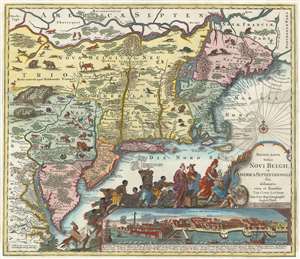
Recens Edita Totius Novi Belgii, in America Septentrionali siti, delineatio cura et sumtibus Tob. Conr. Lotteri, Sac. Caes. Maj. Geographi August. Vind.
sold
- Digital Map Information
- Suitable for large format printing
- Full resolution TIFF file
- ICC color profile embedded
- Delivered instantly via download link
This is Conrad Tobias Lotter's 1777 map of the Northeast and New York, the final map in the Jansson-Visscher series. Despite the map's cartography being over a century old, this map continued to capture the idea of this part of the world for Europeans in general and a German audience in particular. (more details)