
Maariv (sold) (ַעֲרִיב)

Maariv (מַעֲרִיב) (1948 - Present) is an Israeli Hebrew-language daily newspaper. Currently, the newspaper is second in sales nationally and third in readership. Founded in 1948 by former Yediot Aharonot journalists led by Dr. Ezriel Carlebach, Maariv quickly became the most widely read newspaper in the country. After this initial success, the paper slowly began to decline. In the 2010s, Maariv was passed between three different owners before it was acquired by its current operator Eli Azour. Since then, Maariv has slowly reestablished its place in the industry.
AKA: ַעֲרִיב
Published three days after the end of the Six-Day War on the eve of Shavuot.
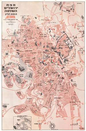
This is a 1967 Maariv pictorial city plan or map of Jerusalem, Israel, published on June 13, 1967, only three days after the end of the Six-Day War. Buildings throughout the city are illustrated in profile. The Old City's walls are immediately eye-catching, and the Dome of the Rock and the Temple Mount recognizable. Other identified locations include the Monastery of the Cross, the Knesset, Hadassah Hospital, and the Jerusalem Biblical Zoo (officially known as the Tisch Family Zoological Gardens), which is marked by a giraffe. (more details)
Three days after the Six-Day War.
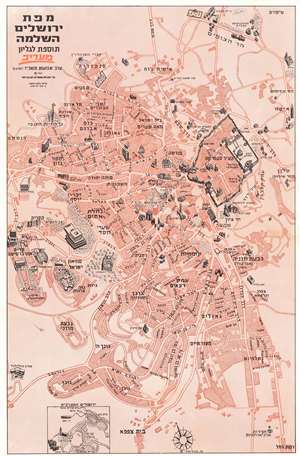
This is a 1967 Maariv pictorial city plan or map of Jerusalem, Israel, published on June 13, 1967, only three days after the end of the Six-Day War. Buildings throughout the city are illustrated in profile. The Old City's walls are immediately eye-catching, and the Dome of the Rock and the Temple Mount recognizable. Other identified locations include the Monastery of the Cross, the Knesset, Hadassah Hospital, and the Jerusalem Biblical Zoo (officially known as the Tisch Family Zoological Gardens), marked by a giraffe. (more details)
Three days after the Six-Day War.
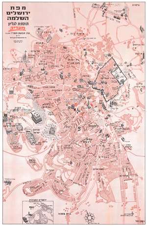
This is a 1967 Maariv pictorial city plan or map of Jerusalem, Israel, published on June 13, 1967, only three days after the end of the Six-Day War. Buildings throughout the city are illustrated in profile. The Old City's walls are immediately eye-catching, and the Dome of the Rock and the Temple Mount are recognizable. Other identified locations include the Monastery of the Cross, the Knesset, Hadassah Hospital, and the Jerusalem Biblical Zoo (officially known as the Tisch Family Zoological Gardens), marked by a giraffe. (more details)