
Major, John (sold)

John Major (fl. c. 1835 – 1854) was a New York based engraver and lithographer active in the middle part of the 19th century. Major began his career in New York as an engraver in 1835. In 1839, he adapted to the new innovation of lithography, founding John Major's Lithography with offices at 49 Wall Street. From 1850 his partner in the lithography business was Daniel Major, perhaps his son. They jointly acquired the lithography business of Peter Mesier, also based at 49 wall street, in 1850. It is unclear how exactly John Major was connected to the family of James Major, Henry Broughman Major, and Alfred Sarony Major, who were business partners with acclaimed lithographer and photographer Napoleon Sarony in the New York City lithographic printing world at the same time, a question complicated by the closeness of the names of John and James Major. But it seems very likely that John Major was part of the same extended family.
The eariest known map of St. Paul, Minnesota.
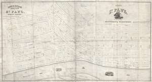
City of Saint Paul, Capital of Minnesota Territory. / Rice and Irvine's addition to St. Paul, Minnesota Territory.
sold
- Digital Map Information
- Suitable for large format printing
- Full resolution TIFF file
- ICC color profile embedded
- Delivered instantly via download link
A rarity of extreme historical importance, this 1849 map by Benjamin Brunson is the earliest printed map of Saint Paul, Minnesota, and the original plat of the city. Centered on Seven Corners and Rice Park, this map covers the original 280 acres of Saint Paul, ... (more details)
Most Important Early Map of the New Mexico Territory.
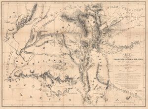
Map of the Territory of New Mexico...
sold
- Digital Map Information
- Suitable for large format printing
- Full resolution TIFF file
- ICC color profile embedded
- Delivered instantly via download link
This is the extremely rare, unpublished 1851 map of the Territory of New Mexico produced by John G. Parke and Richard Kern. Known as the Parke-Kern Map, it was printed within the War Department and separately issued on an individual basis but never included in a Congressional Report, as were other key early maps of the American West. The map was then reprinted several times in the late 19th and early 20th century with no obvious changes, but which can be distinguished from the original plate by very close examination. The present example is one of these later, c. 1900, reissues, which in themselves are still very rare. (more details)