
Montgomery, Thomas J. (sold)

Thomas J. Montgomery (June 8, 1864 - April 18, 1958) was a surveyor and civil engineer active in Trinity County, California in the late 19th and early 20th centuries. Montgomery was born in Ukiah, California and appears to have relocated to Trinity County by the early 1890s, received training as a surveyor and civil engineer, and started a family. Initially working as a contract surveyor for local mines, Montgomery also designed bridges across several creeks in the Trinity Alps region. He later (c. 1903) became the Country Surveyor of Trinity County and held that role until at least 1914.
Northern California's 'Second Gold Rush'.
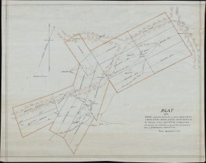
Plat of the Surveys Made at the Chloride and Bailey Quartz Mines. In Canon Creek Mining District, Trinity County, Cal.
sold
- Digital Map Information
- Suitable for large format printing
- File Size: 14.94 MB
- File Type: ZIP / TIFF
- ICC color profile embedded
- Delivered instantly via download link
This is a 1901 manuscript plat map of mining claims along the Canyon (or Cañon) Creek in Trinity County, California, prepared by surveyors Henry L. Lowden and Thomas J. Montgomery. (more details)