
Moule, Thomas (sold)

Thomas Moule (1784 – 1851) was an English antiquarian, writer on heraldry, and cartographer. He is best known for his popular and highly decorative steel-engraved county maps of England.
Oxford's celebrated collegiate crests appear at the top border.
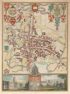
City and University of Oxford.
sold
- Digital Map Information
- Suitable for large format printing
- DPI: 600
- File Size: 5.13 MB
- File Type: ZIP / TIFF
- ICC color profile embedded
- Delivered instantly via download link
This is an 1837 Thomas Moule map or city plan of Oxford, England. Stretching from the observatory on Woodstock Road to the River Isis and the Charwell River and from the Oxford Canal to Magdalen Bridge, this map depicts both the city and university of Oxford in detail. The map centers on the area between Broad Street and High Street along Corn Market. Trinity College, Exeter College, All Soul's College, Christ Church College, Balliol College, St. John's College, Queen's College, University College, and several others, are labeled. Streets and other buildings are identified as well. Along the top and left borders the armorial crests of several of the colleges are illustrated. The Ancient Seal of the City appears along the bottom border. Two views are included along the bottom border as well: one illustrating the front of Christ Church College and the other Oxford from the north. (more details)
Charming map of Oxford University, identifying numerous colleges and their coats of arms.
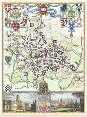
City and University of Oxford.
sold
- Digital Map Information
- Suitable for large format printing
- DPI: 300
- File Size: 2.73 MB
- File Type: ZIP / TIFF
- ICC color profile embedded
- Delivered instantly via download link
This is an 1837 Thomas Moule map or city plan of Oxford, England. Stretching from the observatory on Woodstock Road to the River Isis and the Charwell River and from the Oxford Canal to Magdalen Bridge, this map depicts both the city and university of Oxford in ... (more details)