
Muñozgúren, J. M. (sold)

J. M. Muñozgúren (fl. c 1850 - 1865) was a lithographer and engraver active in Mexico City during the second half of the 19th century. Most of Muñozgúren's work is associated with the lithographic firm of H. Iriarte y Cia. He engraved extensively for the Antonio Garcia y Cubas (1832 - 1912) Atlas Geográfico, Estadístico e Histórico de la República Mexicana.
The only historic map that mentions Mezcal!
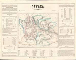
Oaxaca.
sold
- Digital Map Information
- Suitable for large format printing
- File Size: 23.73 MB
- File Type: ZIP / TIFF
- ICC color profile embedded
- Delivered instantly via download link
This is a rare 1858 Antonio Garcia y Cubas map of the state of Oaxaca, Mexico. Centered on Oaxaca City (Oajaca), coverages extends from the Guerrero border to Tehuantepec, then in a separate state, and from Veracruz to the Pacific. The map is divided into various subdistricts with considerable efforts to illustrate the region's mountainous interior - a considerable achievement for the time. Even the Pre-Columbian ruins at Mitla are noted. Only major roads are defined, underscoring just how remote and difficult to access many of these villages were - nonetheless most of the locations are noted with considerable accuracy. The map itself is surrounded by statistical tables. (more details)