
News Map of the Week Inc (sold)

News Map of the Week Inc (c. 1940 - c. 1973) was a company based in Chicago, Illinois that published weekly educational broadsides that were distributed by subscription to elementary and high schools across the United States. The broadsides consisted of a world map on the top half and short summaries of the past week's headlines on the bottom half. Sometimes historical content other than material relating to the past week's news was included.
Global Counter-attack against Axis Forces.
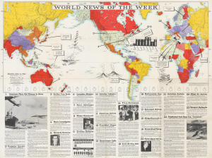
World News of the Week Monday, June 14, 1943 Covering Period June 4 to June 10 Volume 5, No. 41.
sold
- Digital Map Information
- Suitable for large format printing
- File Size: 102.18 MB
- File Type: ZIP / TIFF
- ICC color profile embedded
- Delivered instantly via download link
This is an impressive June 1943 wall map prepared by News Map of the Week, Inc. in Chicago. It discusses major news events of the second week of June 1943, mostly relating to World War II (1939 - 1945), including a Chinese counter-offensive in western Hubei, as well as other domestic and international issues such as striking coal miners and a new government in Chile. (more details)
Highlights the seven Latin American dictators that had been overthrown in the late 1950s and the Soviet rocket that was orbiting the Sun.
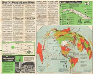
World News of the Week. Monday, Jan. 12, 1959 Covering Period Jan. 2 to Jan. 8 Volume 21 No. 21.
sold
This is a 1959 Hubert A. Bauer and News Map of the Week, Inc. map of the world chronicling the toppling of Latin American dictators from 1954 through 1959. A portrait of Fulgencio Batista, the ousted dictator of Cuba, occupies the southern Pacific Ocean and introduces the map's purpose - to detail the rise and fall of seven Latin American dictators from Cuba to Argentina. The other arrows, each numbered one through thirteen, indicate where the thirteen news stories summarized occurred. These include a landmark study of deep ocean trenches, the appointment of a cabinet in Cuba, a new U.S. national flag with a 49th star, a visit by the No. 2 Russian official Anastas Mikoyan to the United States, and a rebellion in Tibet. An inset, entitled 'Cuba, Island in Turmoil' provides a history of Cuba in thirteen vignettes. Profile views of the Cuban capital and Morro Castle are included as well. Bauer employs the azimuthal projection, developed by American Airlines. The projection allows the rendering great circle routes as straight lines. (more details)