
O'Hare, Daniel P. (sold)

Daniel P. O'Hare (c. 1866 - April 3, 1921) was a map draftsman and engraver for the General Land Office. Born in Washington, D.C., to an Irish father and an American mother, O'Hare worked for the U.S. Geological Survey and the General Land Office until his death. He appeared in the Washington D.C. city directory as an engraver beginning in the late 1880s but was not associated with the Geological Survey until 1890, which does not necessarily mean he wasn't working for the Geological Survey before 1890.
Arizona after statehood.
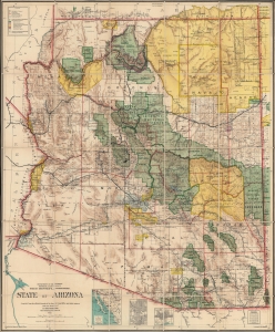
State of Arizona.
sold
- Digital Map Information
- Suitable for large format printing
- Full resolution TIFF file
- ICC color profile embedded
- Delivered instantly via download link
This is the 1912 Ithamar Berthrong and Daniel O'Hare map of Arizona - among the first official U.S. government maps Arizona as a state. (more details)