
Ono Kenjin (sold) (小野縣人)

Ono Kenjin (小野縣人; fl. c. 1923 - 1938) was an employee of the Tokyo Nichi Nichi Shimbun involved in the printing and distribution of materials by the news agency. Ono later moved to Women's World (婦女界) magazine and published books on kanji reform and Western art.
AKA: 小野縣人
How a wood and paper city burns.
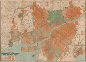
帝都大震火災系統地圖 / Map of the Fire of Tokyo.
sold
- Digital Map Information
- Suitable for large format printing
- File Size: 191.05 MB
- File Type: ZIP / TIFF
- ICC color profile embedded
- Delivered instantly via download link
An infographic masterpiece detailing the ignition and development of the Great Fire of Tokyo following the 1923 Great Kanto Earthquake. This partially bilingual 1923 map of the Great Tokyo Fire was issued by the Relief Information Bureau of Tokyo Imperial University just four months after the disaster. It focuses on ignition points and on the strong winds that coincided with the earthquake, which caused fire to spread rapidly and eventually burn down much of the dense wooden city. (more details)
How a wood and paper city burns.
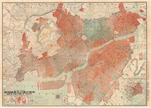
帝都大震火災系統地圖 / Map of the Fire of Tokyo.
sold
- Digital Map Information
- Suitable for large format printing
- File Size: 69.11 MB
- File Type: ZIP / TIFF
- ICC color profile embedded
- Delivered instantly via download link
An astounding infographic masterpiece detailing the ignition and development of the Great Fire of Tokyo following the 1923 Great Kanto Earthquake. This is a partially bilingual 1923 map of Great Tokyo Fire was issued by the Bureau of Tokyo Imperial University just four months after the disaster. It focuses ignition points and on the strong winds that coincided with the earthquake, which caused fire to spread rapidly and eventually burn down much of the city - which was constructed of tightly packed wooden buildings. (more details)
How a wood and paper city burns.
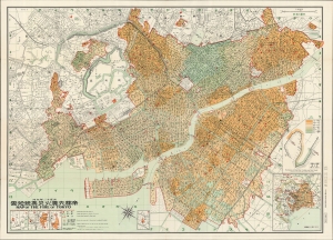
帝都大震火災系統地圖 / Map of the Fire of Tokyo.
sold
- Digital Map Information
- Suitable for large format printing
- File Size: 70.51 MB
- File Type: ZIP / TIFF
- ICC color profile embedded
- Delivered instantly via download link
An infographic masterpiece detailing the ignition and development of the Great Fire of Tokyo following the 1923 Great Kanto Earthquake. This partially bilingual 1923 map of the Great Tokyo Fire was issued by the Relief Information Bureau of Tokyo Imperial University just four months after the disaster. It focuses on ignition points and on the strong winds that coincided with the earthquake, which caused fire to spread rapidly and eventually burn down much of the dense wooden city. (more details)