
Orléans, Louis-Philippe-Albert d', Comte de Paris (sold)
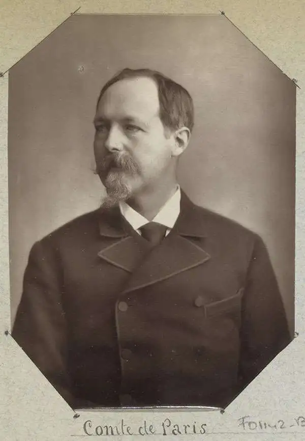
Louis-Philippe-Albert d'Orléans, Comte de Paris (August 24, 1838 - September 8, 1894) was a French prince, scholar, officer in the American Civil War (1861 - 1865), and unofficially King of France (February 24, 1848). Louis-Philippe-Albert was the grandson of French king, Louis Philippe I of the house of Orléans. With the advent of the French Second Republic (1848 - 1852), Louis-Philippe-Albert and his family fled to the United States. Louis-Philippe-Albert became an outspoken journalist who, when the Civil War broke out, volunteered to serve in the Union Army, being instantly appointed assistant adjutant general under General George McClellan with the rank of captain. During his service, he used the abbreviated name Philippe d'Orléans. He served in the Peninsular Campaign, the first large-scale offensive in the Eastern Theater, but resigned from service in July 1862. Later, he wrote a History of the Civil War in America, published in 1875. He returned to Europe in 1864, where in England, he married his paternal first cousin, Princess Marie Isabelle d'Orléans (1848–1919), Infanta of Spain. In 1871, after the Franco-Prussian War and the downfall of Napoleon III, they were allowed to return to France, and many of their properties were restored. He renounced all claims to the French throne in 1873 but was still considered by some Orléanists as Philippe VII of France. In 1886, the prince and his family again went into exile in London, where he died in 1894.
Georgia and South Carolina Coasts.
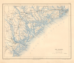
Sea Islands (Caroline due Sud).
sold
- Digital Map Information
- Suitable for large format printing
- File Size: 7.96 MB
- File Type: ZIP / TIFF
- ICC color profile embedded
- Delivered instantly via download link
This is a striking 1890 Dumas Vorzet map of the coasts of South Carolina and Georgia, issued to illustrate the scarce atlas volume of the French edition of Price Philippe d'Orléans' Histoire de la Guerre Civile en Amérique. (more details)
The Bloodiest Day in U.S. Military History.
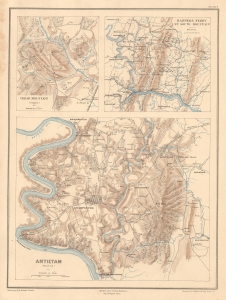
Cedar Mountain (Virginie). Harpers Ferry et South Mountain. Antietam (Maryland).
sold
- Digital Map Information
- Suitable for large format printing
- Full resolution TIFF file
- ICC color profile embedded
- Delivered instantly via download link
This is Ernest Dumas-Vorzet's map of the 1862 Civil War Battles of Cedar Mountain, Harpers Ferry, and Antietam, issued to illustrate the 1890 book Histoire de la Guerre Civile en Amérique. (more details)
Crucible of the Civil War.
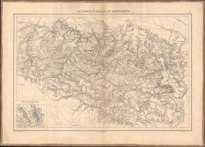
Les champs de bataille du Rappahannock.
sold
- Digital Map Information
- Suitable for large format printing
- File Size: 26.28 MB
- File Type: ZIP / TIFF
- ICC color profile embedded
- Delivered instantly via download link
This 1890 Dumas Vorzet map displays eastern Virginia south of the Rappahannock River, the site of several important battles in the U.S. Civil War. It appeared in the scarce 1890 atlas volume of the French edition of Philippe d'Orléans' Histoire de la Guerre Civile en Amérique. (more details)
Capturing the Crescent City.
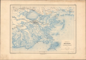
Bouches du Mississippi et Nouvelle Orleans.
sold
- Digital Map Information
- Suitable for large format printing
- File Size: 13.43 MB
- File Type: ZIP / TIFF
- ICC color profile embedded
- Delivered instantly via download link
A remarkable map of the Mississippi River Delta, New Orleans, and environs, prepared in 1890 by Ernest Dumas-Vorzet. It appeared in the scarce 1890 atlas volume of the French edition of Philippe d'Orléans' Histoire de la Guerre Civile en Amérique. (more details)
A French Prince in the American Civil War.
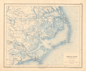
Pamlico Sound (Caroline du Nord).
sold
- Digital Map Information
- Suitable for large format printing
- File Size: 9.12 MB
- File Type: ZIP / TIFF
- ICC color profile embedded
- Delivered instantly via download link
This is a striking 1890 Dumas Vorzet map of the Pamlico Sound and Albemarle Sound, eastern North Carolina, issued to illustrate the scarce atlas volume of the French edition of the Prince Philippe d'Orléans' Histoire de la Guerre Civile en Amérique. (more details)
Emergence of 'the Grey Ghost'
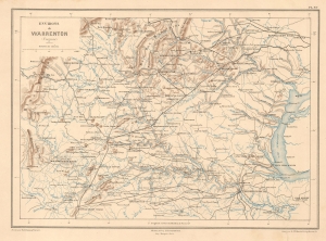
Environs de Warrenton (Virginie).
sold
- Digital Map Information
- Suitable for large format printing
- File Size: 7.95 MB
- File Type: ZIP / TIFF
- ICC color profile embedded
- Delivered instantly via download link
This is Ernest Dumas-Vorzet's 1890 map of Warrenton, Virginia and environs, prepared for his Histoire de la Guerre Civile en Amérique. It relates to the 1863 American Civil War (1861 - 1865) Warrenton Junction Raid, one of the first significant actions of 'the Gray Ghost', Confederate commander John S. Mosby and his eponymous Mosby’s Rangers. (more details)
Georgia and South Carolina Coasts.
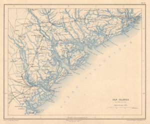
Sea Islands (Caroline due Sud).
sold
- Digital Map Information
- Suitable for large format printing
- File Size: 7.55 MB
- File Type: ZIP / TIFF
- ICC color profile embedded
- Delivered instantly via download link
This is a striking 1890 Dumas Vorzet map of the coasts of South Carolina and Georgia, issued to illustrate the scarce atlas volume of the French edition of Price Philippe d'Orléans' Histoire de la Guerre Civile en Amérique. (more details)
A House Divided...
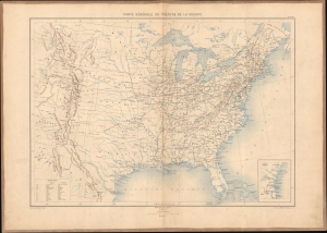
Carte générale du théâtre de la guerre.
sold
- Digital Map Information
- Suitable for large format printing
- Full resolution TIFF file
- ICC color profile embedded
- Delivered instantly via download link
This is Ernest Dumas-Vorzet's 1890 map of the United States, prepared for Histoire de la Guerre Civile en Amérique. It was the first map in the atlas volume accompanying the book. (more details)
An Imperiled Capital.
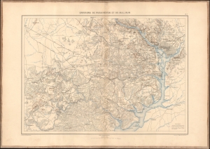
Environs de Washington et du Bull Run.
sold
- Digital Map Information
- Suitable for large format printing
- File Size: 21.94 MB
- File Type: ZIP / TIFF
- ICC color profile embedded
- Delivered instantly via download link
This is an 1890 Dumas Vorzet map of Washington, D.C., and its environs in eastern Virginia, the scene for multiple important battles during the American Civil War (1861 - 1865), issued as part of the scarce atlas volume of the French edition of Philippe d'Orléans' Histoire de la Guerre Civile en Amérique. (more details)