
Ōtsuka Usaburo0 (sold) (大塚宇三郎)

Ōtsuka Usaburō (大塚宇三郎 ; fl. c. 1894 - 1895) was an Osaka-based editor who produced books and maps related to the First Sino-Japanese War
AKA: 大塚宇三郎
The beginning of the Japanese empire.
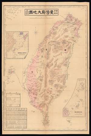
實測詳密 台灣島大地圖 附-澎湖島 琉球島 / [Map of Taiwan Island Measured in Detail, with the Penghu and Ryukyu Islands].
sold
- Digital Map Information
- Suitable for large format printing
- File Size: 34.75 MB
- File Type: ZIP / TIFF
- ICC color profile embedded
- Delivered instantly via download link
This is a very rare 1895 Ōtsuka Usaburō map of Taiwan, the Penghu Islands (also known as the Pescadores), and the Ryukyu Islands. It was made in the midst of Japan's conquest of Taiwan and includes a range of information that would be useful from an administrative perspective. (more details)