
Phelippeaux, Rene (sold)

Rene Phelippeaux (1748 - 1784) (also, Rene Phelipeau) was a French cartographer, geographer, and surveyor active in Paris in the latter half of the 19th century. Phelippeaux most likely began his mapmaking career as a public surveyor. His earliest known map is a 1791 survey of the burrow to Croissy-Sur-Seine commissioned by Jean Chanorier in 1781. Later Phelippeaux worked as a professor of mathematics at the Royal Military Academy of London. He seemed to have a special interest in the mapping of the fledgling United States and the West Indies. In addition to several important case maps published in conjunction with J. B. Nolin and Brion de la Tour, Phelippeaux also produced important map collections focusing on the colonies of Santo Domingo and Martinique.
Revolutionary War map of the United States drawn to capitalize on French interest in the war.
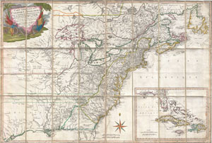
Carte Generale Des Colonies Angloises Dans L'Amerique Septentrionale.
sold
- Digital Map Information
- Suitable for large format printing
- Full resolution TIFF file
- ICC color profile embedded
- Delivered instantly via download link
This is an important and extremely rare 1779 case map of the English colonies in in North America at the height of the American Revolutionary War. Focusing on the English Colonies, this map covers the eastern part of North America from the Hudson Bay to the Gulf ... (more details)