
Phelps, Humphrey (Phelps and Watson, Phelps Ensigns and Thayer, Phelps Fanning and Company)

Humphrey Phelps (June 10, 1799 - October 8, 1875) was an American map, guidebook, broadside, and print publisher active in New York City from the early 1830s through the 1860s. Born in Hebron, Connecticut, he developed a publishing business centered on geographical information for travelers, emigrants, and urban visitors. His early New York City plan, subsequently issued as Strangers Guide through the City of New York: With the Latest Improvements, carried a copyright dated July 1, 1830. During the mid-1830s, he published with B. S. Squire, Jr., their joint imprint appearing on maps and emigrant information concerning the expanding western states. Phelps subsequently worked through several publishing partnerships: the 1847 edition of Phelps's Travellers' Guide through the United States appeared under Phelps, Ensigns and Thayer, while Phelps, Fanning and Company issued Fanning's Illustrated Gazetteer of the United States and Phelps' Hundred Cities and Large Towns of America in 1853. His output ranged from portable folding maps and city guides to decorative geographical sheets, including Pictorial View of the World, copyrighted in 1846. He also participated in the market for historical and popular prints. With his nephew Gaylord Watson (1833 - 1896), he operated Phelps and Watson, a New York map and print publishing concern that distributed Kellogg lithographs during 1859 - 1864; this partnership dissolved on January 1, 1865. Phelps returned to Hartford, Connecticut, in 1868 and died there in 1875.
AKA: Phelps and Watson, Phelps Ensigns and Thayer, Phelps Fanning and Company
References: Finlay, Nancy, 'Some Evidence for the Sale and Distribution of Kellogg Prints', paper presented at 'Representations of Economy: Lithography in America from 1820 to 1860', Library Company of Philadelphia, October 15, 2010, p. 6, p. 21, note 16, and p. 22, note 18.
Identifies the Ouisconsin (Wisconsin) Territory before its official creation.
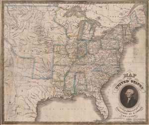
Map of the United States.
$1,250.00
Acquire
- Digital Map Information
- Suitable for large format printing
- Full resolution TIFF file
- ICC color profile embedded
- Delivered instantly via download link
This is an 1832 Humphrey Phelps map of the United States with a dramatic portrait of George Washington. Coverage extends from the Atlantic Ocean to the Rocky Mountains. (more details)
The founding of the Republic of Texas.
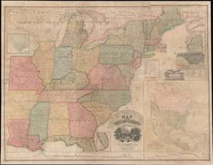
Map of the United States with the Recent Counties, Cities, Villages and Internal Improvements in the Western States.
$7,500.00
Acquire
- Digital Map Information
- Suitable for large format printing
- DPI: 600
- File Size: 209.92 MB
- File Type: ZIP / TIFF
- ICC color profile embedded
- Delivered instantly via download link
An impressive 1836 Phelps and Squire map of the United States with an inset of the newly formed Republic of Texas. This map is a much revised and updated variant on the 1817 Varlé map, and more specifically, the 1832 Stebbins / Varlé reissue. It stands out for its inclusion of the Republic of Texas as an inset - the Republic was declared shortly before this map was published. The map also illustrates U.S. claims to British Columbia - part of the Oregon Question or 54-40 border debate between the United States and British North America. (more details)
Patriotic wall map of the United States illustrating the Republic of Texas.
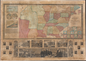
Phelps and Ensign's Travellers' Guide, and Map of the United States, containing the Roads, Distances, Steam Boat and Canal Routes etc.
$3,000.00
Acquire
- Digital Map Information
- Suitable for large format printing
- DPI: 600
- File Size: 161.68 MB
- File Type: ZIP / TIFF
- ICC color profile embedded
- Delivered instantly via download link
This is the spectacular 1841 edition of Phelps and Ensign's pictorial wall map of the United States and the Republic of Texas. The Republic of Texas appears in one of its smaller configurations, with the printed border reflecting not the vast tracts claimed by the Republic, but rather those lands it effectively controlled, with a border at the Nueces River. (more details)
Features the Republic of Texas.
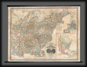
Map of the United States with the Recent Counties, Cities, Villages and Internal Improvements in the Western States.
$3,500.00
Acquire
- Digital Map Information
- Suitable for large format printing
- DPI: 600
- File Size: 199.26 MB
- File Type: ZIP / TIFF
- ICC color profile embedded
- Delivered instantly via download link
An impressive 1845 Phelps and Ensign map of the United States with an inset of the newly formed Republic of Texas. This map is a much revised and updated variant on the 1817 Varlé map, and more specifically, the 1832 Stebbins / Varlé reissue. It stands out for its inclusion of the Republic of Texas as an inset. The map also illustrates U.S. claims to British Columbia - part of the Oregon Question or 54-40 border debate between the United States and British North America. (more details)
Looking over Boston.
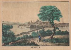
Boston.
$1,200.00
Acquire
- Digital Map Information
- Suitable for large format printing
- Full resolution TIFF file
- ICC color profile embedded
- Delivered instantly via download link
This is a c. 1862 - 1864 E. B. and E. C. Kellogg hand-colored lithographic view of Boston from Chelsea, probably adapted from William Henry Bartlett's earlier composition. It presents the city through three defining features: its crowded maritime waterfront, the State House above Beacon Hill, and the Bunker Hill Monument rising over Charlestown. A wooded foreground, occupied by a man carrying a bundle of sticks, a boy, and a dog, turns the urban prospect into a picturesque landscape suited to domestic display. The publishers' imprints point to an early 1860s issue. (more details)
Ephemeral Territories in the American West.
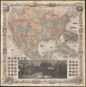
Phelps and Watson's New Map of the United States.
$3,000.00
Acquire
- Digital Map Information
- Suitable for large format printing
- Full resolution TIFF file
- ICC color profile embedded
- Delivered instantly via download link
This is a rare 1860 wall map of the United States published by Phelps and Watson. It presents the territorial configuration of U.S. states and territories on the eve of the U.S. Civil War (1861 - 1865), which would drastically reshape the map. (more details)