
Phelps, Humphrey (sold)

Humphrey Phelps (1799 - 1875) was an American map, broadside, and book publisher based in New York City. Phelps was born in 1799 in Hebron, Connecticut. Phelps' earliest work seems to be a plan of New York City for his Stranger's Guide, dating to about 1830. Between 183- and 1837 he published with Bela Scovil Squire (1786 - 1861) under the imprint of Phelps and Squire. The New York map publishing circle seems to have been quite close and Phelps commonly partnered with various other New York publishers and printers including Edward H. Ensign (1818 - 1871), Horace Thayer, Erastus Clark Bridgman (1817 - 1870), Thomas C. Fanning (1805 - 1873), Hooker, Peabody, Charles Magnus, Gaylord Watson, and George Walker, among others. The natural consequence of his rampant partnering is a vast and varied corpus of work including many scarce items with low print runs. Phelps is best known for his emigrant and tourist guides.
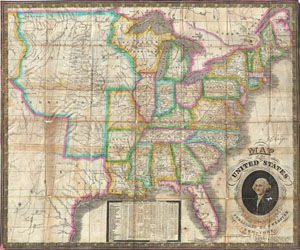
Map of the United States.
sold
- Digital Map Information
- Suitable for large format printing
- DPI: 300
- File Size: 13.02 MB
- File Type: ZIP / TIFF
- ICC color profile embedded
- Delivered instantly via download link
An exceptional and rare map of the United States published by James Webster in 1835. Extends from the east coast of the United States westward as far as the Rocky Mountains, including much of Texas. This map of the United States is heavily based upon Humphrey ... (more details)
An early pocket map of New York City.
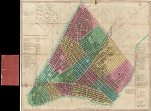
Strangers Guide Through the City of New York, with the latest Improvements.
sold
- Digital Map Information
- Suitable for large format printing
- Full resolution TIFF file
- ICC color profile embedded
- Delivered instantly via download link
A scarce map of 1837 map New York City issued by Humphrey Phelps. This map details the southern part of Manhattan from the battery to 14th Street, though it technically extends, though with less detail, all the way to 41st street. Phelps identifies all ... (more details)
Spectacular patriotic wall map of the United States illustrating the Republic of Texas.
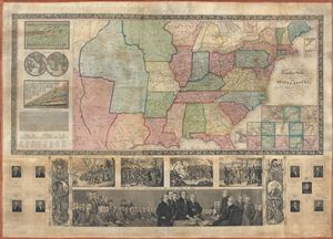
Phelps and Ensign's travellers' guide, and map of the United States, containing the roads, distances, steam boat and canal routes etc.
sold
- Digital Map Information
- Suitable for large format printing
- DPI: 300
- File Size: 34.84 MB
- File Type: ZIP / TIFF
- ICC color profile embedded
- Delivered instantly via download link
A very patriotic piece, this spectacular 1841 decorative wall map of the United States was prepared New York firm of Phelps and Ensign. The highly appealing production covers the United States from the Rocky Mountains to the Atlantic Seaboard and from ... (more details)
Scarce map of New York City.
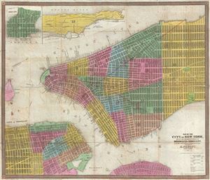
Map of the City of New York, with the adjacent Cities of Brooklyn & Jersey City, and the Village of Williamsburg.
sold
- Digital Map Information
- Suitable for large format printing
- DPI: 300
- File Size: 13.32 MB
- File Type: ZIP / TIFF
- ICC color profile embedded
- Delivered instantly via download link
This scarce 1845 map of New York City and adjacent parts of Brooklyn was published by Humphrey Phelps. Oriented to the west, this map covers the lower parts of Manhattan from the Battery to 32nd Street. It additionally covers adjacent parts of ... (more details)
United States as the Tree of Liberty.
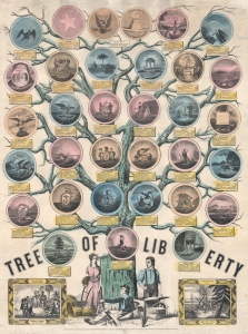
Tree of Liberty.
sold
- Digital Map Information
- Suitable for large format printing
- DPI: 600
- File Size: 79.42 MB
- File Type: ZIP / TIFF
- ICC color profile embedded
- Delivered instantly via download link
This is an 1846 Humphrey Phelps political broadside of the United States as the Tree of Liberty. Thirty-six medallions adorn the branches: 34 represent states and two, at top center, depict the Great Seal of the United States. (more details)
Wonderful decorative propaganda map advocating for the United States as a global power following the acquisition of Upper California and Texas as the end of the Mexican American War.
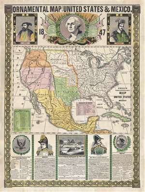
Ornamental Map of The United States and Mexico, 1847.
sold
- Digital Map Information
- Suitable for large format printing
- DPI: 300
- File Size: 18.49 MB
- File Type: ZIP / TIFF
- ICC color profile embedded
- Delivered instantly via download link
A remarkably graphic propaganda map of the United States in 1847 by Humphrey Phelps. Boldly expressing U.S. dominance of the continent, this map loudly proclaims Manifest Destiny. The United States is here transformed by victory in the ... (more details)
On the cusp of the Westward Expansion.
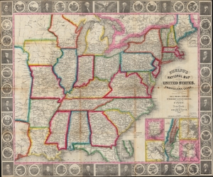
Phelps’s National Map of the United States, A Travellers Guide. Embracing the Principal Rail Roads, Canals, Steam Boat and Stage Routes throughout the Union.
sold
- Digital Map Information
- Suitable for large format printing
- DPI: 600
- File Size: 45.75 MB
- File Type: ZIP / TIFF
- ICC color profile embedded
- Delivered instantly via download link
This is the 1848 issue of the first state of Phelps's map of the United States. The map was issued during the Mexican-American War (1846 - 1848), and as such captures an ephemeral moment in American history: after Texas joined the Union, but before the Treaty of Guadeloupe-Hidalgo and the annexation of Upper California. (more details)
An iconic and beautiful map of New York City.
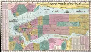
New York City Map.
sold
- Digital Map Information
- Suitable for large format printing
- File Size: 14.27 MB
- File Type: ZIP / TIFF
- ICC color profile embedded
- Delivered instantly via download link
This is an uncommon and colorful 1857 map of New York City by Humphrey Phelps. The map depicts Manhattan south of 131st Street as well as adjacent parts of Brooklyn, Queens, Hoboken, and Jersey City. Individual streets are named as are ... (more details)

New York City Map.
sold
- Digital Map Information
- Suitable for large format printing
- File Size: 17.53 MB
- File Type: ZIP / TIFF
- ICC color profile embedded
- Delivered instantly via download link
An uncommon and colorful 1857 map of New York City by Humphrey Phelps. The map covers Manhattan south of 131st street as well as adjacent parts of Brooklyn, Queens, Hoboken, and Jersey City. Individual streets are named as are many ... (more details)